Weekly Outlook: February 12-18, 2024

Some snow is on the way, quite a bit for some areas, and probably more than once this week.
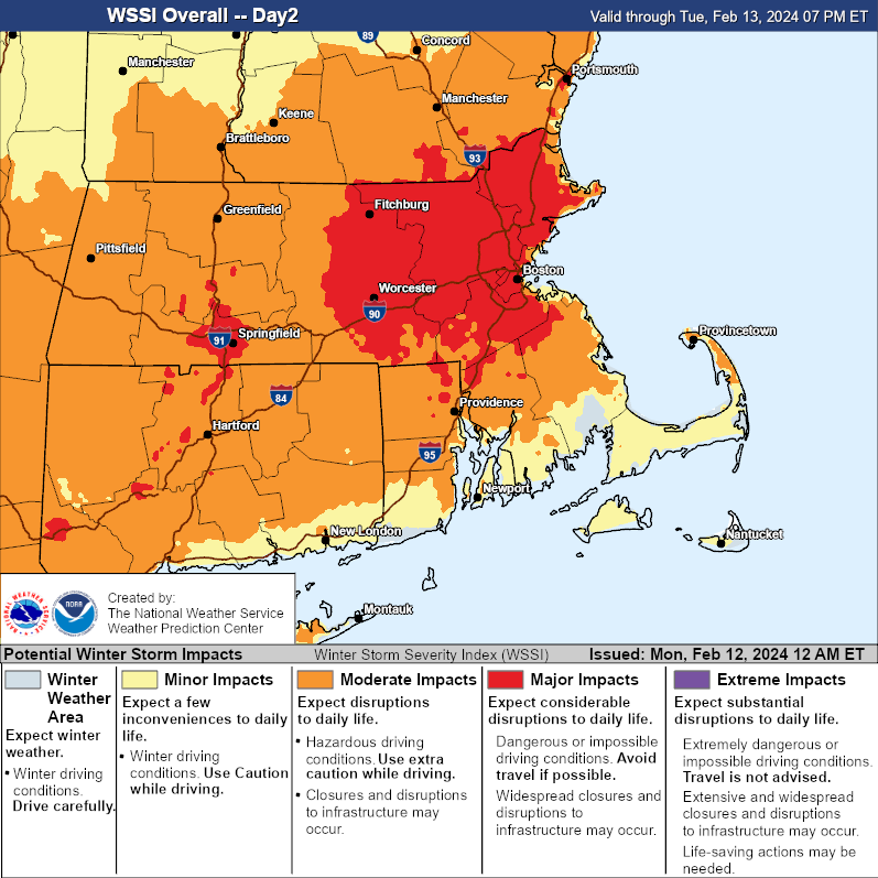
Tuesday’s storm will be very impactful across the region. Image provided by the Weather Prediction Center.

We’ll start the week off with sunshine thanks to high pressure in control of the region, but it won’t last too long. Clouds will start to steam in this afternoon and thicken up tonight as the low pressure area that brought severe weather to parts of Texas and the Deep South yesterday moves into the Tennessee Valley. By Monday night, a secondary area of low pressure will develop near the Mid-Atlantic coast, passing south of New England on Tuesday. There’s not a lot of cold air in place, but with the storm passing far enough to the south, we should be cold enough for snow across most of the region, except for parts of Cape Cod and possibly southeastern Massachusetts, but even there, a change to snow is expected. The snow will be accompanied by gusty northeast winds, especially across the Cape and Islands where a High Wind Watch has been posted. With tides already at astronomically high levels, some coastal flooding is also expected, so a Coastal Flood Watch has been issued for much of eastern Massachusetts. The storm will be moving rather quickly, so snowfall totals won’t be outrageous. Snow should start around sunrise Tuesday, and end around sunset, but in between, it could snow rather heavily for a while late Tuesday morning and early afternoon. If you don’t have to be on the roads, we’d recommend you stay home. Complicating the snow forecast is that many of the models show a sharp cutoff to the northern edge of the snow, but don’t agree where that northern edge will be. Some have it in central New Hampshire, some in southern New Hampshire, some across northern Massachusetts. Wherever it does setup, you are going to see snowfall totals go from quite a bit to virtually nothing over a small area, perhaps even as little as 20 miles. Having said that, our snowfall forecast is, for lack of a better term, our “best guess” across central and southern New Hampshire right now.

Wind gusts of 30-40 mph are possible across much of the region, especially at the coast, perhaps stronger across Cape Cod. Image provided by Weathermodels.com

So, how much snow can we expect?

Outer Cape/Islands: 1-3″
Upper Cape/South Coast: 3-5″
Central New Hampshire: (Concord): 3-6″
Southeastern Massachusetts: 4-8″
Southern New Hampshire (Nashua/Manchester to Portsmouth): 4-8″
Remainder of Eastern Massachusetts: 6-10″ with a few spots picking up 12″ or more
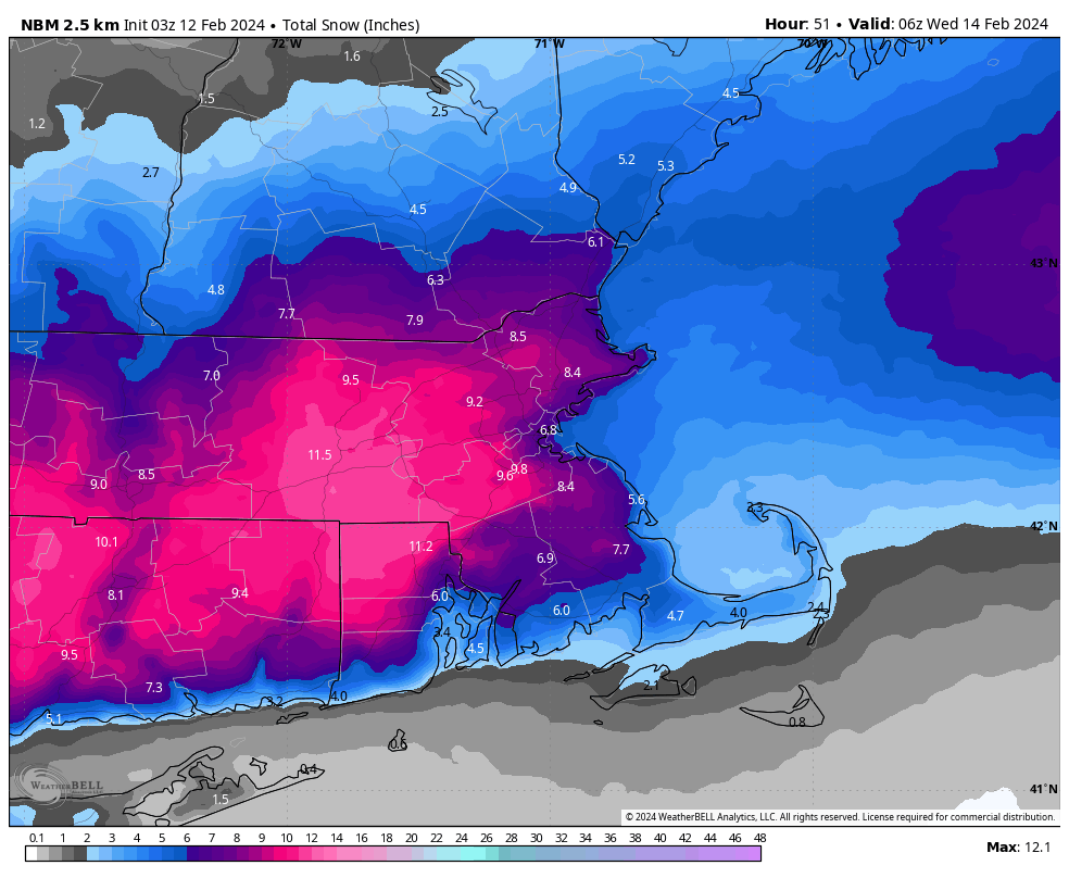
The National Blend of Models is the closest to our snow forecast at this time. Images provided by WeatherBell.

We’ll quickly clear out Tuesday night, then a cold front moves through with a few flurries Wednesday morning, followed by high pressure building in for Wednesday afternoon and Thursday with sunshine and colder weather. Clouds will start to move back in later Thursday ahead of a weak storm system moving out of the Great Lakes. That system will bring in some light snow or rain for Thursday night into early Friday. Skies will start to clear out Friday afternoon, but clouds quickly return ahead of yet another storm moving out of the Ohio Valley. This one will likely bring in some more light snow on Saturday. Another cold front follows on Sunday with some more clouds and possibly a few snow showers.

Another weak system may bring in some snow or rain for Thursday night. Images provided by Pivotal Weather.

Monday: Morning sunshine, clouds filter in and thicken up during the afternoon. High 42-49.

Monday night: Becoming mostly cloudy, snow developing by daybreak, possibly mixed with some rain across Cape Cod and southeastern Massachusetts. Low 26-33.

Tuesday: Windy with snow, possibly heavy at times, tapering off late in the day. High 30-37 early, temperatures start falling in the afternoon.

Tuesday night: Any lingering snow ends in the evening, then skies clear out, breezy. Low 17-24.

Wednesday: Sunshine and a few clouds, windy, colder, slight chance for a snow flurry early. High 28-35.

Thursday: Sunny in the morning, clouds move in during the afternoon, some light snow or rain possible overnight, breezy. High 31-38.

Friday: Any snow or rain ends early, becoming partly sunny and windy in the afternoon. High 33-40.

Saturday: Mostly cloudy and breezy with some light snow possible. High 28-35.

Sunday: Partly sunny, breezy, chance for a few snow showers. High 31-38.

Weekend Outlook: February 9-12, 2024

Milder weather is on the way for the upcoming weekend.

Temperatures could be very mild around here on Saturday. Image provided by WeatherBell,

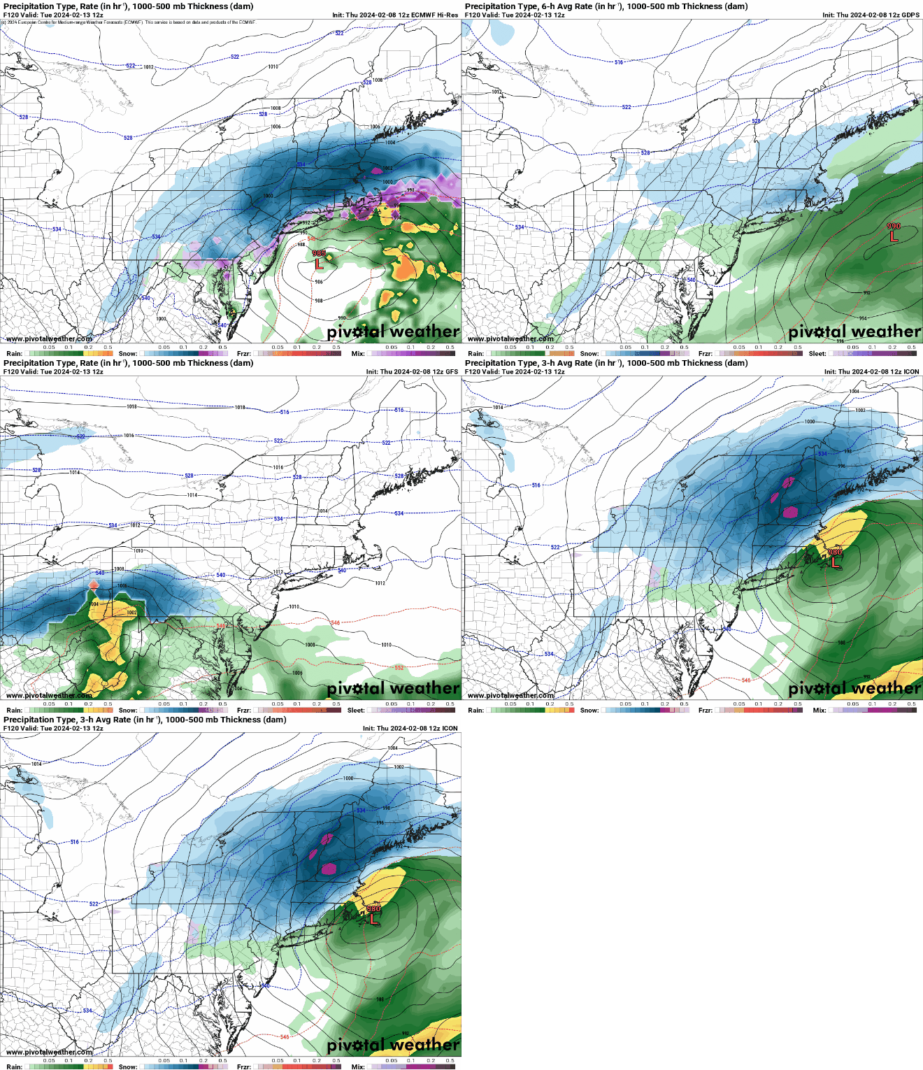
We finally got some sunshine over the past several days, but unfortunately, there are more clouds on the way. They’ll spread across the region tonight as low pressure moving into the Great Lakes sends a warm front our way. There could be a stray rain or snow shower accompanying the warm front, but they’ll be few and far between. We’ll see some sunshine return on Friday along with milder temperatures, with highs getting well into the 40s. Clouds come back Friday night and much of Saturday, but south to southwest winds will result in a very mild day for Saturday. High temperatures should get well into the 50s away from the coastline, with some places possibly topping 60. Along the coast, especially south-facing shorelines, we’ll have a seabreeze (yes, in February), keeping temperatures in the 40s, which is still well above normal. A cold front moves through late in the day, bringing some showers with it. High pressure builds in behind the front for Sunday, but the air isn’t that much colder. Most of us will still be in the 40s, with a few spots possibly reaching 50 again. Clouds stream back in Sunday night and Monday as low pressure heads toward the Mid-Atlantic states. The hype train left the station yesterday for this storm, as several computer models showed the potential for a sizeable snowstorm Monday night and Tuesday. Well, the models all continue to shift, and range from a moderate snowstorm, to a snow to rain situation, to a complete miss to the south. It’s still several days away, so things will continue to change, and if it does become a threat, we’ll go into more detail on our Weekly Outlook early Monday morning. For now, don’t believe the hype and don’t get too worked up about it.

Snow? Rain? Both? None? The models don’t agree on the storm threat for Tuesday right now. Images provided by Pivotal Weather.

Thursday night: Clear skies through the evening, clouds move in overnight, slight chance for a sprinkle or flurry. Low 25-32.

Friday: Morning clouds, becoming partly sunny in the afternoon, a little breezy at times. High 42-49.

Friday night: Becoming partly to mostly cloudy. Low 32-39.

Saturday: Partly to mostly cloudy with some showers likely during the afternoon and evening. High 52-59, cooler along south-facing shorelines.

Saturday night: Any lingering showers end during the evening, some clearing possible late at night. Low 35-42.

Sunday: A mix of sun and clouds, breezy. High 44-51.

Sunday night: Partly cloudy. Low 27-34.

Monday: Becoming mostly cloudy, chance for some snow or rain towards evening. High 40-47.

Weekly Outlook: February 5-11, 2024

Our first sign that winter is on its way out arrives today. No, we’re not talking about the groundhog. It’s Truck Day, the day that the equipment truck leaves Fenway to head to Fort Myers for the beginning of Spring Training next week.

The first sign of spring is upon us – today is Red Sox Truck Day, when all of the equipment gets loaded up and shipped down to Fort Myers for Spring Training. Image provided by Boston.com

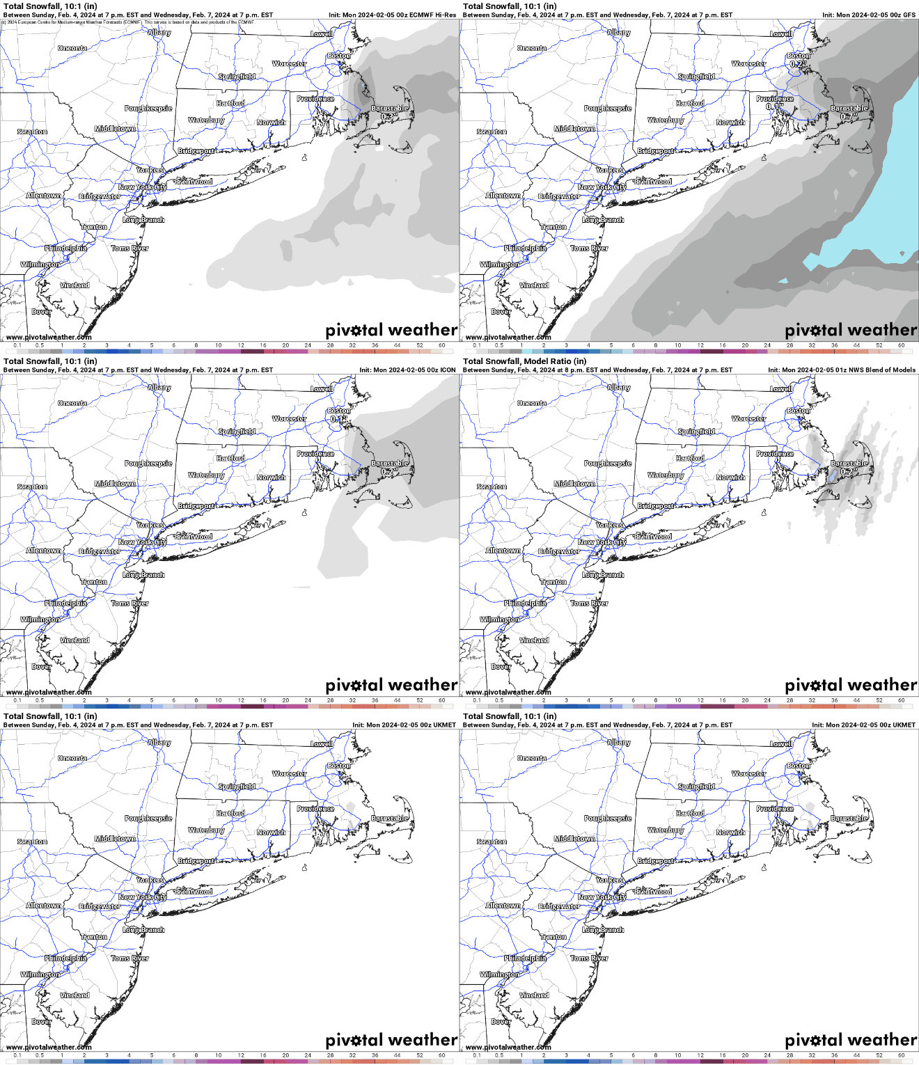
In terms of weather, we start the week with more sunshine as high pressure remains in control. Tuesday and Wednesday should end up decent for a good portion of the region, but it could be a little complicated. High pressure will remain in place across southeastern Canada. The low pressure system that produced severe weather across Florida on Sunday will slowly move into the Atlantic, passing well south and east of New England. We’ve also got an upper-level low spinning south of Atlantic Canada. The pressure gradient between the high to the north and low to the south will result in some gusty northeast winds, especially near the coast Monday night into Wednesday. They’ll also bring in some cloud cover, especially across southeastern Massachusetts. Meanwhile, disturbances rotating around that upper-level low well to the east will bring in a little more cloud cover on Tuesday, and possibly a few snow showers, especially along the coast, and south of Boston. It wouldn’t be a shock if the ground got covered across parts of southeastern Massachusetts and Rhode Island, and a few of these ocean-effect snow bands could even produce an inch or two across coastal Plymouth County and Cape Cod.

A little bit of snow is possible south of Boston from tonight into Wednesday morning. Images provided by Pivotal Weather.

We should clear out later Wednesday, but clouds will start to move back in on Thursday as a frontal system starts to approach the region from the west. Temperatures will warm to above normal levels for the end of the week, with temperatures possibly topping 50 across parts of the region on Friday. Some showers are likely Friday night into Saturday ahead of the front. Temperatures will drop a few degrees on Sunday but it will remain mild with more clouds expected.

For now, Saturday looks like it could be a mild day. Image provided by Weathermodels.com

Monday: Plenty of sunshine, clouds start to move in late in the day, breezy. High 35-42.

Monday night: Partly to mostly cloudy, some snow showers possible south of Boston, breezy along the coast. Low 20-27.

Tuesday: Plenty of clouds, some sunny breaks well inland, more snow showers south of Boston, breezy near the coast. High 32-39.

Tuesday night: Partly to mostly cloudy more snow showers possible, mostly across eastern Massachusetts, breezy along the coast. Low 22-29.

Wednesday: Morning clouds and a few more snow showers across eastern Massachusetts, skies start to clear out in the afternoon, still breezy near the coast, especially in the morning. High 35-42.

Thursday: Sunshine and some afternoon clouds. High 38-45.

Friday: Becoming mostly cloudy, breezy. High 41-48.

Saturday: More clouds than sun, breezy. High 49-56.

Sunday: Partly sunny, breezy. High 46-53.

Weekend Outlook: February 2-5, 2024

The sun will finally return this weekend (but not tomorrow, sorry Annie).

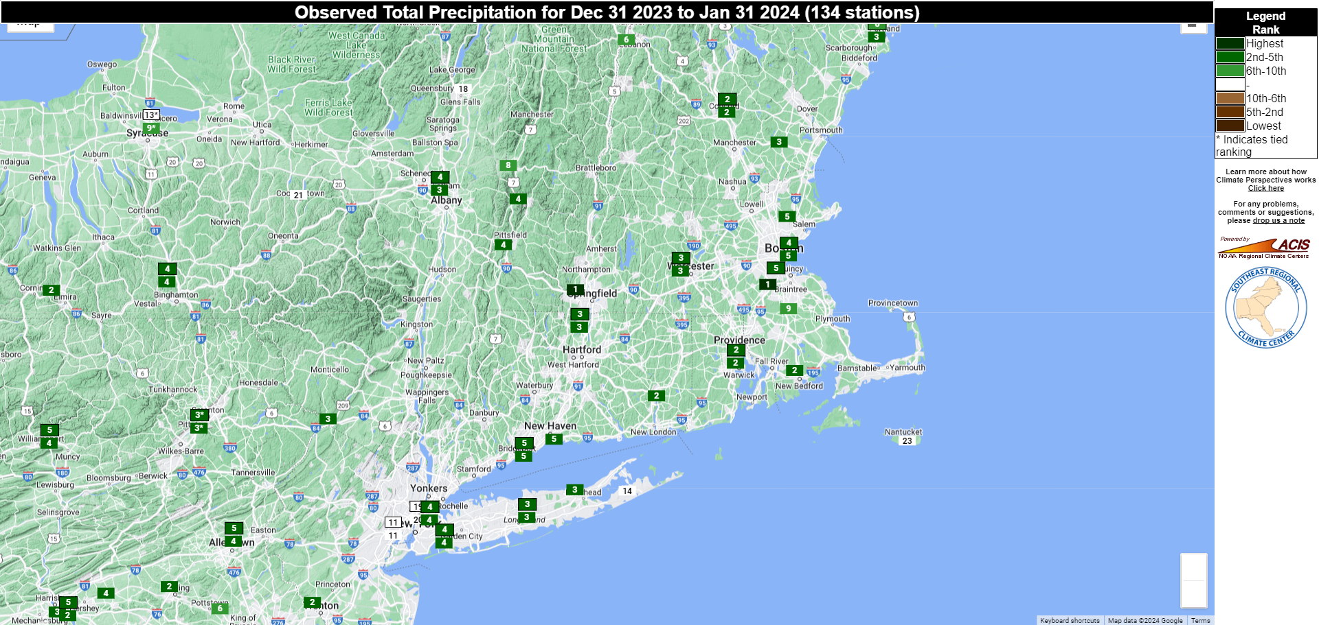
January was among the Top 5 wettest of all-time across the region. Image provided by the Southeast Regional Climate Center.

We have had little to no sunshine around here for over 10 days now, but that will finally change. A cold front will drop down from the north tonight and Friday, with a few showers ahead of it tonight. A wave of low pressure will develop along the front, bringing some additional showers in on Friday, mainly south of the Mass Pike, as the front moves by. One more weak disturbance moves through Friday evening and night with a few more rain or snow showers, then high pressure finally starts to build in. Skies may be slow to clear out on Saturday, but the sun should finally return. Sunday and Monday should both feature sunshine, though we may have some more clouds around at times on Monday.

Break out the sunglasses on Sunday, models are forecasting very little in the way of clouds. Images provided by WeatherBell.

Thursday night: Cloudy, chance for a few showers. Low 25-32.

Friday: Plenty of clouds, a few more showers likely, especially south of the Mass Pike. High 38-45.

Friday night: Some rain or snow showers during the evening, some clearing late at night, especially north and west of Boston, becoming breezy near the coast. Low 21-28.

Saturday: A few snow showers across Cape Cod early, gradual clearing from northwest to southeast during the day, a little breezy at times. High 32-39.

Saturday night: Partly cloudy across Cape Cod, clear skies elsewhere, breezy along the coast. Low 18-25.

Sunday: Plenty of sunshine. High 34-41.

Sunday night: Partly cloudy across southeastern Massachusetts and Cape Cod, clear elsewhere. Low 19-26.

Monday: Partly to mostly sunny, breezy. High 32-39.

Weekly Outlook: January 29 – February 4, 2024

January is going to end on a chilly note, but February isn’t going to be much warmer to start.

Tuesday night is looking quite chilly across the area. Image provided by WeatherBell.

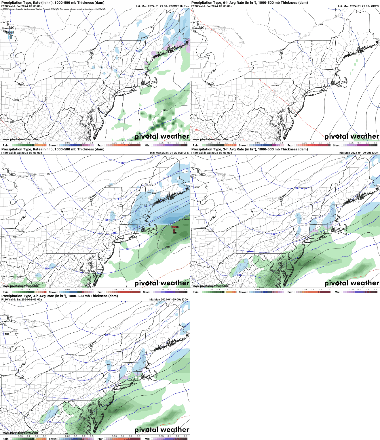
Low pressure pulls away from the region today with any lingering snow ending during the morning or early afternoon showers. It’ll become breezy with steady or falling temperatures during the afternoon, so it’ll definitely feel like late January. High pressure builds in for tonight through Wednesday with some rather chilly air, but it probably won’t completely clear out. If it did, with some fresh snowcover, it could get very cold Tuesday night. By Thursday, high pressure slides off to the east and temperatures start to moderate, but this won’t last too long. A strong cold front will drop southward from Canada on Friday. An upper-level disturbance will move through at the same time, with low pressure likely developing along the front offshore. These will combine to bring in some light snow Friday afternoon and night, but the system will likely deepen too far offshore to have a significant impact on the region. High pressure then builds in for a rather cold first weekend of February.

Another system may bring in some light snow later Friday, or it could be too far offshore. Time will tell. Images provided by Pivotal Weather.

Monday: Cloudy and breezy with light snow and snow showers ending by early afternoon. High 32-39 early, temperatures hold steady or drop during the afternoon.

Monday night: Partly to mostly cloudy, breezy along the coast. Low 16-23.

Tuesday: Plenty of clouds with some sunny breaks developing. High 26-33.

Tuesday night: Partly to mostly cloudy. Low 11-18.

Wednesday: A mix of sun and clouds. High 32-39.

Thursday: Some morning sun, then clouds return, breezy. High 38-45.

Friday: Mostly cloudy and breezy with some light snow or snow showers possible during the afternoon and at night. High 37-44.

Saturday: Becoming partly sunny, breezy, and colder. High 29-36.

Sunday: A mix of sun and clouds, still breezy. High 28-35.

Weekend Outlook: January 26-29, 2024

Our active weather pattern continues through the weekend and that dreaded “S” word features prominently.

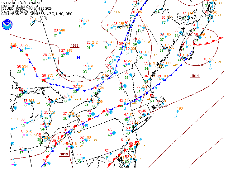
A frontal system bisects the region this afternoon. Image provided by NOAA.

A wavy frontal system sits across the region this afternoon, separating the mild air across much of southern New England from the seasonable chill to the north. That front will sag southward as a cold front later today, bringing the cool air back. A wave of low pressure will ride along the front, bringing another round of rain in for late tonight and Friday morning. There could be some sleet or freezing rain across parts of central New Hampshire where temperatures will be close to freezing, so if you’ll be in that area tonight or Friday morning, use some caution. The rain should end during the afternoon, but clouds will hang tough Friday night into Saturday. A weak upper-level disturbance swings through on Saturday, possibly generating a few additional rain or snow showers.

Around half an inch of rain is expected for most of the region on Friday. Image provided by WeatherBell.

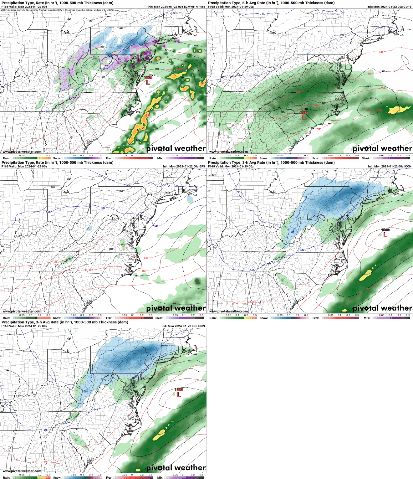
As we get into Sunday, we turn our attention to a low pressure area moving across the Tennessee Valley. The system will head towards the eastern Great Lakes while a secondary area of low pressure develops off the Mid-Atlantic coastline. We’ll see rain developing across the region Sunday morning, likely changing to snow from north to south at some point Sunday afternoon or night. Everything winds down Monday morning as the storm pulls away. There are plenty of variables that still need to be worked out with this storm, including how close the system passes to New England, and when the change from rain to snow occurs, which will have a big impact on the snow forecast. At this point, it’s safe to say that plowable snow is likely for a good chunk of the region. We’ll try to post an update on Saturday, when things should be much clearer.

There are still a few details for the models to clarify with Sunday’s storm. Images provided by Pivotal Weather.

Thursday night: Cloudy with rain redeveloping, possibly some sleet or freezing rain across central New Hampshire. Low 32-39.

Friday: Rain tapers off to showers, ending in the afternoon. High 37-44.

Friday night: Partly to mostly cloudy. Low 30-37.

Saturday: Plenty of clouds with a few rain or snow showers possible. High 36-43.

Saturday night: Cloudy, rain may develop late at night. Low 28-35.

Sunday: Cloudy with rain changing to snow from north to south, becoming breezy. High 34-41.

Sunday night: Cloudy and windy with snow likely, tapering off late at night. Low 21-28.

Monday: Mostly cloudy and windy, any lingering snow ends early. High 27-34.

Weekly Outlook: January 22-28, 2024

Cold weather is on the way out, but wet weather may be on the way back in.

Normal high temperatures are in the lower to middle 30s at this time of year. Image provided by Weathermodels.com

We start the week off with high pressure sliding offshore to our south, which means moderating temperatures today with sunshine for part of the day, but we’ll see some clouds start to move in by evening. A cold front will drop down from the north on Tuesday with more clouds, but as a wave of low pressure rides along with, we may see a period of light snow Tuesday night into early Wednesday. Accumulations will be on the light side, generally a few inches at most. By later Wednesday, that front will lift northward as a warm front, changing the snow to rain across the region as the precipitation tapers off.

While the snow may impact the Wednesday morning commute, it won’t be a big deal overall. Image provided by WeatherBell.

Another wave of low pressure brings in a second bout of rain for Wednesday night into Thursday, with temperatures warming to above normal across the region. Yet another wave of low pressure could bring in more rain for Friday, before high pressure builds in with drier weather on Saturday. Sunday is highly uncertain at this point. Another cold front will be dropping down from the north while a developing low pressure area moves off the Mid-Atlantic coast. Does the low stay too far south to have any impact on us, does it come farther north and bring in some snow or rain? We can’t answer this question yet, but hope to have more clarity when it is time for our Weekend Outlook Thursday afternoon.

The models all have different ideas for the end of the weekend. Images provided by Pivotal Weather.

Monday: Sunny in the morning, some clouds start to move in during the afternoon. High 33-40.

Monday night: Partly to mostly cloudy, breezy, slight chance for a snow flurry. Low 26-33.

Tuesday: Some sunny breaks in the morning, otherwise mostly cloudy, some light snow possible toward evening. High 35-42.

Tuesday night: Cloudy with some light snow developing. Low 26-33.

Wednesday: Cloudy with light snow tapering off early, eventually changing to sleet and then rain showers. Some steadier rain expected at night, possibly still as freezing rain across central New Hampshire. High 34-41.

Thursday: Cloudy with occasional light rain and showers. High 42-49.

Friday: Mostly cloudy, breezy, more rain, especially in the morning. High 47-54.

Saturday: Partly to mostly cloudy. High 43-50.

Sunday: Partly sunny, breezy, chance for some snow or rain showers, mainly near the South Coast. High 37-44.

Weekend Outlook: January 19-22, 2024

Snow and cold temperatures are on the way, but neither will be around for too long.

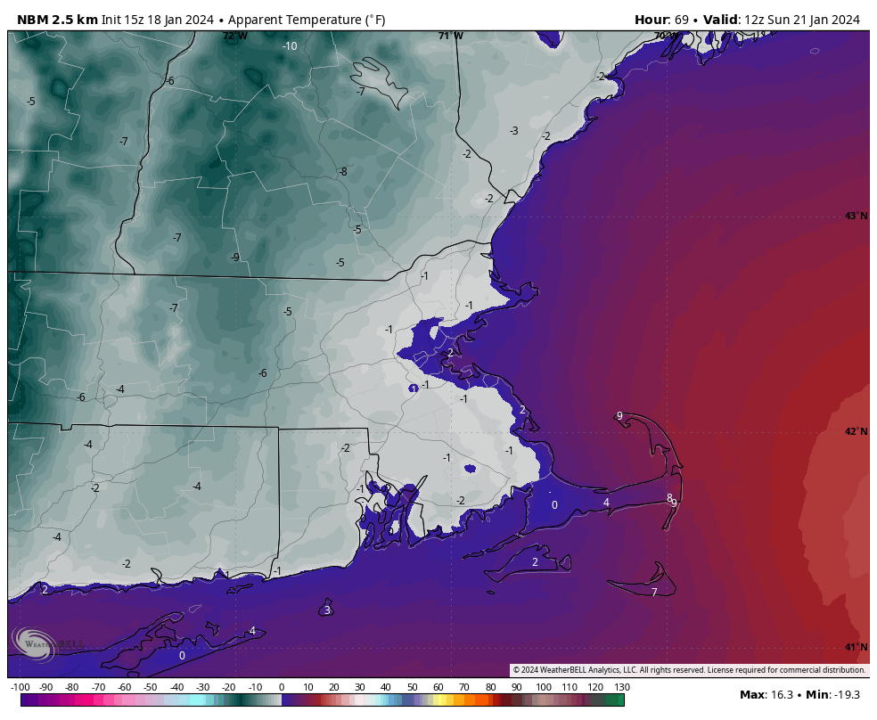
Bundle up if you’re headed out the day early Saturday or Sunday morning. Image provided by WeatherBell.

Low pressure will develop off the Carolina coast tonight and head northeastward, passing well south and east of New England on Friday. It will spread some light snow into the region Friday afternoon and evening, mainly south of the Mass Pike, but possibly as far north as the MA/NH border. For much of the region, this will be “nuisance snow”, with a coating to an inch of accumulation. However, along the coast from Plymouth County to Cape Cod, things will be a bit different. Northeast to northerly winds off of the relatively mild Atlantic, will produce some ocean-effect snow. This is similar to the lake-effect snow you hear about near Buffalo, but not nearly as heavy. It will enhance to snow near the coast, with the potential for 2-4 inches in spots, maybe even a few heavier amounts. The storm pulls away Friday night, and some very chilly air settles in behind it. Temperatures may struggle to reach 20 in parts of the region on Saturday, with sub-zero wind chills, especially in the morning both Saturday and Sunday. High pressure moves off to the east for Sunday and Monday, allowing temperatures to begin to moderate. We will some clouds starting to move in again on Monday ahead of another storm system headed our way.

We’re not expecting much snow with this system, but along the coast you may need a shovel. Image provided by Weathermodels.com

Thursday night: Mostly cloudy. Low 15-22.

Friday: Cloudy with light snow developing. High 25-32.

Friday night: Mostly cloudy, snow ending before midnight. Low 7-14.

Saturday: Plenty of clouds with a few sunny breaks developing, breezy. High 17-24.

Saturday night: Clearing, breezy. Low 9-16.

Sunday: Lots of sunshine, breezy. High 23-30.

Sunday night: Clear skies. Low 10-17.

Monday: Morning sunshine, increasing afternoon clouds, breezy. High 33-40.

Weekly Outlook: January 15-21, 2024

It took until mid-January, but this week will finally feel like winter around here.

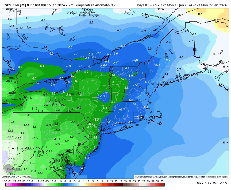
Temperatures will be well below normal this week. Image provided by WeatherBell.

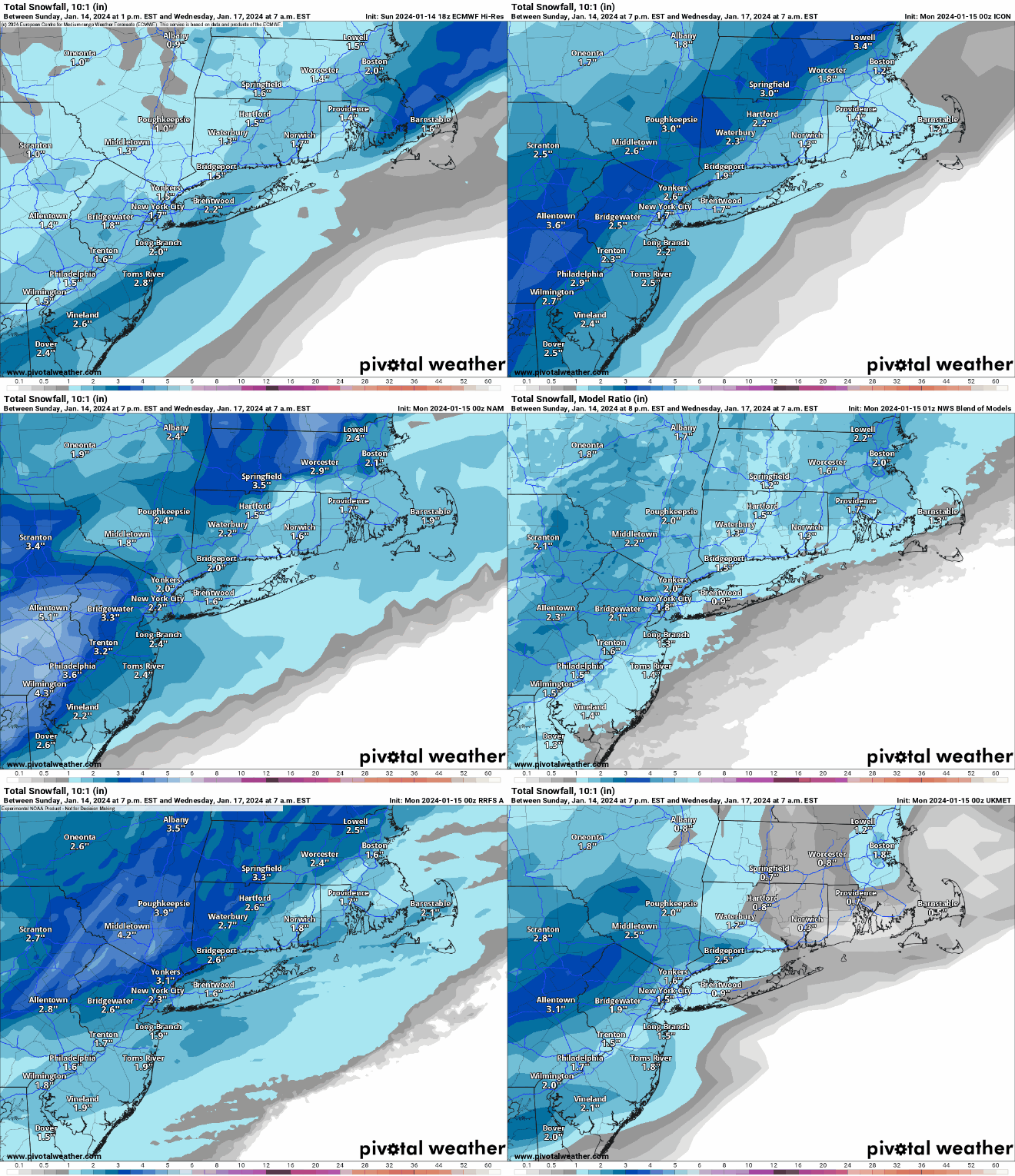
The week starts off with high pressure providing the region with sunshine and chilly temperatures. Low pressure will start to organize across the Southeast and begin heading up the East Coast, spreading some clouds in during the afternoon and evening. While that system is heading our way, an upper-level disturbance will move toward the region from the Midwest. If these two systems were to come together, we could have quite the snowstorm on our hands…but that’s not going to happen. Instead, we’ll have the coastal low pass well south and east of New England while the upper-level disturbance moves through. The result will be a period of light snow developing toward midday Tuesday, ending before midnight. Most places will pick up 1-3 inches of snow, possibly a little more in spots, possibly a little less across parts of Cape Cod and the Islands where a little rain could mix in.

The models are in pretty good agreement that Tuesday’s storm will produce just a few inches of snow. Images provided by Pivotal Weather.

High pressure builds in behind the system with dry and chilly conditions for Wednesday and Thursday, though not nearly to the magnitude of what they have been experiencing from the Midwest into the Northern Rockies. Clouds start to stream in on Thursday as a scenario similar to Tuesday unfolds. Low pressure passes south and east of New England on Friday while an upper-level low moves in, resulting in another round of light snow. Much like Tuesday, it looks like just a few inches for most places, though we’re not expecting any rain across the Cape and Islands this time. As that system pulls away, Saturday is shaping up to be quite a chilly day with high pressure building in, likely the coldest one so far this winter, with some places struggling to reach 20 degrees in the afternoon. Sunday looks dry as well with high pressure still in control, but not as chilly as Saturday.

Wind chills will likely be below zero across most of the region Saturday morning. Image provided by Weathermodels.com

Monday: Sunny in the morning, clouds start to move in during the afternoon. High 27-34.

Monday night: Becoming cloudy. Low 18-25, temperatures may start to rise after midnight.

Tuesday: Cloudy with light snow likely. High 28-35, possibly warmer across Cape Cod.

Tuesday night: Clearing. Low 14-21.

Wednesday: Sunshine and a few clouds, colder. High 24-31.

Thursday: Increasing clouds, breezy. High 25-32.

Friday: Cloudy and breezy with light snow likely. High 26-33.

Saturday: Partly sunny, windy, and cold. High 17-24.

Sunday: Mostly sunny, breezy. High 21-28.

Weekend Outlook: January 12-15, 2024

Another potent storm system is on the way, with quite a bit of rain and wind expected.

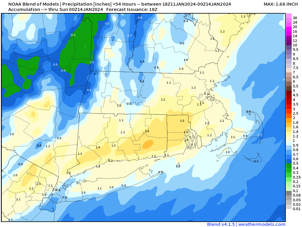
Most of the region can expect another inch or more of rain on Saturday. Image provided by Weathermodels.com

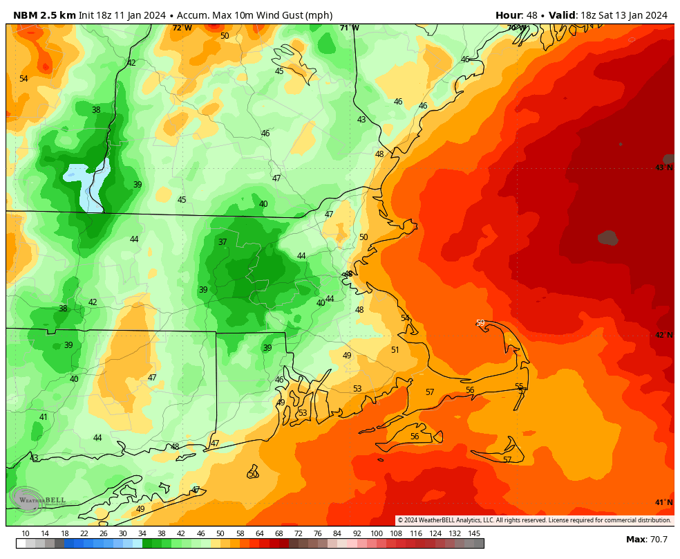
Before we get to the stormy weather, high pressure remains in control tonight and a good chunk of Friday with dry weather. Clouds will stream in on Friday as low pressure heads toward the Great Lakes once again. This storm will be fairly similar to the one we had a couple of days ago. However, the airmass in place ahead of it is not as cold, and the snowcover is mostly gone, so this one will be mainly rain for most of the region. There could be some light snow right at the start from central Massachusetts into southern New Hampshire, but it won’t last long. We’re also not expecting as much rain from this storm, though there will still be quite a bit, with widespread totals of 1-2 inches likely. This will worsen flooding issues across the region. Flood Watches have been issued for much of the area once again. Winds will also be gusty, but again, not quite to the magnitude of the last storm. Sustained winds of 20-30 mph are expected, with gusts upwards of 40 mph inland, and 50-60 mph along the coast. In addition, some coastal flooding is also possible at the time of high tide Saturday morning/early afternoon.

Wind gusts could exceed 50 mph along the coast again Saturday morning. Image provided by WeatherBell.

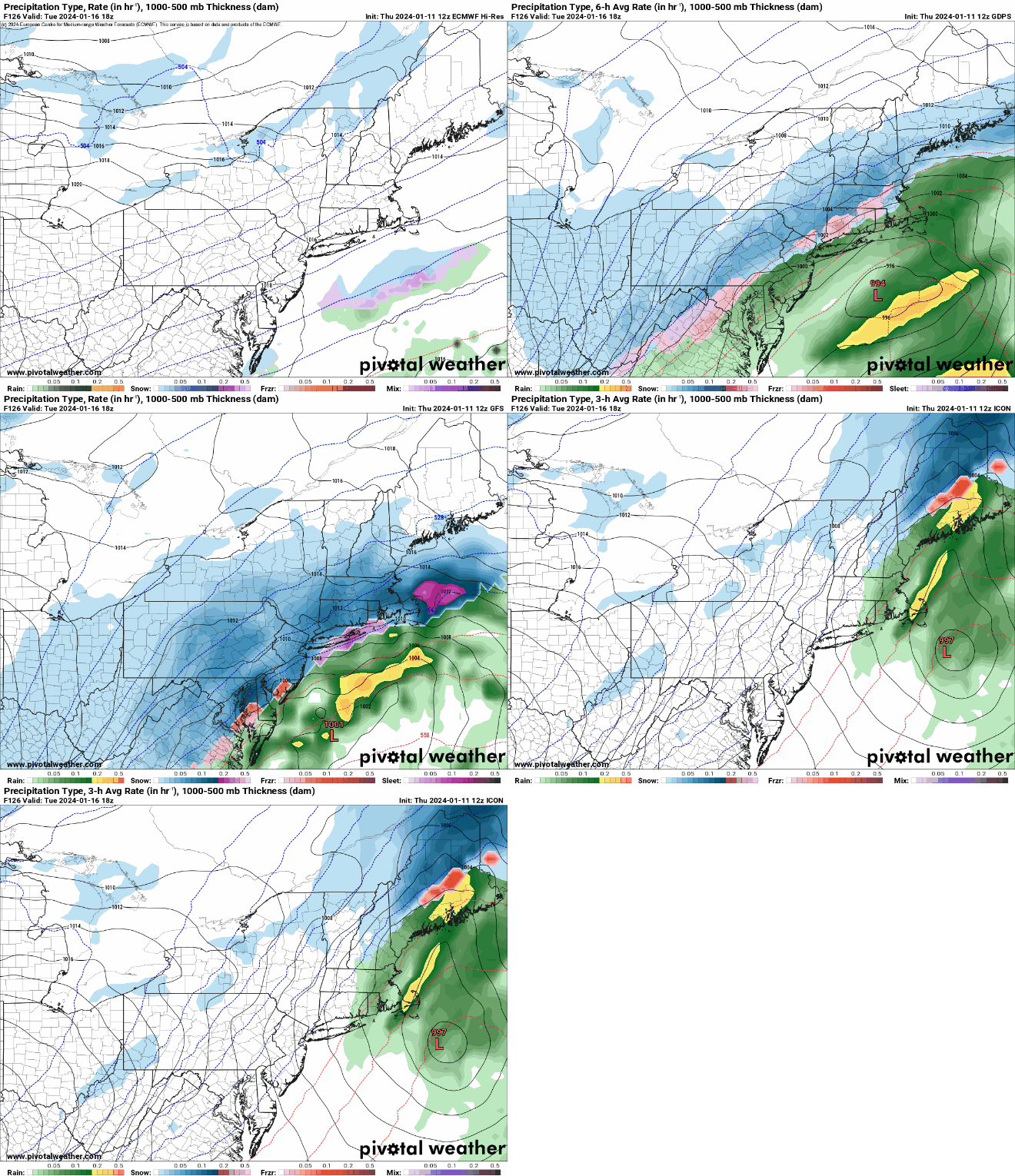
The rain should come to an end by midday Saturday, then we’ll start to clear out, with high pressure building in for Saturday night into Monday with windy and colder conditions. Even though it’s beyond the range of this outlook, we feel it’s worth mentioning that the models are showing the potential for another storm to impact the region on Tuesday, and this one could be more white than wet for much of the region. We’ll get into that in more detail in our Weekly Outlook early Monday morning.

Will another storm impact us on Tuesday? It’s a possibility. Images provided by Pivotal Weather.

Thursday night: Partly cloudy through the evening, clearing overnight. Low 27-34.

Friday: Sunny in the morning, clouds move back in during the afternoon. High 39-46.

Friday night: Cloudy and becoming windy with rain developing, possibly starting as some snow from central Massachusetts into southern New Hampshire. Rain could be heavy at times. Low 30-37 during the evening, temperatures rise overnight.

Saturday: Steady rain ending in the morning, a few showers possible through the afternoon with some late-day clearing, windy. High 51-58 in the morning, temperatures drop in the afternoon.

Saturday night: Clear to partly cloudy, windy. Low 25-32.

Sunday: A mix of sun and clouds, breezy, colder. High 32-39.

Sunday night: Partly cloudy, breezy. Low 17-24.

Monday: Partly sunny. High 29-36.