After a couple of heavy rainstorms, some drier and milder air is on the way this week.

The storm system that brought in the rain yesterday morning will move into Atlantic Canada today while high pressure starts to build in from the west. With a tight pressure gradient between the two, it’ll be quite the windy day, with sustained winds of 20-30 mph and gusts to 40-50 mph or higher across the region. Clouds will gradually give way to some sunshine today, but temperatures will remain on the cool side. The high pressure area then builds for Tuesday into Thursday. Sunshine will return on Tuesday with diminishing winds. A few clouds are expected on Wednesday, but temperatures will start to moderate as a warm front moves through, possibly accompanied by a shower or two. Clouds will become a little more numerous on Thursday, but temperatures could get well into the 60s across the area, away from the shoreline, where a seabreeze is expected. More showers are possible though ahead of a cold front.
The end of the week and the weekend is a different story. A series of weak systems will move through, with episodes of showers likely. It’s not going to rain the entire time, and the rain shouldn’t be that heavy, but it won’t be the nicest of weekends. Temperatures will cool off, but still remain above normal for mid-March. Friday is the day that is the biggest question mark. Some models have the cooler air move in rather early, some wait until later in the day. If the earlier ones are right, temperatures may only be in the 40s or lower 50s for highs, but if the later ones are right, we could get well into the 60s once again. We’re leaning towards the cooler model solutions at this time, but we will refine this forecast when we publish our Weekend Outlook on Thursday.

Monday: Morning clouds give way to some afternoon sunshine, windy. High 38-45.
Monday night: Clear skies, breezy. Low 28-35.
Tuesday: Plenty of sunshine, still breezy, not as cool. High 48-55.
Tuesday night: Clear skies during the evening, some clouds start to filter in late at night. Low 29-36.
Wednesday: A mix of sun and clouds, just a slight chance for a shower. High 52-59, cooler along the coast.
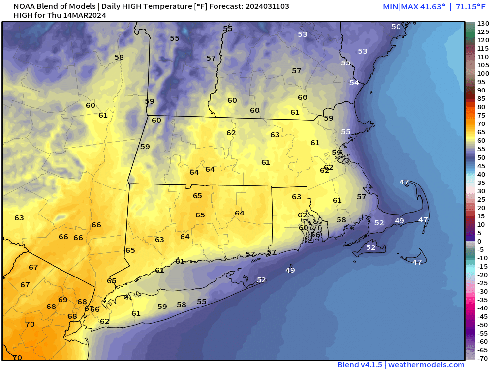
Thursday: Partly sunny and mild, showers possible late in the day and into the evening. High 57-64, cooler along the coast.
Friday: Mostly cloudy and breezy with showers likely. High 48-55.
Saturday: Intervals of clouds and sunshine, breezy, chance for a few showers, mainly early. High 47-54.
Sunday: Partly to mostly cloudy, breezy, rain possible. High 48-55.
