The internet has been doing its thing this week, so we’re here to separate hype from reality in terms of the weekend forecast.
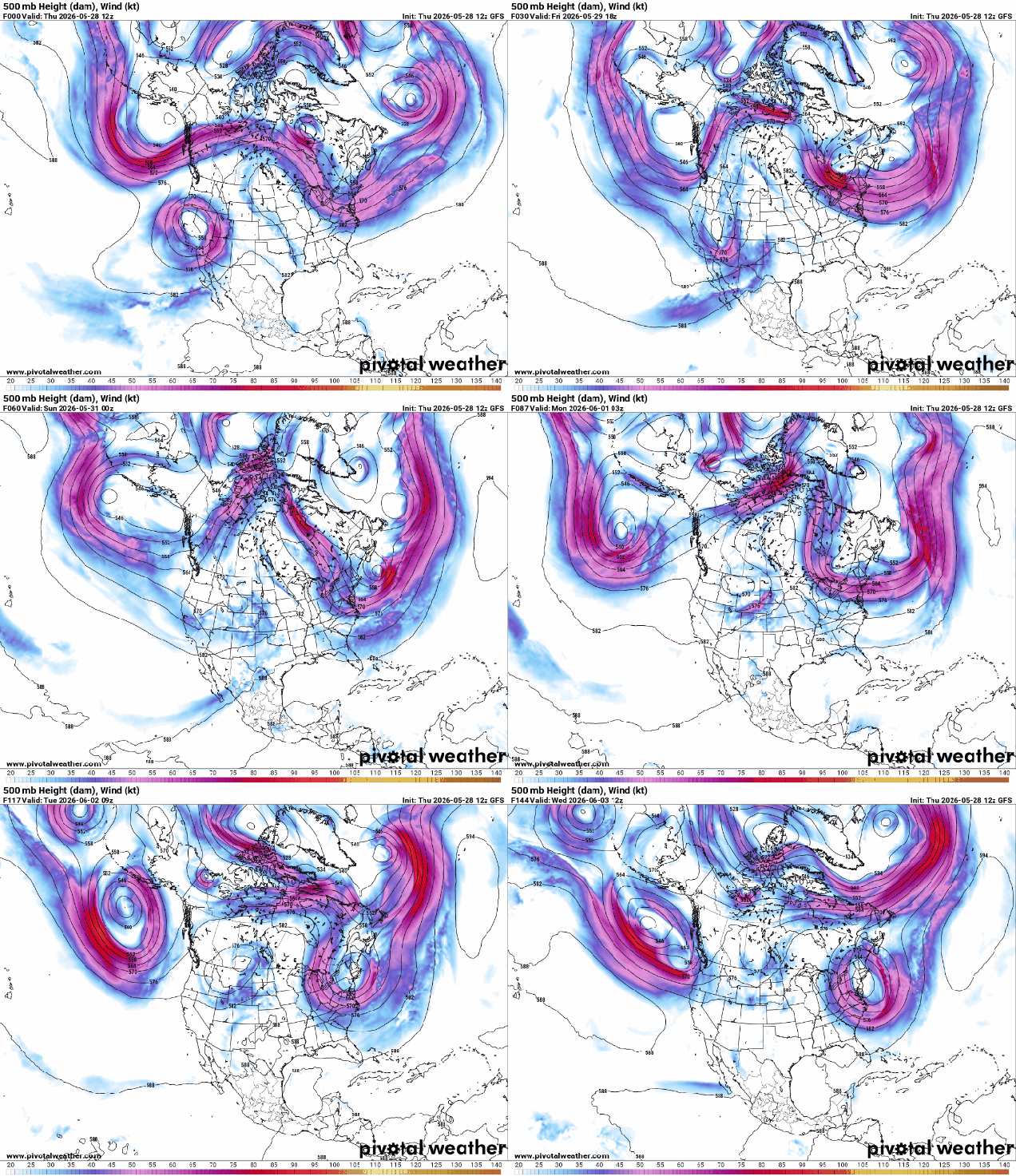
The upper-level pattern across the country will settle into an “Omega Block” over the next days. With upper-level lows across the Pacific Northwest and in the Northeast, with a ridge of high pressure in the middle, the flow resembles the Greek letter Omega. This pattern does not allow systems to move across the country swiftly, like they usually do. If you’re underneath one of the upper lows, the pattern isn’t that great for a while. If you’re under the ridge, it’s usually dry and warm to hot, depending on the season. Well, we’re going to be under one of the upper lows through the weekend, but that doesn’t mean it’s going to be miserable the entire time.
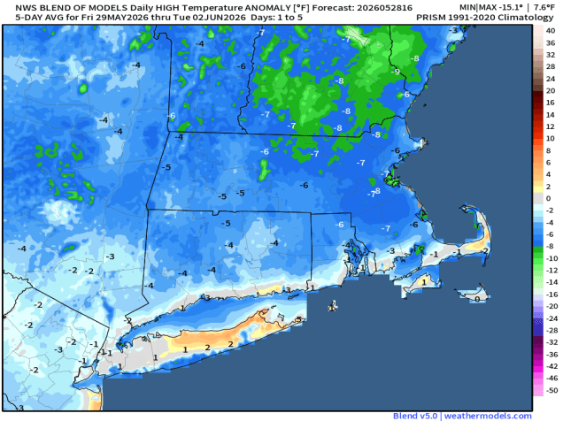
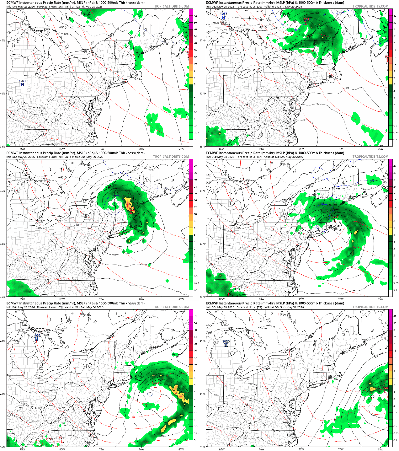
In terms of sensible weather, showers will taper off this evening, and then we’ll remain dry for the overnight and first part of Friday. A potent upper-level disturbance will begin dropping southward from Quebec on Friday, so we’ll see clouds moving in, with rain likely Friday night into Saturday morning. Showers may linger into the afternoon, especially across eastern Massachusetts. The rain won’t be exceptionally heavy, but any rain is welcome, as it helps with the ongoing drought. Along the coast, especially south of Boston, winds will be gusty Saturday afternoon as the system moves offshore and continues to develop, with some gusts to 40 mph possible. With the clouds, rainfall, and cooler air aloft, it will be a chilly day by late-May standards, with temperatures likely in the 50s and lower 60s during the daytime.
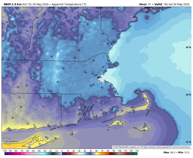
This is where the internet hype machine has gone into overdrive. No, it is not going to feel like mid-winter on Saturday with wind chills in the 30s all day long as some have been claiming. First of all, wind chills in the 30s is not what we normally get in mid-winter to begin with – actual temperatures in the 30s, yes, when it’s milder than normal. Yes, there are a few models that show this potential on Saturday, but just because a model forecasts it, doesn’t mean that is what going to happen. As a colleague of ours is fond of saying “if the models were as good as people think, there’d be no need for meteorologists”.
Similarly, we’ve seen plenty of posts about the “snowstorm hitting New England this weekend.” Yes, a storm is coming, as we explained above. Yes, temperatures will be well below normal, which we also have mentioned already. Yes, there may be some snow in the higher elevations of northern New Hampshire and northwestern Maine for a few hours Saturday morning. There could even be some minor accumulations at elevations above 3000 feet. Care to guess how many people in that region live at elevations above 3000 feet? The answer might not be zero, but it’s probably less than 1000 (maybe even less than 100). Also, while this is unusual, it’s actually not that abnormal. Mount Washington has received snow in every month of the year.
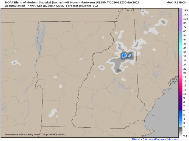
As for the rest of the weekend, Sunday should be a better day with milder temperatures, but with that upper-level low overhead we’ll see clouds popping up by midday, with a few pop-up showers in the afternoon. Another disturbance will drop down on Monday with a few more clouds and likely a few more showers.
Thursday night: A few showers through the evening, then becoming clear, clouds start to move back in late at night. Low 48-55.
Friday: A mix of sun and clouds through the morning, then clouds thicken up in the afternoon with showers possible by evening. High 65-72.
Friday night: Periods of rain and showers likely. Low 42-49.
Saturday: Showers likely during the morning, some clearing possible by late in the day, windy at times, especially during the morning and early afternoon and along the coastline. High 53-60, but temperatures may stay in the upper 40s for much of the morning and early afternoon, especially across eastern Massachusetts.
Saturday night: Becoming clear. Low 40-47.
Sunday: Some morning sun, then clouds pop up with a few afternoon showers. High 64-71, a little cooler along the coast.
Sunday night: Partly cloudy. Low 47-54.
Monday: More clouds than sun with some showers likely. High 62-69.

