Friday is looking like a really nice day, so you’d better enjoy it, because the rest of the weekend isn’t looking so great.

The upper-level low pressure that’s been hanging around all week will finally move away and high pressure builds in tonight into Friday with drier and milder conditions. Friday like starts with some sunshine, but clouds will increase and thicken up during the afternoon and evening as low pressure begins to slowly move this way. The high will keep the rain shield from the low at bay for a while, but showers should eventually develop Saturday afternoon and continue into Sunday morning. Sunday may not be that bad of a day, but it certainly isn’t looking great. As the first system moves out, a second, more potent one, will begin to approach. Most of the rain from that system will hold off until Sunday night, so the bulk of Sunday will be just cloudy, but there will be enough moisture around for some drizzle and possibly a few showers. Rain is likely Sunday morning, ending by midday Monday, with some sunny breaks developing in the afternoon.
Thursday night: Becoming clear to partly cloudy with areas of fog developing. Low 36-43.
Friday: Some morning sun, then clouds increase and thicken up. High 58-65, coolest along the coast.
Friday night: Mostly cloudy. Low 40-47.
Saturday: Cloudy and becoming breezy with showers developing during the afternoon. High 51-58.
Saturday night: Periods of rain and showers, breezy. Low 42-49 during the evening, temperatures may rise a bit after midnight.
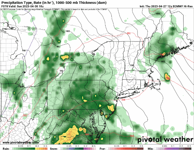
Sunday: Rain tapers off in the morning, still some showers or drizzle around during the afternoon, still breezy. High 57-64.
Sunday night: Windy with rain redeveloping. Low 47-54.
Monday: Showers end in the morning, some clearing during the afternoon, breezy again. High 61-68.
