Despite the snow last night and this morning, temperatures will remain above normal for much of the upcoming week.
Low pressure slowly pulls away from the region today, with snow lingering near the coast , but the sun may come out as you head westward. Skies should clear out near the coast as well Monday night as the storm finally moves far enough away. Tuesday starts off nice, but clouds return during the afternoon ahead of another fast-moving but weak storm system. A few showers are possible, but temperatures will also turn milder, helping to melt the snow that fell late Sunday and Monday. We’ll start to clear out again on Wednesday as high pressure builds back in with mild temperatures once again.
The next system moves toward the region on Thursday, and will impact the region late Thursday into much of Friday. While it will be mostly rain, it may start as snow across southern New Hampshire, where some accumulations are possible. The rain may also change back to snow before ending across the region late Friday. High pressure then builds in for next weekend with drier weather.

Monday: Plenty of clouds, breezy, some sunny breaks inland, snow showers continue near the coastline, tapering off in the afternoon. Additional accumulation an inch or less. High 32-39.
Monday night: Clearing. Low 24-31.
Tuesday: Morning sun, increasing afternoon clouds. High 39-46.
Tuesday night: Partly to mostly cloudy with a few showers possible. Low 29-36.
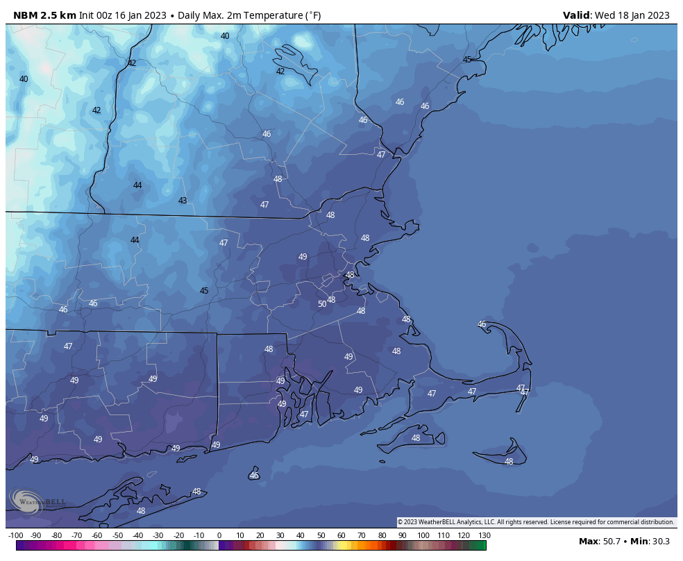
Wednesday: Becoming partly to mostly sunny. High 44-51.
Thursday: Becoming cloudy, showers developing late in the day, possibly starting as snow north and west of Boston before changing to rain at night. High 37-44.
Friday: Cloudy with showers ending, possibly as wet snow, especially north and west of Boston. High 36-43.
Saturday: A mix of sun and clouds, chance for a few snow showers. High 35-42.
Sunday: Partly sunny. High 38-45.
