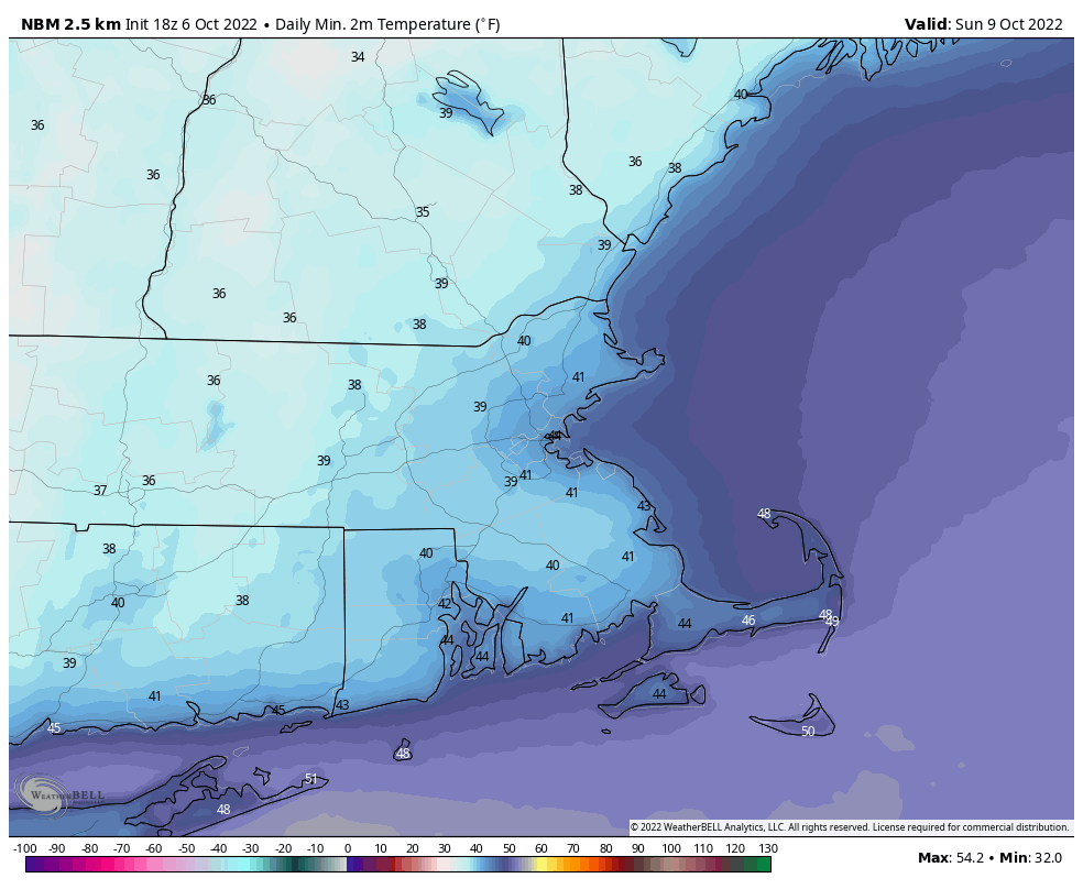
We’ve got one more mild day coming up but fall weather really arrives.
We’ll have some clouds across the region tonight as a weak upper-level disturbance crosses the Northeast, but Friday is shaping up to be another fantastic early October day with mostly sunny skies and mild temperatures, with many locations topping 70. However, a strong cold front will slice across the region late in the day. It will be accompanied by some clouds and possibly a few showers, but for the most part, it’ll have little fanfare. Behind it, you’ll notice a big difference. High pressure builds in for the weekend with sunshine for Saturday through Monday, but temperatures will be significantly cooler. Many locations may fail to top 60 on Saturday despite ample sun, and some frost is possible Saturday night as temperatures tumble into the 30s in some of the normally cooler locations. Temperatures will moderate a bit for Sunday and Monday, but will still be near or a little below normal for early October.
Thursday night: Partly to mostly cloudy. Low 50-57.
Friday: Becoming partly to mostly sunny, chance for a few late-day showers. High 69-76.
Friday night: Gradual clearing. Low 40-47.
Saturday: Sunny and cool. High 54-61.
Saturday night: Clear and chilly. Low 35-42.
Sunday: Plenty of sunshine. High 56-63.
Sunday night: Clear skies. Low 38-45.
Monday: Sunshine and some afternoon clouds. High 57-64.
