We’ve got a fantastic late summer/early fall weekend coming up across the region.
The forecast for the next several days is actually fairly simple. High pressure will build into the region, and slowly drift eastward over the next several days. The result is sunshine each afternoon through Sunday, with temperatures gradually warming. Some of the smoke from the wildfires out West may reach our skies this weekend, resulting in hazy conditions at times. Some clouds will start to filter in on Sunday and Monday as the next low pressure system approaches the region. Some showers are possible on Monday, but it looks like most of the activity should hold off until Monday night or Tuesday.

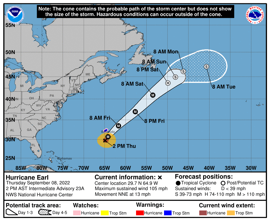
One other thing to keep in mind – Hurricane Earl will pass well south and east over the region over the next few days, but it will brush Bermuda. It will have one impact around here though – it will churn up some rough seas which will impact our coastal waters and beaches through the weekend. If you’re planning to head to the beach, there will be a high risk for rip currents, so use some caution. Offshore, small craft advisories are up for the coastal waters south and east of the Cape and Islands.
Thursday night: Partly cloudy. Low 51-58.
Friday: Early clouds, then becoming mostly sunny and hazy at times. High 74-81.
Friday night: Clear skies. Low 53-60.
Saturday: Hazy sunshine. High 79-86.
Sunday night: Partly cloudy. Low 58-65.
Sunday: Partly sunny, hazy. High 79-86.
Sunday night: Partly to mostly cloudy. Low 59-66.
Monday: Intervals of clouds and sun, chance for a shower. High 74-81.
