The week is starting off on a very stormy note, but should quiet down later in the week.

Low pressure will move across the region today, bringing a variety of hazardous conditions in, mainly during the morning hours. Some heavy rain is likely through the morning, tapering off by early afternoon as an occluded front moves across the region. Some strong winds are also likely this morning, especially near the coast, where gusts of 50-60 mph are possible. In addition, some coastal flooding is likely around high tide, due to the combination of strong onshore winds and already astronomically high tides. Notice what we didn’t mention? Snow. Any snow will be confined to areas well north and west of Boston, and likely will have changed to rain and/or ended by the time most of you read this.

During the afternoon it will still be breezy, but winds won’t be nearly as strong as they are in the morning. A cold front will move through by evening as the low passes by to our north, and that front could be accompanied by some rain or snow showers. High pressure then builds in for Tuesday with sunshine, but it will be breezy and turning colder once again. The cold air will be short-lived as another weak system approaches for Wednesday. As this system moves through, we could see some rain or snow showers late Wednesday and Wednesday night. High pressure then builds back in for Thursday and Friday, with a return to much colder weather, though not likely as cold as we had earlier this past weekend. As we head into next weekend, we’ll be keeping our eyes on a potential coastal storm. While some models have shown the potential for it to impact us next weekend, at this point, the more likely scenario is that it stays offshore with little impact, and high pressure continues to build in, keeping us dry and cold. As usual, we should have a better idea of what to expect when we publish our Weekend Outlook on Thursday.
Monday: Windy with snow across the interior changing to rain early, elsewhere rain, heavy at times in the morning, ending by early afternoon. Mostly cloudy with diminishing winds in the afternoon. High 41-48 in the morning, temperatures start to drop in the afternoon.
Monday night: Mostly cloudy and breezy, chance for a few rain or snow showers during the evening. Low 18-25.
Tuesday: Becoming partly to mostly sunny, still breezy. High 23-30.
Tuesday night: Clear during the evening, clouds start to move back in late at night. Low 8-15.
Wednesday: Mostly cloudy and breezy, chance for a few snow or rain showers late in the day and at night. High 37-44.
Thursday: Mostly cloudy, any lingering snow showers end early. High 31-38.
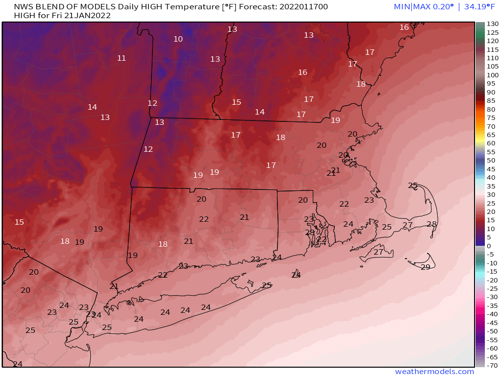
Friday: Partly sunny and cold, except mostly cloudy across Cape Cod with a few snow showers possible. High 17-24.
Saturday: Partly to mostly sunny. High 21-28.
Sunday: Mostly cloudy. High 28-35.
