All the signs are there that we’re well into fall – the leaves are changing colors, baseball’s playoffs are in full swing, football is well into the season, hockey starts up this week, basketball next week, pumpkin flavored everything has invaded everywhere, but someone forgot to give Mother Nature the memo, as we’ve got some warm weather on the way for much of the week.

We start the week off with high pressure to the north and low pressure well south of New England. The low may produce a few showers near the South Coast this morning, but high pressure should eventually win out, with some sunshine developing during the afternoon. Even more sunshine and milder temperatures are expected on Tuesday as the high continues to build in. A weak system moves through on Wednesday with little fanfare except for some clouds and just a slight chance for a shower. High pressure returns for Thursday and Friday with dry and warm conditions.
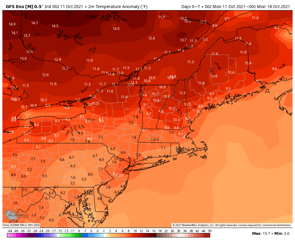
Next weekend is where things get a little uncertain. A cold front will be approaching the region, and it’s timing is still a bit of a question mark. Saturday looks quite mild at this point, but as the front draws nearer, some showers and possibly thunderstorms are likely ahead of it. Much of the day should remain dry, with showers holding off until nightfall, but this is far from certain. The front likely moves through at night, with much cooler air settling in on Sunday. However, if the front doesn’t move through until sometime Sunday, as at least one model shows, then Sunday could start off quite warm before temperatures drop during the afternoon. We should have better clarification of the timing of the front for our Weekend Outlook on Thursday.

Monday: A few showers near the South Coast early, otherwise plenty of clouds with some sunny breaks. High 64-71.
Monday night: Becoming partly cloudy. Low 49-56.
Tuesday: Partly sunny. High 68-75.
Tuesday night: Clear to partly cloudy. Low 50-57.
Wednesday: Partly sunny, slight chance for a shower. High 69-76.
Thursday: Partly sunny. High 69-76.
Friday: Becoming partly to mostly cloudy. High 69-76.
Saturday: A mix of sun and clouds, showers and possibly some thunderstorms likely at night, breezy. High 68-75.
Sunday: Showers end early, then becoming partly to mostly sunny, breezy, and cooler. High 61-68.
