We’ve got showers and thunderstorms in the forecast for nearly every day this week, but aside from today, it may not actually be that wet in most spots.
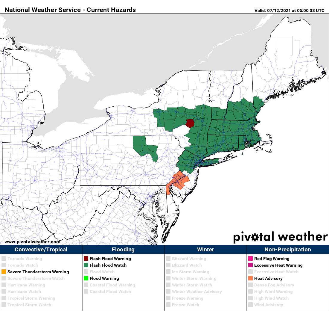
A warm front is going to take its time crossing the region today and Tuesday. A wave of low pressure riding along the front will bring in rain today, some of which may be heavy. Given the amount of rain we’ve had over the past 2 weeks, the ground is already saturated in many areas, so additional rain will lead to flooding problems. As a result, flash flood watches have been issued for much of the region. Tuesday looks to be drier, but still on the cool side, as the front will take its time lifting northward. A few showers can’t be ruled out.
The front finally lifts through on Wednesday, allowing warm to hot and humid weather to return, and it will remain in place into Saturday. With the hot and humid weather will come a daily chance for showers and thunderstorms. Those showers and storms will become more numerous on Sunday as a cold front moves in.

Monday: Plenty of clouds with periods of rain and showers, mainly during the morning. High 67-74.
Monday night: Mostly cloudy with a few showers possible. Low 58-65.
Tuesday: Clouds and a few sunny breaks, chance for a shower or two. High 68-75.
Tuesday night: Partly to mostly cloudy. Low 59-66.
Wednesday: More clouds than sun with scattered showers and thunderstorms possible. High 76-83.
Thursday: A mix of sun and clouds, chance for a late-day shower or thunderstorm. High 79-86.
Friday: Partly sunny, a shower or thunderstorm may pop up. High 82-89.
Saturday: A mix of sun and clouds, breezy, showers and thunderstorms possible late in the day and at night. High 82-89.
Sunday: Partly to mostly cloudy with scattered showers and thunderstorms. High 78-85.
