We’re not sure if you’ve heard, but Tropical Storm Elsa is heading this way. It have have some impacts around here tonight and Friday.
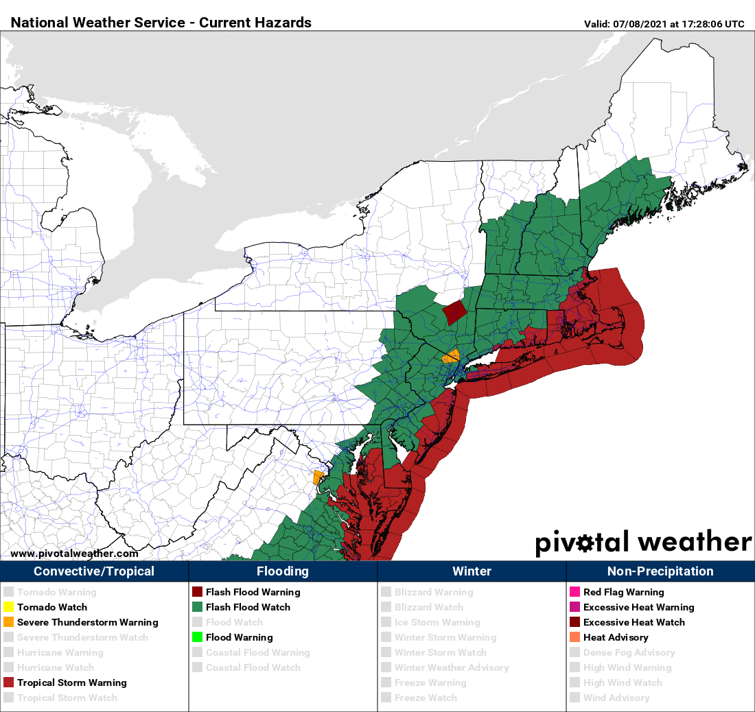
As of 2pm EDT, Elsa was centered about 25 miles southwest of Raleigh, NC and moving toward the northeast at 20 mph. Maximum sustained winds are down to 45 mph. A Tropical Storm Warning is in effect for the coast of Connecticut from New Haven eastward, coastal Rhode Island, and nearly all of the coast of Massachusetts from the Mouth of the Merrimack River southward (sorry Salisbury, you don’t get to play), including Cape Cod and the Islands. Elsa will continue northeastward tonight, turning more toward the east-northeast on Friday, likely passing right across southeastern Massachusetts.
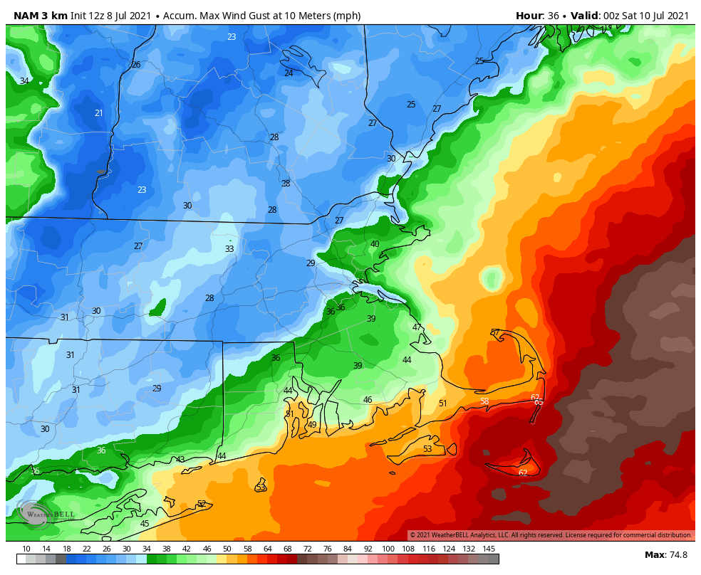
Tropical systems have different characteristics when they get up this way, compared to how they look in the Caribbean or Gulf of Mexico. They take on a “rain to the left, wind to the right” appearance. This means that the heavy rain shifts to the left side of the storms track, while most of the strong winds are to the right of the track. In this case, that means most of the wind will be confined to parts of southern RI, southeastern MA, and the offshore waters, but much of the rest of the region can expect heavy rain. How much rain? Rainfall totals of 2-4 inches and possibly heavier, most of it falling between about 8am and 2pm on Friday. Oh, an just to add to the fun for the folks in southern RI and southeastern MA, these systems can and usually do produce some short-lived weak tornadoes, mainly in the right-front quadrant of the storm.

Before Elsa gets here, we’ll have some showers and thunderstorms to deal with this evening and tonight, thanks to a stalled out frontal system draped across the South Coast. Once Elsa’s rain moves out late Friday, high pressure will try to build back in on Saturday, but we’ll still have plenty of moisture around, which means we could pop a few showers and thunderstorms Saturday afternoon. Warm and humid air moves back in for Sunday and Monday (and into the middle of next week), with some showers and thunderstorms possible each afternoon, especially Monday.
Thursday night: Cloudy with showers and thunderstorms during the evening. Rain and showers redevelop late at night. Low 60-67, a little warmer along the South Coast.
Friday: Windy with rain, heavy at times, tapering off in the afternoon. High 72-79. Offshore: East Coast Southeast 15-25 knots, gusts to 40 knots, becoming northwest late in the day, seas 3-6 feet. South Coast: Southeast to south winds 20-40 knots, gusts to 50 knots, seas 6-10 feet.
Friday night: Showers end in the evening, then becoming partly cloudy. Low 62-69.
Saturday: Partly sunny, chance for an afternoon shower or thunderstorm. High 73-80. Offshore: West to northwest 5-10 knots, seas 3-6 feet.
Saturday night: Clear to partly cloudy. Low 59-66.
Sunday: Intervals of clouds and sunshine, a shower or thunderstorm is possible during the afternoon. High 75-82. Offshore: East to southeast winds 5-10 knots, seas 2-4 feet.
Sunday night: Partly to mostly cloudy. Low 61-68.
Monday: Partly sunny, chance for a few afternoon showers or thunderstorms. High 77-84. Offshore: South winds 5-10 knots, seas 2-4 feet.
