We’ve got a tug-of-war this weekend between high pressure to our northeast and a frontal boundary stalled out to the south. For the most part, the high should win out.

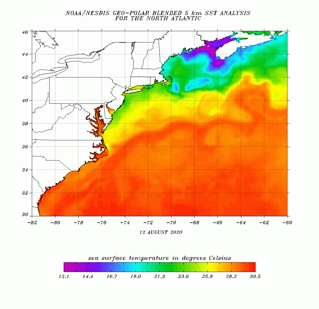
As high pressure builds in, drier air has also settled in, with dewpoints dropping into the 50s across much of the region. While we’ll still be warm today, cooler air will gradually settle in over the next few days, thanks mainly to east to northeast winds off of the Atlantic. The ocean is about the warmest it will get around here during the year, but it’s still only in the 60s and lower 70s east of New England, so winds blowing off the water will still have a cooling effect, especially along the coastline.
Meanwhile, that front to the south will keep some clouds around, especially along the South Coast. A couple of waves of low pressure will ride along this front. They’ll bring heavy rain and thunderstorms to the Mid-Atlantic states, where flash flood watches and warnings remain in effect, but around here, they won’t do much for now. The first wave should pass harmlessly south of the region, except for possibly a few showers along the south coast this afternoon and evening. It’s the second wave, for late Sunday and Monday, that we’re keeping an eye on. Many of the models have it coming in farther north, bringing us some showers and thunderstorms late Sunday into Monday. However, we’ve also had plenty of times recently when the models have been trying to bring in widespread showers a few days out, and they just haven’t materialized. As we’ve said several times, the old forecaster’s adage is “When in Drought, Leave it Out”. We wouldn’t be surprised if the high pressure area wins out again, and most of us stay dry Sunday night and Monday too.
Thursday night: Clear to partly cloudy. Low 63-70.
Friday: Partly to mostly sunny. High 79-86, coolest along the coast.
Friday night: Clear to partly cloudy. Low 60-67.
Saturday: A mix of sun and clouds, breezy. High 73-80, coolest along the coast.
Saturday night: Partly to mostly cloudy. Low 58-65.
Sunday: Mostly cloudy with a chance for a few showers. High 72-79.
Sunday night: Mostly cloudy, chance for some showers. Low 61-68.
Monday: Plenty of clouds with some sunny breaks, some showers are also possible. High 75-82.
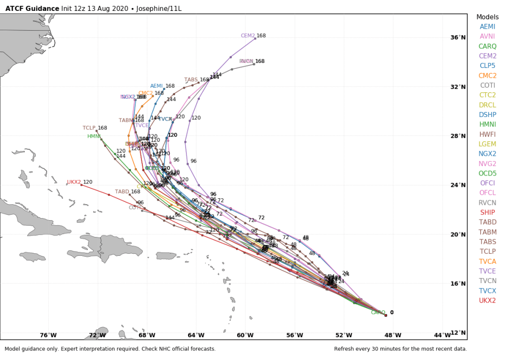
Finally, we’ll briefly mention Tropical Storm Josephine. Tropical Depression 11 strengthened into Tropical Storm Josephine this morning. As of midday, it was centered a little less than 1000 miles east of the Lesser Antilles, moving toward the west-northwest at 15 mph. Maximum sustained winds are near 45 mph. Josephine may strengthen a little more in the next day or so, but after that, it will be moving into some rather unfavorable conditions. The current forecast calls for it to pass north of the Antilles this weekend, by which point strong wind shear could rip the system apart. It will likely dissipate without threatening any land areas. Even if it does survive, it will start to recurve and head out to sea north of the Greater Antilles and east of the Bahamas.
