Who likes rain? Well, you’ve got some coming this week. What about mild weather? That’s coming as well. Cool weather instead? Yup, we’ve got that too. What about snow? Sorry, none of that…..yet.
We start the week off with what’s left of “Tropical Storm Nestor” (we’re not convinced it was ever really a tropical storm), south and east of the Cape and Islands. Any lingering showers from the storm end in the morning, with some clearing taking place in the afternoon, especially the farther north you go. The clouds come right back in Monday night as a frontal system starts to move in from the west. That front will bring in some showers, mainly late Tuesday into early Wednesday.

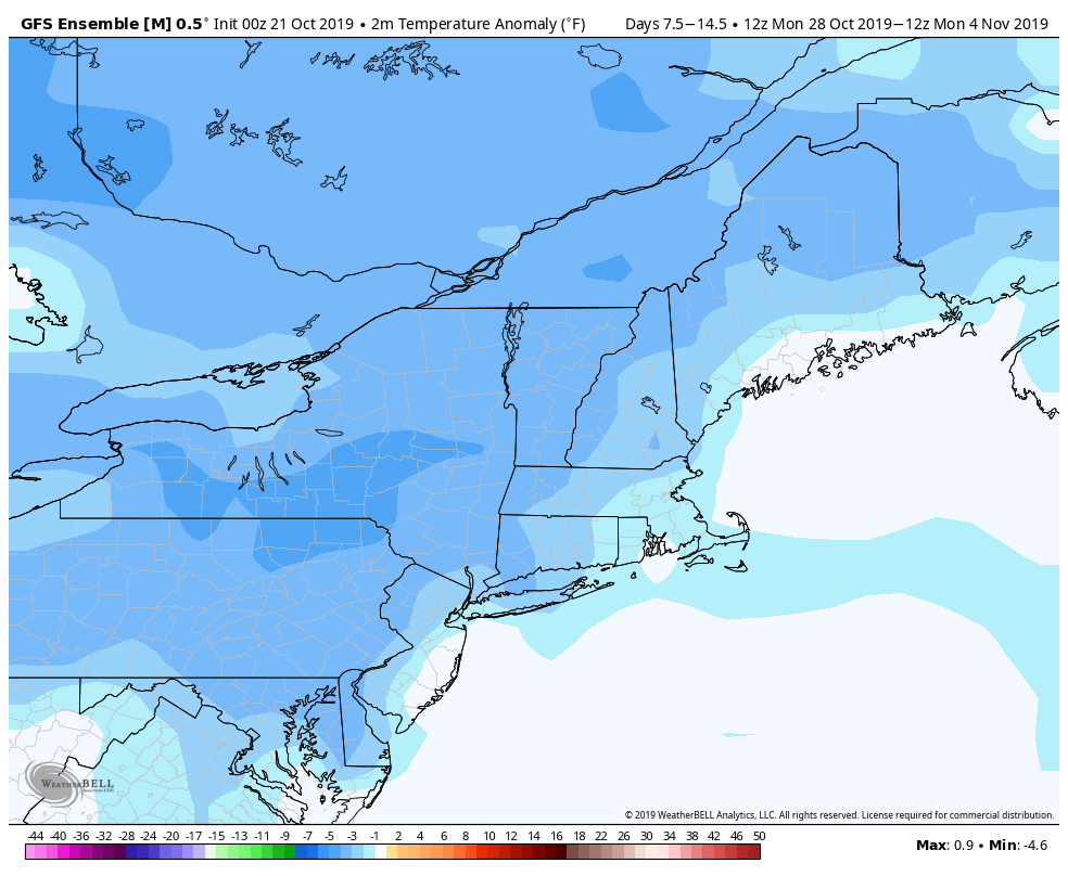
Once the front moves offshore on Wednesday, skies start to clear out as high pressure builds in. That will bring us dry and seasonably mild weather for Thursday. However, another system will start to move in later Friday with another round of showers expected late Friday and Friday. High pressure builds in behind the system with dry and cooler conditions for next weekend. While we’re fairly sure Saturday will be dry, Sunday may not be. One model shows the potential for another storm to move in, with rain by late in the day. A second model holds the rain off until Sunday night, while a third keeps the system south of the region entirely. We’re going to lean towards a dry forecast for now, but it’s low confidence at this time.
Monday: Some lingering clouds and a few showers across southeastern Massachusetts, becoming partly to mostly sunny elsewhere. High 56-63.
Monday night: Clouds return. Low 42-49.
Tuesday: Mostly cloudy with a chance of showers late in the day. High 53-60.
Tuesday night: Cloudy and breezy with showers likely, a few of which may be heavy. Low 48-55.
Wednesday: Breezy with showers ending early then clouds gradually give way to afternoon sunshine. High 59-66.
Thursday: Sunshine and a few clouds. High 57-64.
Friday: Mostly cloudy with showers likely late in the day and at night. High 57-64.
Saturday: Any lingering showers end in the morning, then a mix of sun and clouds and cooler in the afternoon. High 50-57.
Sunday: Partly to mostly cloudy with a chance of showers late in the day and at night. High 49-56.