We’ll be riding a rollercoaster for temperatures again this week, but today will leave no doubt that winter has finally arrived.
Some of the coldest air of the season will settle into the region today on gusty north to northwest winds in the wake of the storm system that brought us a mess over the weekend. We’ll have partly sunny skies on average, with some snow showers possible over the Outer Cape. High pressure builds in tonight with light winds, resulting in a bitterly cold night. As the high moves offshore, we’ll start to moderate on Tuesday, but it will remain quite chilly.

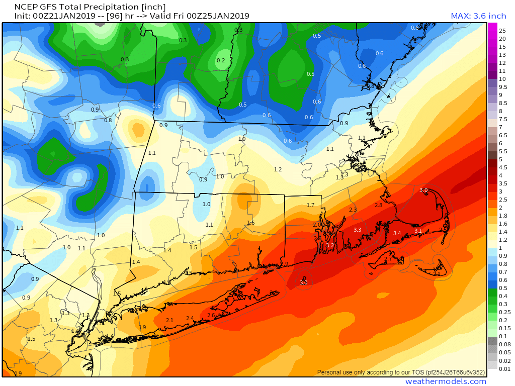
The moderating trend will continue on Wednesday as a storm system approaches the region. While we may see a little snow or a wintry mix in the afternoon, this system will mainly produce some rain showers. The system will drag a cold front through, but the cold air will lag a bit. As the front stalls out offshore, a wave of low pressure will ride up the front, bringing in more rain on Thursday. Some of this rain could be heavy, especially south of Boston. The rain may mix with some wet snow before ending Thursday evening.
Another weak system will quickly follow for late Friday into early Saturday. This one will likely produce some light snow or snow showers, but it does not look like a big deal at this time. Another shot of arctic air moves in for Saturday night. Next Sunday is a bit of a question mark once again. As we’ve mentioned a few times, the models have not been that good beyond a few days. There are some indications that another storm could impact us at some point in the Sunday/Monday time frame next week. Frankly, we’re not sure what to expect at this point, so we’re not going to go into too much detail. Could be snow. Could be rain. Could be more sleet and ice. Could be all of the above. Could be a complete miss. Right now, it’s impossible to pin down. Just keep in mind, that it *could* be another stormy Sunday.

Monday: Partly sunny and breezy, chance for some snow showers across parts of Cape Cod. High 4-11 above.
Monday night: Clear and quite cold. Low 2 below to 5 above.
Tuesday: Mostly sunny, though some clouds will start to move in during the afternoon. High 20-27.
Tuesday night: Becoming mostly cloudy. Low 11-18.
Wednesday: Mostly cloudy and breezy with showers likely, possibly starting as a little snow or a wintry mix. High 38-45.
Thursday: Mostly cloudy and windy with rain likely, possibly heavy at times. High 43-50, possibly warmer across Cape Cod and southeastern Massachusetts.
Friday: Becoming partly to mostly sunny and breezy. Clouds return at night. High 30-37.
Saturday: Mostly cloudy, chance for a few snow showers early. High 18-25.
Sunday: Mostly cloudy with a chance of……something. High 30-37.
