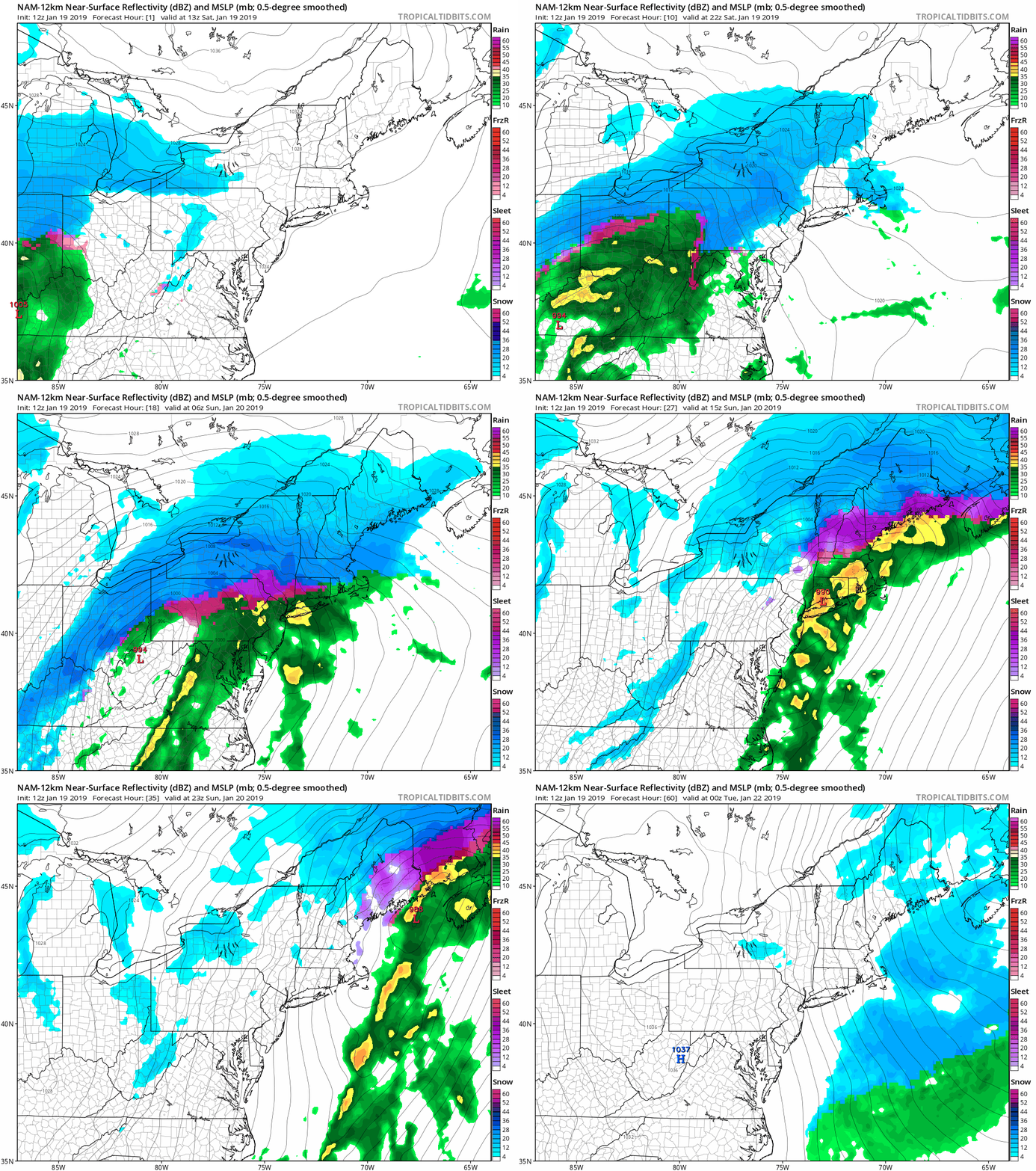
In our forecast yesterday, we told you that some of the biggest questions were the track of the storm system and related to that, how far north the change to sleet/freezing rain would take place. Well, we’ve got some more clarity on that now.
Some of you are already seeing some snow falling this afternoon, but this is not related to the storm. Some ocean-effect snow has pushed into Cape Cod and Plymouth County, and will continue to push inland this afternoon. This will be light, with less than an inch in most spots. The steadier snow will move in late this afternoon and evening from the west, reaching southern NH and the Merrimack Valley first, then the rest of Eastern Massachusetts and Rhode Island. It’s after midnight where the changes start to take place.

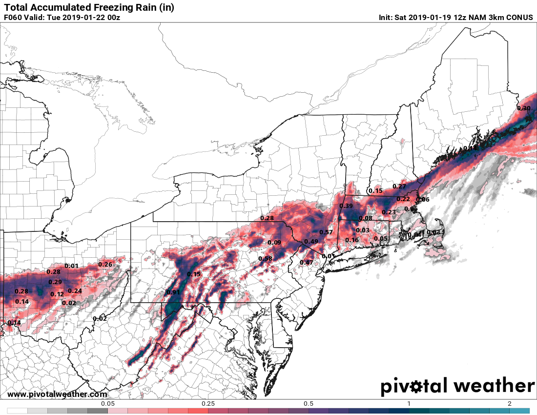
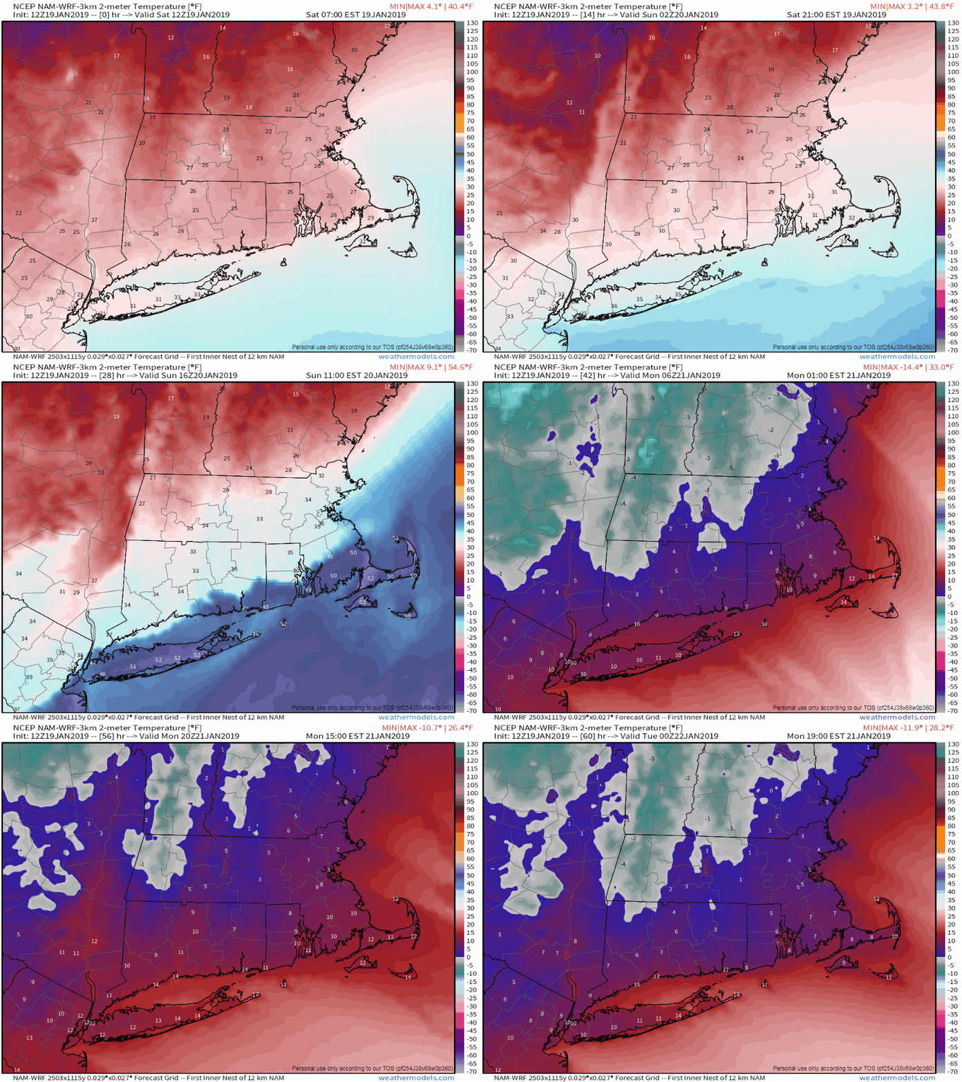
The storm system looks like it will track a bit farther north, passing very close to Boston on Sunday. This will not only allow milder air to move into most of southeastern Massachusetts, but the milder air aloft will also move much farther north than we had anticipated yesterday. Snow will fall heavy at times overnight, especially north of the Mass Pike, but as the warmer air starts to move in, we’ll see a change to sleet and eventually freezing rain move into the South Coast towards Midnight. A change to plain rain is likely before daybreak across southern Rhode Island and southeastern Massachusetts, as temperatures may break into the 40s Sunday morning. Some of the rain could be heavy, which may wash away most of the snow that does fall. Farther north, snow will gradually change to sleet and freezing rain north and west of Boston towards daybreak, with the changeover likely getting into southern NH as well. This will significantly cut down on snow amounts, but could make travel quite hazardous if there’s enough freezing rain.

By midday, the storm passes by and moves offshore, with winds shifting into the north. This will bring much colder air back in, and rather quickly. Temperatures may get close to or a little above freezing during the morning from southern NH into the Merrimack Valley and the northern and western suburbs of Boston, but by afternoon they’ll quickly drop into the 20s during the afternoon and teens by evening. That will result in a flash freeze, and any untreated surfaces will quickly freeze up, resulting in very hazardous travel. It will also mean that anything you haven’t cleaned off of your car, driveway, sidewalk, etc. will quickly turn into cement. The bitterly cold air will continue to flow in, and temperatures on Monday may struggle to reach the lower teens, with wind chills below zero thanks to gusty northwest winds. These gusty winds may also produce some ocean effect snow across parts of Cape Cod, especially the Outer Cape.

So, how much snow are we expecting now? Here’s our current thinking:
Cape Cod/South Coast: 1-3 inches
Southeastern Massachusetts/I-95 corridor: 2-4 inches
MetroWest/North Shore: 3-5 inches
Merrimack Valley/NH Seacoast: 3-6 inches
Southern NH: 4-7 inches
Central NH/Southern Maine: 8-14 inches, with higher amounts the farther north you go.

Temperatures will slowly start to moderate on Tuesday, then another system may move in on Wednesday, but this one, believe it or not, may be mostly rain. We’ll see how that evolves over the next few days.