Well, many of you wanted it, now you’ve got it. The heat has arrived, and the humidity will be creeping up as well. It won’t last too long though, so you’d better enjoy it while it’s here. We’ll cool off for the middle and end of the week, then start to warm back up again next weekend.
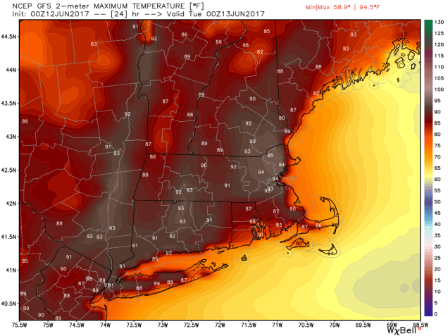
With a Bermuda high sitting off the East Coast and a ridge of high pressure aloft over the Eastern US, we have all the ingredients needed for a couple of hot days across the region. Plenty of sunshine and southwest winds mean temperatures should soar into the 90s again today, mainly away from the South Coast. Tuesday also looks hot, but a cold front will approach the region during the afternoon. How quickly the clouds move in ahead of the front will determine how hot we actually get. As the front moves through in the afternoon, it will trigger showers and thunderstorms. Some of the storms could be quite strong, with gusty winds, heavy, and heavy downpours. Skies clear out behind the front Tuesday night, and high pressure builds in for Wednesday and Thursday, bringing cooler temperatures with it.
Things get a little trickier for Friday and the weekend. A warm front will move through on Friday, bringing warmer and more humid air back into the region for the weekend. This will also increase the chance for showers and thunderstorms, especially on Saturday. By Sunday, another cold front will be approaching the region, which means more showers and thunderstorms are possible. The amount of cloud cover that we get each day will play a big factor in determining how warm each day ends up.
Monday: Sunshine and a few clouds, humid. High 88-95, except 80-87 along the South Coast and Cape Cod.
Monday night: Clear to partly cloudy, muggy. Low 67-74.
Tuesday: A mix of sun and clouds, scattered showers and thunderstorms in the afternoon. Some of the storms may contain hail. gusty winds, and heavy downpours. Humid with high 85-92.
Tuesday night: Becoming mostly clear. Low 58-65.
Wednesday: Partly to mostly sunny. High 69-76, cooler along the coast.
Thursday: Sunshine and some high clouds. High 68-75.
Friday: Increasing clouds, showers and thunderstorms possible late in the day and at night. High 65-72.
Saturday: Partly sunny and becoming humid, chance for showers and thunderstorms. High 70-77.
Sunday: A mix of sun and clouds, humid, more showers and thunderstorms possible. High 80-87, except 73-80 along the South Coast and Cape Cod.

