Fall is definitely in the air as we start this week, with some frost in places to start the day. With the change in seasons, we may start to see a change in the pattern too, but there is plenty of uncertainty that goes with that. We are fairly certain about what will happen for the next few days though. High pressure moves offshore today with sunshine and seasonably cool temperatures once again. A cold front moves in tomorrow, with some showers likely. After that, things get quite tricky.

That cold front will likely stall out near or just south of New England, and high pressure will try to build in from the north. At the same time, and upper-level low pressure system will settle into the Appalachians and remain in place for much of the rest of the week. Exactly where it sets up has big implications on the forecast though.If the high is able to build in enough, we’ll stay mostly dry, albeit it cool and breezy with an easterly flow bringing in some drizzle at times off the Atlantic. If the low sets up a bit farther north, we may have to deal with episodes of showers from Wednesday right through to the weekend. At this point, we’re not completely sure which way is right, so this is a low confidence forecast. Recent history says we stay dry, but climatology and the normal tendencies with the models say we more than likely would be cool and damp. For now, that’s the direction we’re leaning, but keep in mind, things could end up considerably different.
Monday: Sunny and chilly to start the day, but clouds start to filter in during the afternoon. High 61-68.
Monday night: Becoming cloudy with showers developing after midnight.Low 51-58.
Tuesday: Showers taper off and end from northwest to southeast, lingering longest near the south coast. Some sunshine may develop late in the day across the interior. High 67-74.
Tuesday night: Clearing skies well inland, remaining partly to mostly cloudy near the coast, with a few showers still possible across the Cape. Low 49-56.
Wednesday: More clouds than sunshine, a few spotty showers or drizzle may develop, especially near the south coast. High 63-70.
Thursday: Mostly cloudy and breezy with showers possible. High 61-68.
Friday: Cloudy and breezy with more showers and drizzle possible. High 60-67.
Saturday: Intervals of clouds and sunshine, chance for more showers. High 63-70.
Sunday: A mix of sun and clouds, chance for some showers. High 62-69.
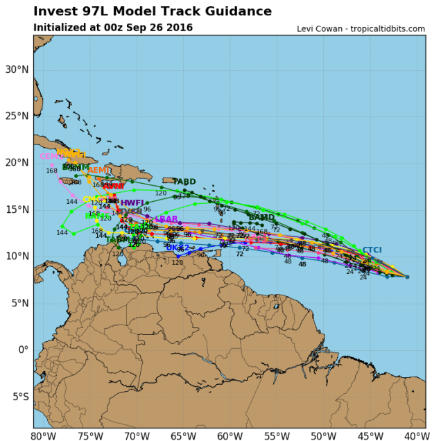
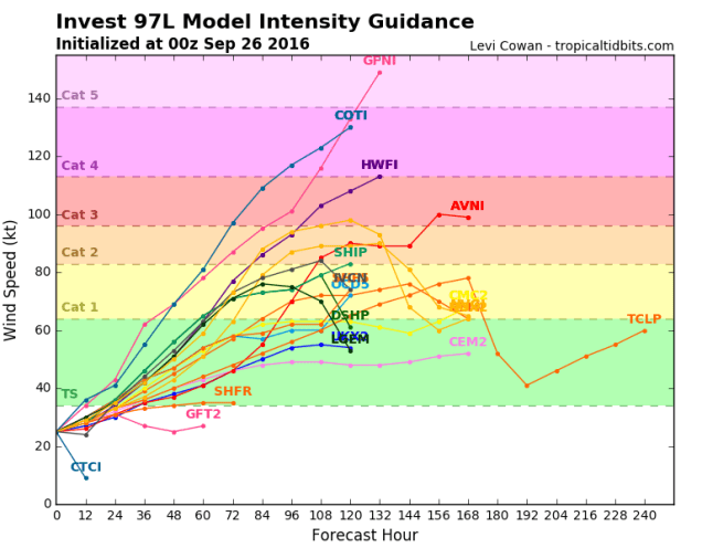
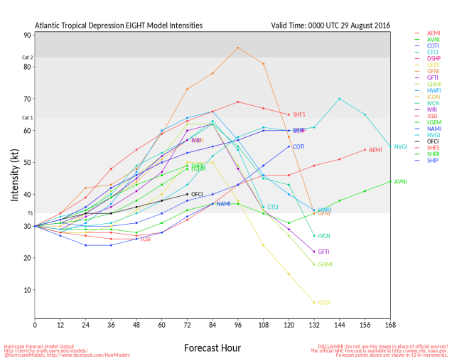
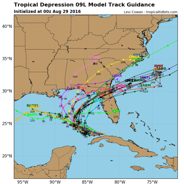
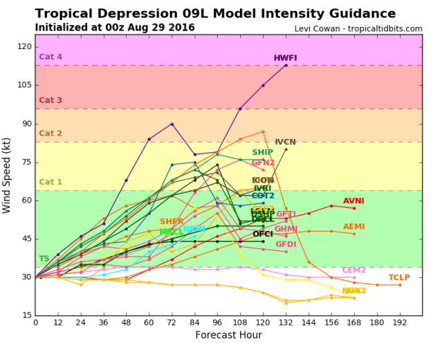
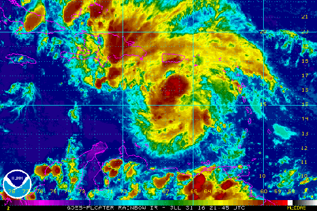
On another note, keep an eye on the tropics. There’s a disturbance that’s about 1300 miles east-southeast of the Lesser Antilles early this morning that bears watching. There’s a decent chance it could become a tropical depression later this week before moving into the Caribbean. Once it gets into the Caribbean, some models show some modest strengthening, while others develop the storm into a monster (see below). It’s what the storm does more than a week out (assuming it develops) that bears watching. Some models have it keep cruising west-northwestward across the Caribbean and into the Gulf of Mexico, and from there who knows. That would be bad for a lot of reasons. One silver lining though would be that after it moves inland and weakens it could bring us some beneficial rainfall. Other models have it turn northward, cross Hispaniola or Cuba, then head out into the open Atlantic. Still, there are other models that have it cross Hispaniola, then head northward, up the East Coast. We don’t have to explain to you why that wouldn’t be good at all. While the odds of this system doing anything up here are fairly remote, there’s a chance that it could impact the US at some point. Again, don’t worry too much, but keep an eye on what this system does, if it does anything at all.