It’s been a very wet spring across much of the Northeast, and it’s going to get a lot wetter over the next few days.

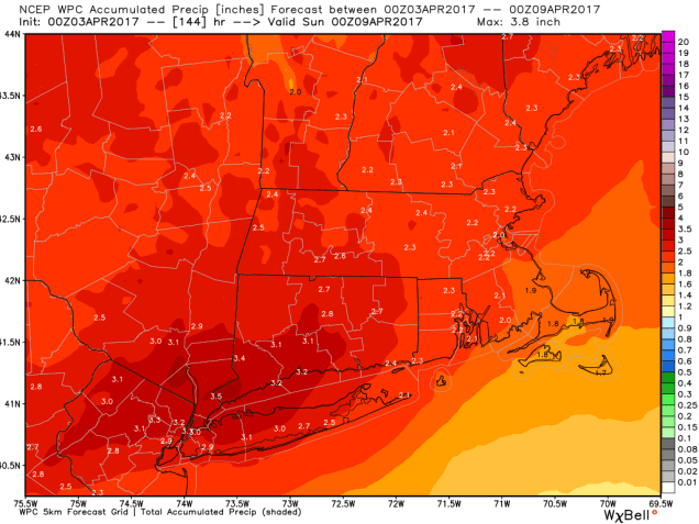
After experiencing drought conditions for much of the past year, a much wetter pattern has settled in across the Northeast this Spring. Much of the region has received 6-12 inches of rain since the middle of March, which is up to twice the normal amount. As a result, flooding has developed in some places, especially north of the border into portions of Ontario and Quebec. Persistent heavy rains across these provinces has flooded hundreds of communities in the past few weeks.
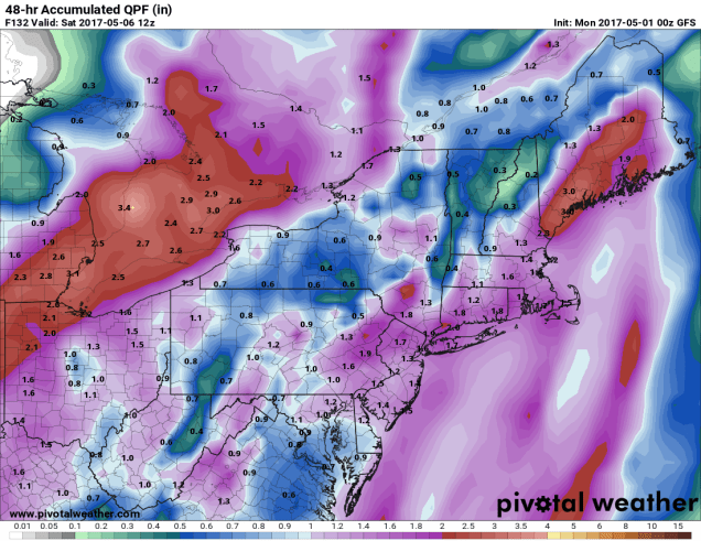
Instead of relief, it looks like conditions will worsen this weekend. Low pressure will move into the Carolinas on Friday, then off the East Coast on Saturday, slowly moving northeastward over the weekend. Rain and thunderstorms will move across the Mid-Atlantic states on Friday, spreading northeastward during the day. The rain should reach the New York City area around daybreak Saturday, moving into Southern New England during the afternoon. As the system slows down south of Long Island, heavy rain is likely across portions of the Northeast Saturday night into Sunday. Although the rain will taper off Sunday afternoon, it may not completely end until sometime on Monday as the storm takes it time to depart the region.
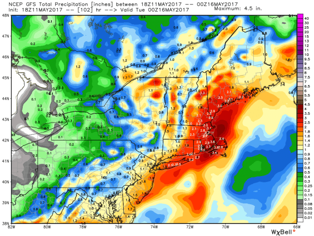
While heavy rain and flooding are the main threats with this system, they are not the only threats. As the system intensifies over the North Atlantic, gusty winds are expected, especially along the coastline of New England and Long Island. Sustained winds of 20-30 mph with gusts to 50 mph are likely. These winds will help churn up some rough seas, which may lead to some coastal flooding on Sunday, especially along east-facing shorelines in New England.
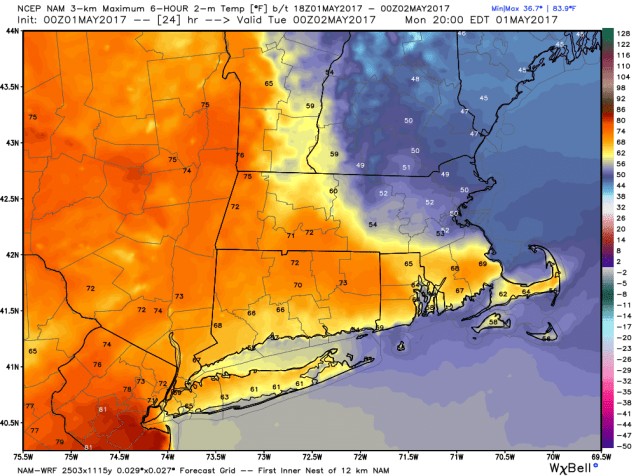
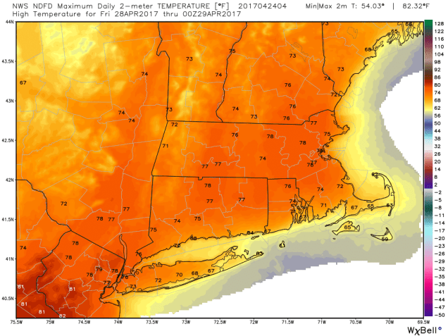
Much of the last week to 10 days has been characterized by cool and damp conditions across the Northeast, thanks to an upper-level low pressure area that has been anchored in placed. That pattern is finally changing, and the result will be welcome news across the region. A ridge of high pressure will build in for much of the upcoming week, which means the clouds and below normal temperatures will be replaced by sunshine and near to above normal temperatures.

High temperatures across the Northeast have only been in the 50s and 60s for the past several days across much of the region, which is 5 to 10 degrees below normal. By mid-week, temperatures should reach the 70s and 80s across much of the region, which will be 5 to 10 degrees (or more) above normal.