We’ve made it to July, and the stubborn pattern we had for much of the Spring and well into June is finally gone.
We’ll start right off with the forecast for Tuesday, since that’s the day people are most interested in. Planning a barbecue? Perfect weather for it. Heading into the pool or to the beach? Bring the sunscreen. Watching fireworks in the evening? No problems expected. Stuck working because your chosen profession doesn’t take holidays? Sucks to be you, but don’t expect anyone to feel bad for you.
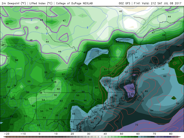
As for the rest of the week, sunshine and warm temperatures will be here for the next few days, along with low humidity, as high pressure builds in across northern New England. There is a slight chance for a shower or thunderstorm this afternoon as a weak upper-level disturbance moves through, mainly along the South Coast. However, the bulk of the activity looks like it should remain well to our south and west. As the high slides offshore later this week, humidity will start to creep back into the region. With humidity comes the risk for afternoon showers and thunderstorms. That risk looks to be the greatest Friday and Saturday as another cold front starts to approach the region. While it’s still a bit early, and the timing of the front will play a critical role, we wouldn’t be surprised to see some severe storms develop on Saturday, if everything comes together. We’ll monitor this as the week progresses. High pressure will build in behind the front with drier conditions for next Sunday.

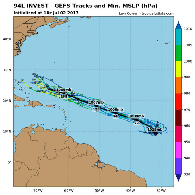
While we’ve got a fairly simple forecast here for most of the week, things are starting to cook out in the Atlantic. A tropical disturbance located well east of the Lesser Antilles has the potential to develop into a tropical depression later this week. There’s nothing to worry about now, but some of the models (not all), try to develop the system into a hurricane at some point, and possibly become a threat to the East Coast or Bermuda about 2 weeks from now. The odds of this happening are still pretty low, so we wouldn’t worry about it too much, but we’ll certainly keep our eyes on this system, as well as the rest of the tropics.
Monday: A mix of sun and clouds, just a slight chance for an afternoon shower or thunderstorm near the South Coast. High 81-88.
Monday night: Clear to partly cloudy. Low 58-65.
Tuesday: Sunshine and a few clouds. High 77-84.
Tuesday night: Clear skies. Perfect weather for fireworks in the evening. Low 55-62.
Wednesday: Mostly sunny. High 78-85.
Thursday: A sunny start, then clouds develop along with the chance for some afternoon showers and thunderstorms, becoming humid. High 77-84.
Friday: A mix of sun and clouds, humid, chance for some afternoon showers and thunderstorms. High 80-87.
Saturday: Partly sunny, more showers and thunderstorms are possible. Some of the storms could be strong to severe in the afternoon. High 83-90.
Sunday: Mostly sunny with a few afternoon clouds, drier. High 75-82.