The next few days will not feel like mid-December, but the pattern won’t exactly be quiet.

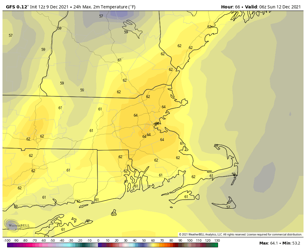
We’ll have a cool evening with high pressure in control, but clouds will be streaming in ahead of a warm front. As that front moves through overnight, temperatures will start to rise after midnight, and we could see a few flurries or sprinkles. Friday will be milder with plenty of clouds, but aside from a few stray sprinkles or showers, the day should remain dry. As low pressure heads into southern Canada, it will drag a strong cold front toward the region. Ahead of that front, we’ll have some showers developing Friday night, continuing off-and-on through Saturday. The day won’t be a washout, but it won’t be completely dry either. That’s not the big story for the day though. South to southwest winds will be quite gusty, sending even warmer air into the region. Many locations will likely top 60 degrees once again. The front moves through overnight, with showers ending by daybreak. Skies clear out for Sunday and Monday with high pressure building in, but temperatures will still be near to even above normal for mid-December.
Thursday night: Mostly cloudy, chance for a flurry or a sprinkle. Low 23-30 during the evening, temperatures may rise a bit after midnight.
Friday: Mostly cloudy, slight chance for a shower. High 42-49.
Friday night: Mostly cloudy, showers developing late at night. Low 29-36 during the evening, temperatures rise again overnight.
Saturday: Cloudy, windy, and mild with occasional showers. High 57-64.
Saturday night: Cloudy and windy with more showers, possibly a thunderstorm, ending late at night. Low 34-41.
Sunday: Becoming mostly sunny, still breezy in the morning. High 40-47.
Sunday night: Clear. Low 28-35.
Monday: Sunshine and a few clouds. breezy at times. High 46-53.
