As we get ready to celebrate America’s 250th, some very hot weather will be here for a few days.
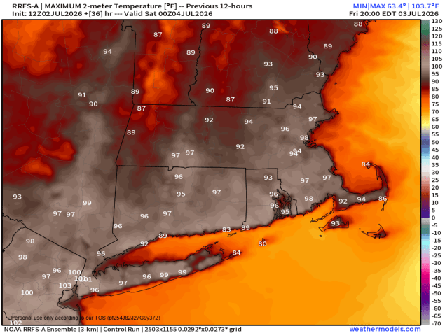
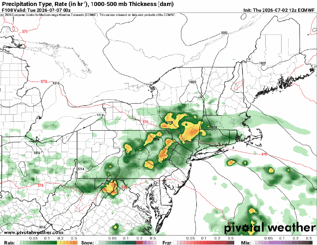
A ridge of high pressure continues to provide the eastern half of the nation with hot and humid conditions into Saturday. Daytime temperatures well into the 90s, combined with dewpoints in the 60s and lower 70s, will make it feel like 100-105 at times. Not much relief comes at night, with lows only in the 70s tonight through Friday night, with places like downtown Boston possibly not falling below 80. A few widely scattered showers and thunderstorms are possible tonight, but they’ll be a bit more numerous Friday afternoon and evening. The Fourth of July is the transition day, and unfortunately, with plenty of outdoor gatherings planned, they could be impacted. A cold front will drop southward, but ahead of it, we’re going to have another hot and humid day, with most places topping 90 again. However, the front will trigger some showers and thunderstorms, especially during the afternoon. Some of these storms may produce heavy downpours and gusty winds, so keep an eye to the sky (or the radar) if you’ll be outside. Hopefully the storms will end before evening, allowing many fireworks celebrations to proceed. Welcome relief arrives on Sunday with cooler and drier air. Cool is a relative term, and most places will still be in the 80s, which is right around or a little above normal. Monday is the day with the most uncertainty at this point. That front will stall out south of New England, and as we get to Monday a wave of low pressure will ride along it. Some models bring in some showers with the wave during the afternoon, some wait until nighttime. We’re going to be cautiously optimistic that most if the day remains dry at this point, but that is far from guaranteed.
Thursday night: Mostly clear, slight chance for a shower or thunderstorm during the evening. Low 72-79.
Friday: Sunshine and a few clouds, a late-day shower or thunderstorm is possible. High 93-100, cooler across Cape Cod.
Friday night: Partly cloudy, chance for a few showers or thunderstorms, mainly before midnight. Low 72-79.
Fourth of July: A mix of sun and clouds, scattered showers and thunderstorms develop, mainly in the afternoon. High 89-96.
Saturday night: Any showers or storms end in the evening, clear to partly cloudy overnight. Low 65-72.
Sunday: Partly sunny, not as humid. High 81-88, cooler near the coast.
Sunday night: Partly cloudy. Low 60-67.
Monday: Intervals of clouds and sun, chance for showers late in the day. High 72-79.
