We’re in a fairly active weather pattern, but despite that, we’re not going to have too much going on for a good portion of this week.
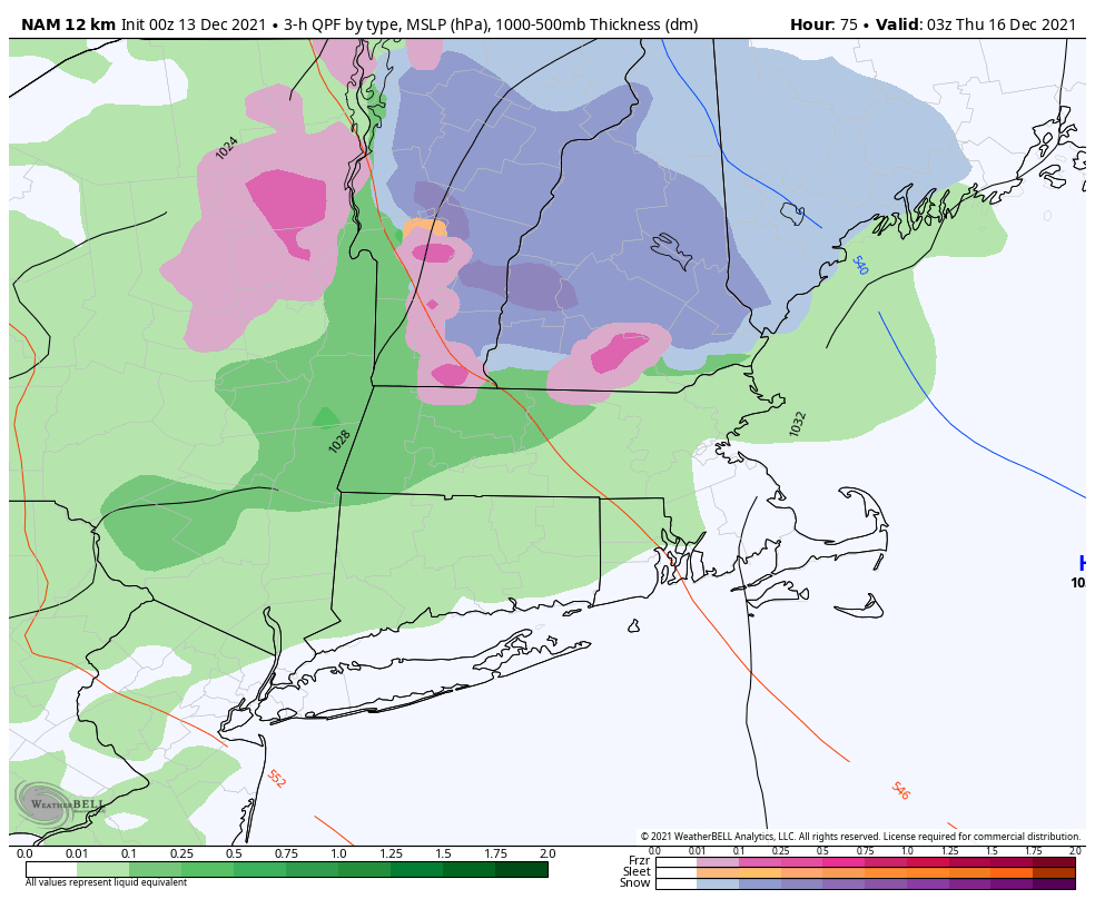
The week starts off with high pressure in control, bringing us sunshine and mild temperatures today. A weak frontal system drops southward across the region on Tuesday with a few clouds, but it will bring slightly cooler temperatures. High pressure passes by to the north on Wednesday while that weak front starts to head northward again as a warm front. It will send some clouds into the region on Wednesday. Some showers are likely Wednesday night into Thursday morning. Temperatures may be near freezing for a while Wednesday evening into southern New Hampshire before the milder air moves back in, which means a period of icing or even some wet snow is possible as the precipitation overspreads the region.
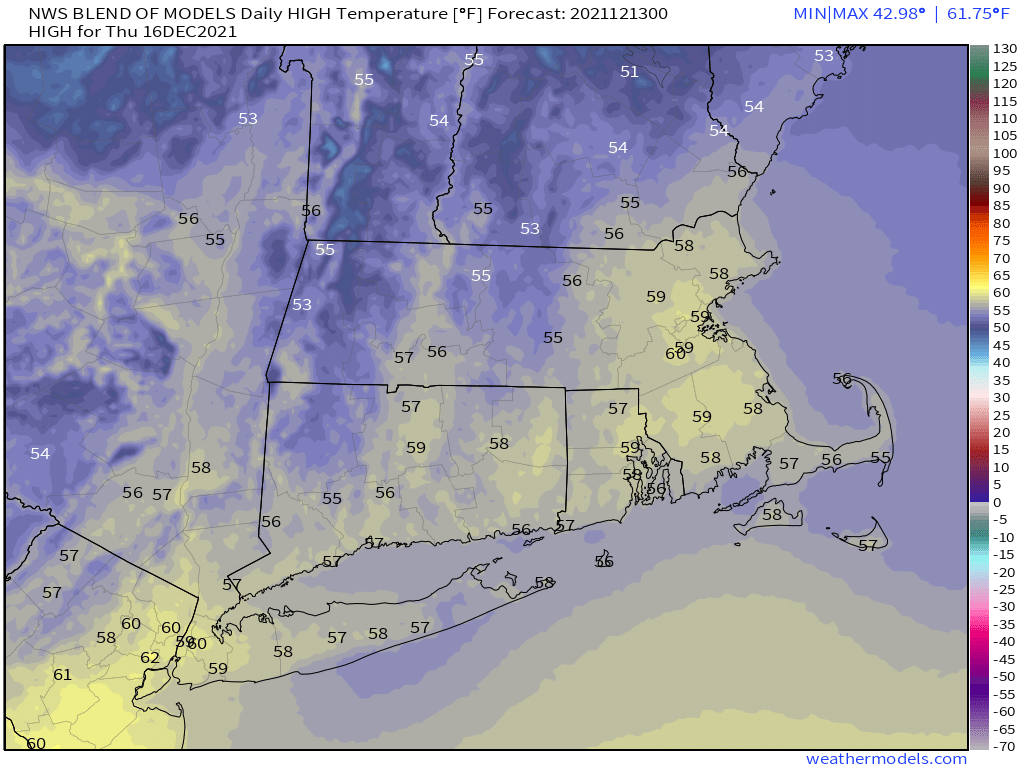
Thursday looks to be quite mild once again, with temperatures well into the 50s, possibly topping 60 in some locations. However, low pressure will be moving across southern Canada, dragging a cold front towards the area. Some showers may accompany the front as it moves through Thursday night. High pressure builds in behind the front on Friday with drier and cooler conditions.
Next weekend is where there is considerable uncertainty. The models have done rather poorly beyond 2 or 3 days recently, so looking ahead 6 days is a low-confidence forecast to begin with. However, the models seem to come up with a different solution nearly every run lately, and none of them agree with the others. A wave of low pressure may move toward the region for Saturday, but exactly where it goes (or if it even develops), is a giant question mark. Some models bring it well north of us, resulting in mild conditions and rain. Some bring in close to or over the region, resulting in a wintry mix, and some bring it south of the region, which could mean snow, or it stays too far south and we get no impacts at all. At this point, any of those solutions could be the right one. As Ozzy Osbourne famous sang “Don’t look at me for answers, don’t ask me, I don’t know.”
Sunday looks to be dry and cool with high pressure building back in, but that could be impacted by what happens (or doesn’t happen) on Saturday. We should have more clarity on that when we get to our Weekend Outlook on Thursday.

Monday: Some clouds in the morning, then becoming sunny. High 44-51.
Monday night: Clear skies. Low 32-39.
Tuesday: Sunshine and some afternoon clouds. High 42-49.
Tuesday night: Partly to mostly cloudy. Low 23-30.
Wednesday: Plenty of clouds with showers likely at night, possibly starting as some freezing rain or wet snow across southern New Hampshire. High 39-46.
Thursday: Cloudy, breezy, and mild, any showers ending in the morning. High 52-59.
Friday: Partly sunny. High 47-54.
Saturday: Partly to mostly ________ with a chance of _______. (We’ll fill in the blanks later this week). High 37-44.
Sunday: Becoming mostly sunny. High 33-40.
