After today’s chill and flurries, some milder weather is on the way. So is some rain for part of the weekend.
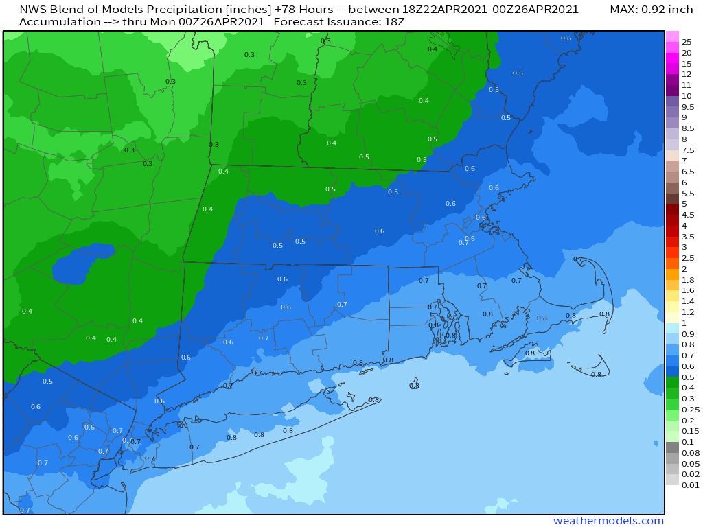
Another chilly night is expected tonight as high pressure builds in. That high will move offshore on Friday, allowing temperatures to start to moderate under mostly sunny skies. Saturday looks even milder, with temperatures possibly topping 70 in some areas, but the sunshine will start to fade as clouds begin to stream into the region. Those clouds will be in advance of a low pressure system that will move up the East Coast Saturday night and Sunday, bringing in some much-needed rain. While we do need the rain, Sunday looks like a damp and cool day, so any of your outdoor plans probably won’t work out. The system pulls away late Sunday, then Monday looks to feature more sunshine and seasonably mild temperatures. There are some indications that a more significant and possibly longer-lasting warmup could be in store for the latter half of next week and into next weekend.
Thursday night: Clear skies, breezy, and chilly. Low 29-36.
Friday: Mostly sunny, breezy, and milder. High 54-61.
Friday night: Clear skies. Low 37-44.
Saturday: Sunshine in the morning, clouds start to stream in during the afternoon. High 64-71.
Saturday night: Becoming cloudy with rain developing after midnight. Low 41-48.
Sunday: Periods of rain, breezy. High 51-58.
Sunday night: Any lingering showers end in the evening, followed by gradual clearing. Low 35-42.
Monday: Becoming partly to mostly sunny. High 55-62.
