The warm and dry weather will continue for a couple more days, but changes are coming.
High pressure remains in control into early Wednesday, which means we’ve got a few more more days with near-record temperatures across the region. While the days will be sunny and warm, the nights will be a bit different. Some low clouds and fog are possible in some areas, especially near the coast. For areas that don’t get any fog, clear skies and light winds will allow for radiational cooling.

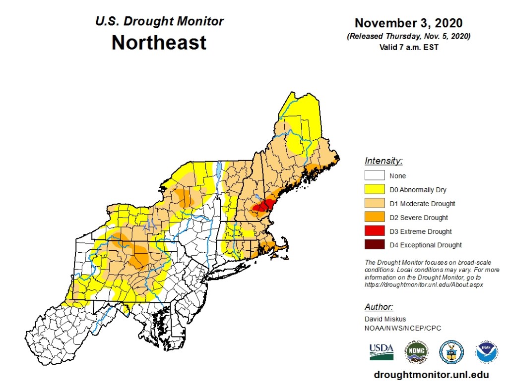
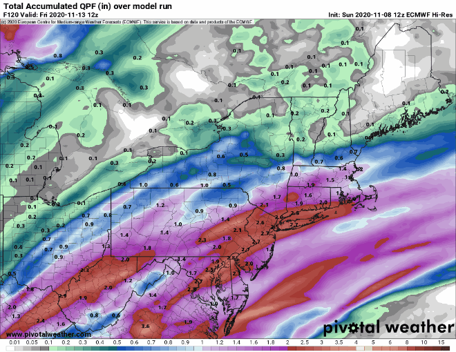
Wednesday is when the changes start happening. A strong cold front will approach from the west. Ahead of it, we’ll have some rain later Wednesday into Thursday, but it will remain warm, especially if we can get any sunshine during the morning. Since we’re still in a significant drought, and it hasn’t rained for a week, any rain is good news. While we may get some heavy rain, especially along the South Coast, it looks like the bulk of the heavy rain, some of which will be aided by moisture streaming northward from Eta, should stay south of the region.
As the front moves offshore, the rain should taper off and end Thursday evening, but the front will stall out south of the region. How far south is still a bit of a question, but it may remain close enough for some additional showers on Friday, mainly along the South Coast, as a wave of low pressure rides along the front.
High pressure builds in later Friday into Saturday with some cooler conditions, but temperatures will still be near to above normal for mid-November, especially on Friday. Sunday is a bit of a question mark as the next system will be starting to approach from the west, but there are significant differences in the timing of this system, depending on which model you decide to look at.
Monday: Some patchy morning fog, then becoming mostly sunny. High 68-75.
Monday night: Clear skies, some low clouds and fog may return in some spots. Low 45-52, though some spots could drop as low as the upper 30s..
Tuesday: Sunshine and a few clouds. High 67-74.
Tuesday night: Clear to partly cloudy, again some low clouds and fog may develop. Low 52-59.
Wednesday: Some early sun, then becoming cloudy and breezy with showers developing late in the day, becoming a steady rain at night. High 67-74.
Thursday: Plenty of clouds with rain likely, ending late in the day. High 59-66.
Friday: A mix of sun and clouds, a few showers are possible along the South Coast, especially early. High 49-56.
Saturday: Mostly sunny and breezy. High 48-55.
Sunday: Mostly cloudy with a chance of showers. High 47-54.
