We’ve passed the midpoint of the year, and arrived at the Fourth of July weekend, so everything will be great for a barbecue, right? For the most part.
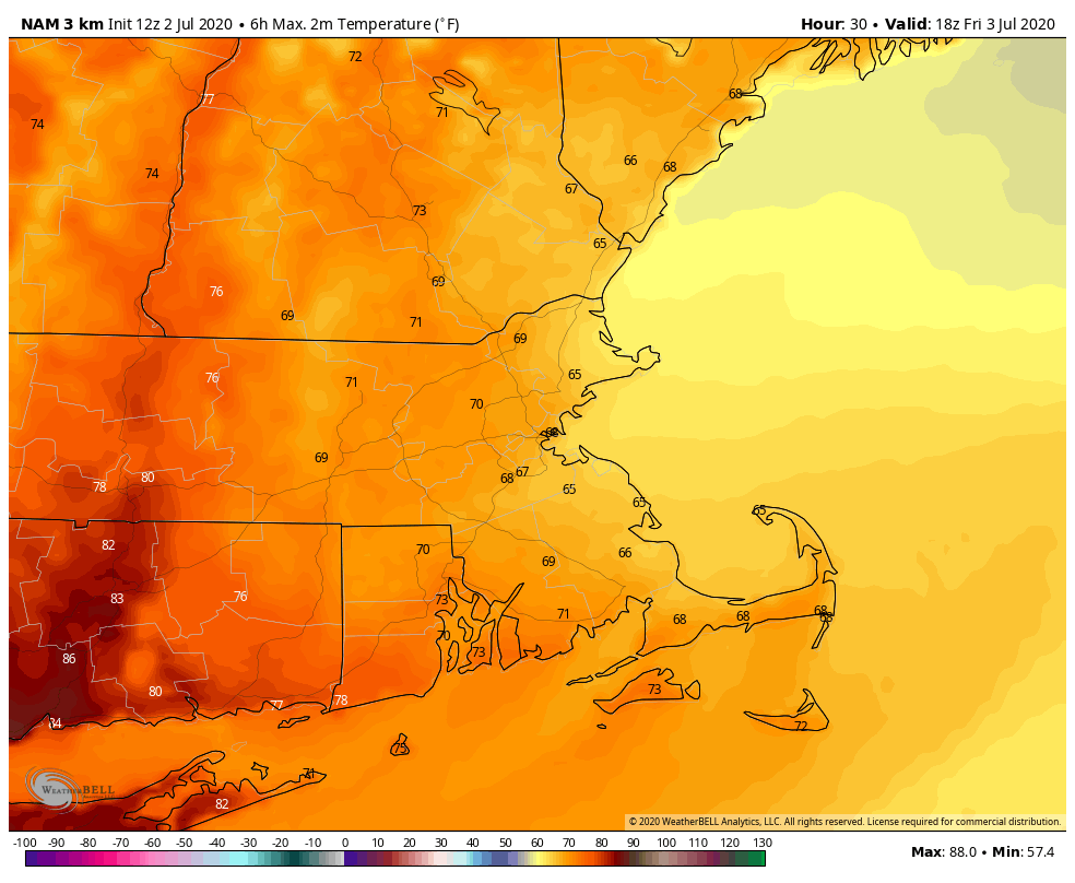
High pressure remains in control for the rest of the day, though a few showers and thunderstorms are possible, mainly well north and west of Boston trough the evening. Friday will be a different story. We’ve got a backdoor cold front dropping down (what month is this?) and it will bring in plenty of clouds, some showers, and maybe even a thunderstorm. We’ll likely reach our highs for the day during the morning, with steady or falling temperatures in the afternoon.
High pressure drops southward on Saturday, resulting in more sunshine for the Fourth of July. However, with easterly winds, it will be on the cool side, especially if you’re closer to the coast. Temperatures will be 5-10 degrees below normal, with most places staying in the 70s, but a few coastal locations may stay in the 60s.
The high slides offshore Saturday night, allowing milder air to move back in, but another cold front will be approaching on Sunday. This front will probably produce a few showers and thunderstorms, but the day likely won’t be a washout. Another disturbance may bring in some additional showers on Monday.

Thursday night: Partly cloudy, slight chance for an evening shower. Low 63-70.
Friday: Becoming mostly cloudy with some showers and possibly a thunderstorm. High 70-77 in the morning, temperatures drop a bit in the afternoon.
Friday night: Mostly cloudy with areas of fog. Low 57-64.
Independence Day: Becoming partly to mostly sunny. High 73-80, coolest along the coast.
Saturday night: Clear to partly cloudy, some fog may redevelop, especially across southeastern Massachusetts. Low 58-65.
Sunday: A mix of sun and clouds, chance for some afternoon showers or thunderstorms. High 80-87, cooler along the coast.
Sunday night: Partly cloudy. Low 60-67.
Monday: Intervals of clouds and sunshine with showers and thunderstorms possible. High 80-87.
