We’ve largely escaped it so far this summer, but it looks like we’ve got some real heat coming later this week. Before then, we’ve actually got a rather nice stretch of weather coming up.
The week starts off with high pressure in control for Monday with sunshine, warm temperatures, and low humidity levels, a perfect combination for mid-July. The high slides offshore on Tuesday, which will allow humidity levels to start to creep up a little bit. A warm front moves through Tuesday night, with a chance for a shower. By Wednesday, hot and humid air moves in, but it may also come with some showers and thunderstorms during the afternoon. We’re not looking at any severe weather, but it will take the edge off the heat in the afternoon, and also make it even more humid late in the Friday.
Thursday is looking like a fairly wet day right now. What’s left of Tropical Storm Barry will likely move across the region, with widespread showers and thunderstorms. Since it’s a tropical airmass, some of these storms may produce heavy rainfall. It’s not going to be the 10-20 inches they’re getting in the Lower Mississippi Valley, but may be enough to cause a few problems around here.
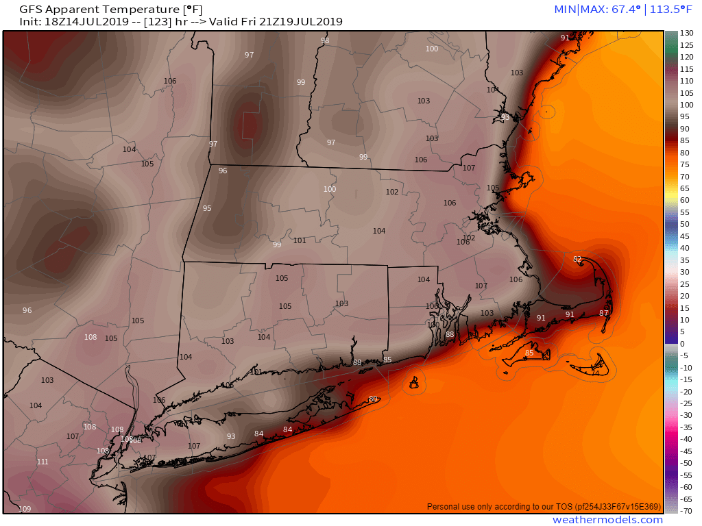
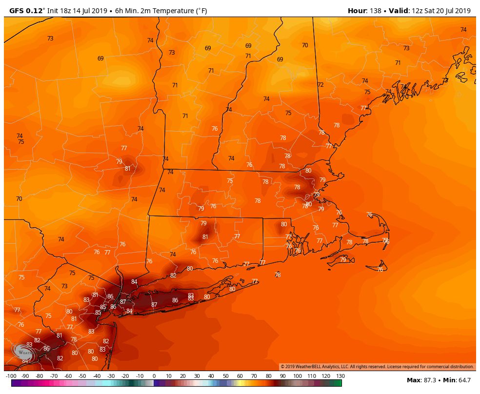
Once ex-Barry pulls away early Friday, things will get hot. It will also remain humid, which means Friday will be a good day to find some air conditioning. If you are going to be outside, make sure you drink plenty of liquids, and wear sunscreen. Temperatures will likely soar well into the middle to perhaps upper 90s across the area. Friday night is looking rather ugly as well for sleeping, as much of the region may not drop below the upper 70s. Some of the cities may stay above 80 all night. Saturday is shaping up to be another hot day, but not quite as humid, with temperatures again in the 90s. Cooler and much drier weather settles in for Sunday.
Monday: Mostly sunny. High 80-87.
Monday night: Clear skies. Low 60-67.
Tuesday: Sunshine and some afternoon clouds. High 83-90.
Tuesday night: Partly cloudy, slight chance for a shower. Low 67-74.
Wednesday: Partly sunny, humid, chance for an afternoon or evening shower or thunderstorm. High 87-94.
Thursday: More clouds than sunshine, scattered showers and thunderstorms likely, some may produce heavy rainfall. High 80-87.
Friday: Lingering clouds early, then becoming mostly sunny, hot, and humid. High 90-97.
Saturday: Sunshine and a few clouds, a late-day shower or thunderstorm is possible. High 90-97.
Sunday: Mostly sunny. High 85-92.

One thought on “Weekly Outlook: July 15-21, 2019”