The upcoming week is going to feel like Summer to start and Spring to end. The first half of the week will be unsettled, with an upper-level low pressure area in southern Canada controlling our weather. Although it will be warm, we’ll have a daily chance of showers and thunderstorms through mid-week, with the best chance coming on Tuesday as a cold front crosses the region. By Thursday we’ll start to dry out as high pressure builds in behind the cold front, but with it will come unseasonably cool conditions. Things may turn unsettled again next weekend as another storm system may move through the region.
Monday: Partly to mostly sunny, just a slight chance for an afternoon shower.High 78-85.
Monday night: Clear to partly cloudy. Low 56-63.
Tuesday: A mix of sun and clouds with afternoon showers and thunderstorms developing. High 76-83.
Tuesday night: Becoming clear to partly cloudy. Low 52-59.
Wednesday: Partly sunny, chance for afternoon showers and thunderstorms.High 66-73.
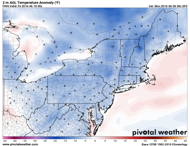
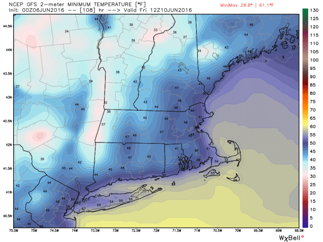
Thursday: Intervals of sunshine and clouds, breezy. High 60-67.
Friday: Partly to mostly sunny.High 63-70.
Saturday: Becoming partly to mostly cloudy, chance for a few showers late. High 67-74.
Sunday:Mostly cloudy with a chance for more showers. High 65-72.
Tropical Storm Colin should pass well south and east of the region later this week, with minimal impacts on our region. It might increase the surf a bit along south-facing coastlines, so grab your wetsuit and board if that’s your thing. Otherwise, you should probably stay out of the water because A) it’s still pretty chilly and 2) it’s not that safe.
