Just when you thought it was safe to call the tropics quiet with Bonnie disappearing, a new tropical depression has formed.
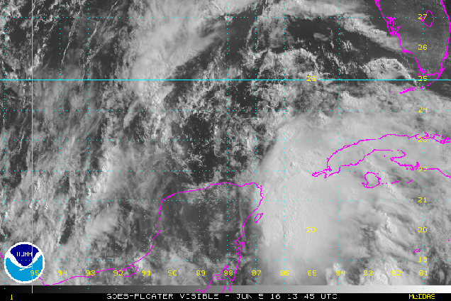
Earlier today, Tropical Depression Three was born in the southern Gulf of Mexico. As of 5:30pm EDT, the system was upgraded to Tropical Storm Colin with top winds near 40 mph. Colin was centered about 465 miles southwest of Tampa, Florida, moving towards the north at 12 mph. The current forecast is for Colin to turn more towards the northeast over the next day or so and strengthen.
Based on the current forecast track, a tropical storm warning has been issued for the west coast of Florida from Indian Pass to Englewood. A tropical storm watch has also been issued for the Atlantic coast from Altamaha Sound, Georgia to the Flagler/Volusia County border in Florida. While the system will likely bring gusty winds to the region along some minor storm surge flooding near where it makes landfall, the biggest impact by far will be heavy rainfall and the flooding it likely produces.Most of the state can expect between 2 and 5 inches of rain, with isolated totals of up to 10 inches possible. Flood watches are already in effect for portions of the state, and more will likely be issued.
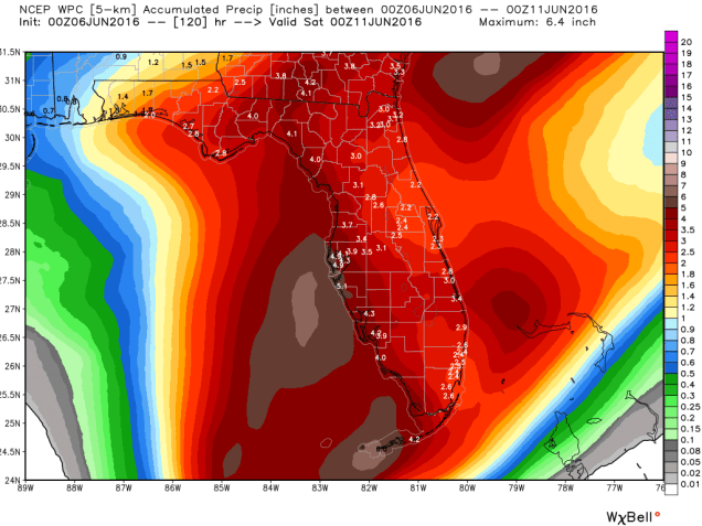
Once the system crosses Florida it will likely move into the Atlantic and continue on a northeasterly track out into the open Atlantic. The system may be close enough to the coast to bring additional heavy rain to parts of the Carolinas that were deluged by Bonnie a week ago. This could lead to additional flooding in this area.


Meanwhile, in the Eastern Pacific Ocean, there are now two areas being monitored this evening. The first one is the same one we’ve been watching all week. An area of low pressure is centered about 1100 miles southwest of Cabo San Lucas, Mexico, heading westward out into the open waters of the Pacific. Despite the models insisting all week that the system would develop (and some continue to insist on this happening), the system has not gotten its act together, and conditions won’t remain favorable for more than another day or two. So, we can probably write this system off.
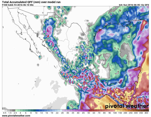
The more immediate concern is a disorganized cluster of showers and thunderstorms a few hundred miles south of Acapulco, Mexico. This system will slowly drift towards the northeast over the next few days, with some strengthening possible. It could become the first tropical depression of the season in the Eastern Pacific by midweek.

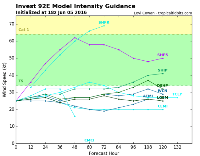
Whether the system develops into a tropical depression or not, it will bring heavy rainfall to portions of southern Mexico and Guatemala over the next several days. Rainfall totals of 5-10 inches are possible in this area, with some heavier amounts likely. This will also certainly lead to flash flooding across parts of the region.