Our active weather pattern continues through the weekend and that dreaded “S” word features prominently.
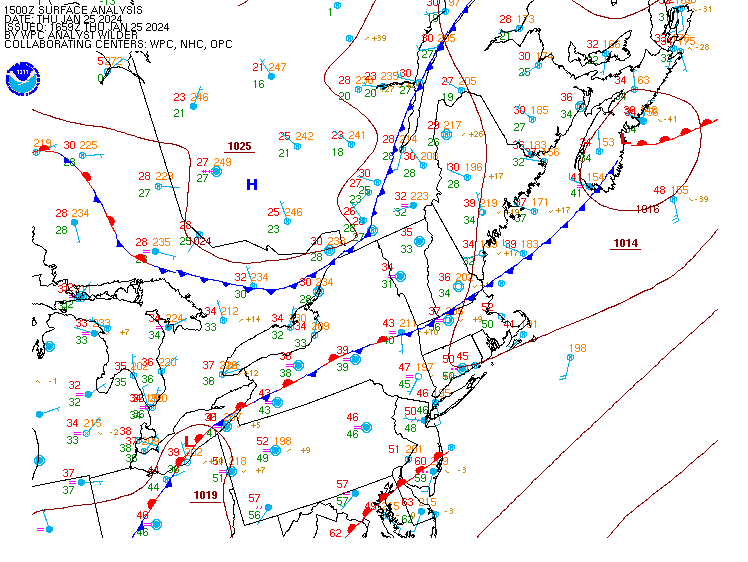
A wavy frontal system sits across the region this afternoon, separating the mild air across much of southern New England from the seasonable chill to the north. That front will sag southward as a cold front later today, bringing the cool air back. A wave of low pressure will ride along the front, bringing another round of rain in for late tonight and Friday morning. There could be some sleet or freezing rain across parts of central New Hampshire where temperatures will be close to freezing, so if you’ll be in that area tonight or Friday morning, use some caution. The rain should end during the afternoon, but clouds will hang tough Friday night into Saturday. A weak upper-level disturbance swings through on Saturday, possibly generating a few additional rain or snow showers.

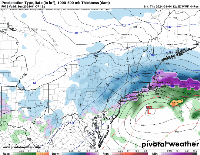
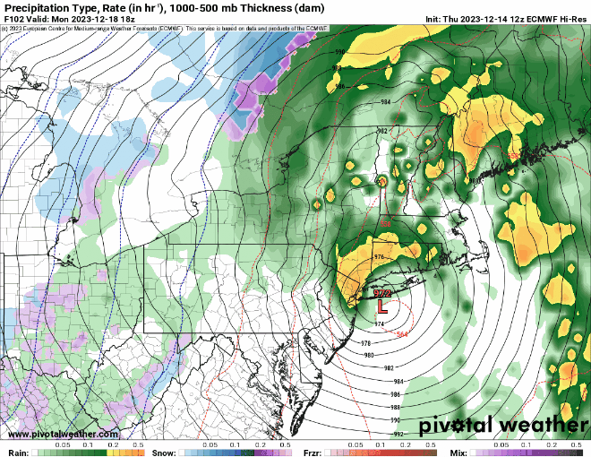
As we get into Sunday, we turn our attention to a low pressure area moving across the Tennessee Valley. The system will head towards the eastern Great Lakes while a secondary area of low pressure develops off the Mid-Atlantic coastline. We’ll see rain developing across the region Sunday morning, likely changing to snow from north to south at some point Sunday afternoon or night. Everything winds down Monday morning as the storm pulls away. There are plenty of variables that still need to be worked out with this storm, including how close the system passes to New England, and when the change from rain to snow occurs, which will have a big impact on the snow forecast. At this point, it’s safe to say that plowable snow is likely for a good chunk of the region. We’ll try to post an update on Saturday, when things should be much clearer.

Thursday night: Cloudy with rain redeveloping, possibly some sleet or freezing rain across central New Hampshire. Low 32-39.
Friday: Rain tapers off to showers, ending in the afternoon. High 37-44.
Friday night: Partly to mostly cloudy. Low 30-37.
Saturday: Plenty of clouds with a few rain or snow showers possible. High 36-43.
Saturday night: Cloudy, rain may develop late at night. Low 28-35.
Sunday: Cloudy with rain changing to snow from north to south, becoming breezy. High 34-41.
Sunday night: Cloudy and windy with snow likely, tapering off late at night. Low 21-28.
Monday: Mostly cloudy and windy, any lingering snow ends early. High 27-34.