Weekly Outlook: April 24-30, 2023

This week can basically be described with one word: “BLAH”.
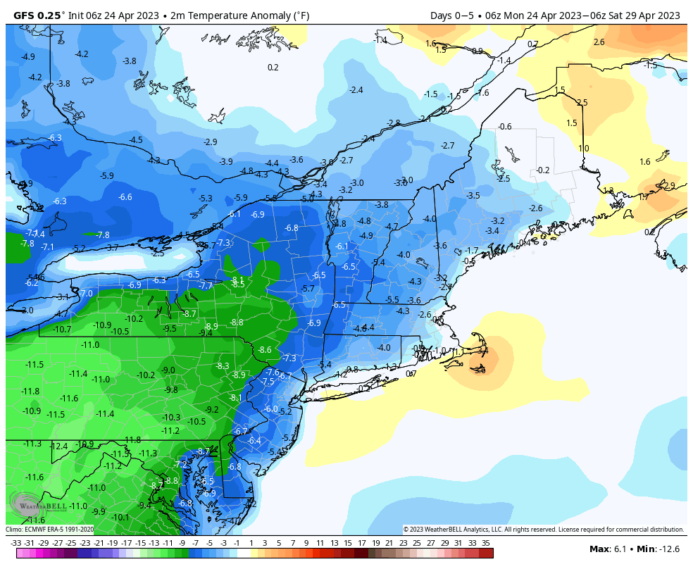
Below normal temperatures are expected for the next several days. Image provided by WeatherBell.

A weak low pressure system slowly moves offshore today, keeping plenty of clouds around with some more showers possible. After that, an upper-level low pressure settles into the Northeast, then remains there through the end of the week. Disturbances will rotate around the system at various times. What this means in terms of sensible weather is that each day through at least Thursday and probably Friday will features intervals of clouds and sun, with the most sun in the mornings, and later in the week, but also a daily chance for some showers. With colder air aloft, some of these showers may produce some graupel at times. These showers will likely be a bit more numerous early in the week, before the upper-level low starts to pull away. As the upper-level low finally moves out next weekend, high pressure should build in with drier conditions, though temperatures will remain on the cool side. Sunday is the wild-card though. Some models show another system moving in with more rain and cool temperatures, while other models keep the storm off to the south. We’ll lean toward the drier forecast for now, but will watch it as the week goes on.

A storm system likely impact the Mid-Atlantic states next weekend, but whether it has any impact up here remains to be seen. Images provided by Pivotal Weather.

Monday: Plenty of clouds, some sunny breaks possible, a few showers may develop. High 55-62.

Monday night: Partly to mostly cloudy. Low 36-43.

Tuesday: Intervals of clouds and sun with more showers possible. High 54-61.

Tuesday night: Partly cloudy. Low 35-42.

Wednesday: Partly sunny, chance for an afternoon shower. High 55-62.

Thursday: Intervals of clouds and sun with a chance for a few showers. High 52-59.

Friday: Partly sunny. High 53-60.

Saturday: Partly to mostly cloudy. High 53-60.

Sunday: More clouds than sun. High 51-58.

Weekend Outlook: April 21-24, 2023

Glass half-full or glass half-empty? Which is your point of view? That’ll help you decide whether the weekend will be good or not so good.

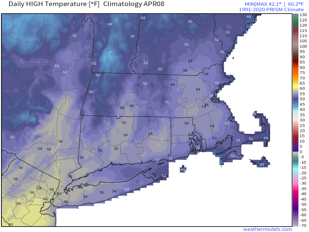
Average high temperatures for mid-to-late April around here are close to 60 degrees. Images provided by Weathermodels.com

High pressure slides off to the east, with another sunny day expected on Friday. Temperatures will be mild away from the shoreline, but a seabreeze will keep coastal areas on the cool side once again. Clouds will start to stream in Friday night ahead of a warm front, but we’re not sure that front ever makes it across the region. Saturday looks to feature plenty of clouds, and maybe even a little drizzle, with seasonably cool temperatures, especially the closer to the coastline you get. Low pressure heads into southeastern Canada Saturday night into Sunday, dragging a slow-moving cold front toward the region. Showers will move in ahead of the front Saturday night. To the amateur, looking at the models you would forecast Sunday to be a washout, but that is likely not the case. We’ll have occasional periods of rain, especially during the morning, but it won’t be all day, and in fact, a good chunk of the day, especially in the afternoon, could end up dry. When it does rain though, some of it could be heavy. Since it’s been rather dry lately, we actually do need the rain, so despite it falling on a weekend, it’s not completely bad. Temperatures will be on the cool side once again thanks to the clouds, rain, and gusty onshore winds. The cold front moves offshore later Sunday, but an upper-level low moves into the Northeast on Monday, meaning we’ll still have plenty of clouds, more showers at times, and breezy and cool conditions. This is Mother Nature’s way of reminding you that despite our summer preview a week ago, it is still April in New England.

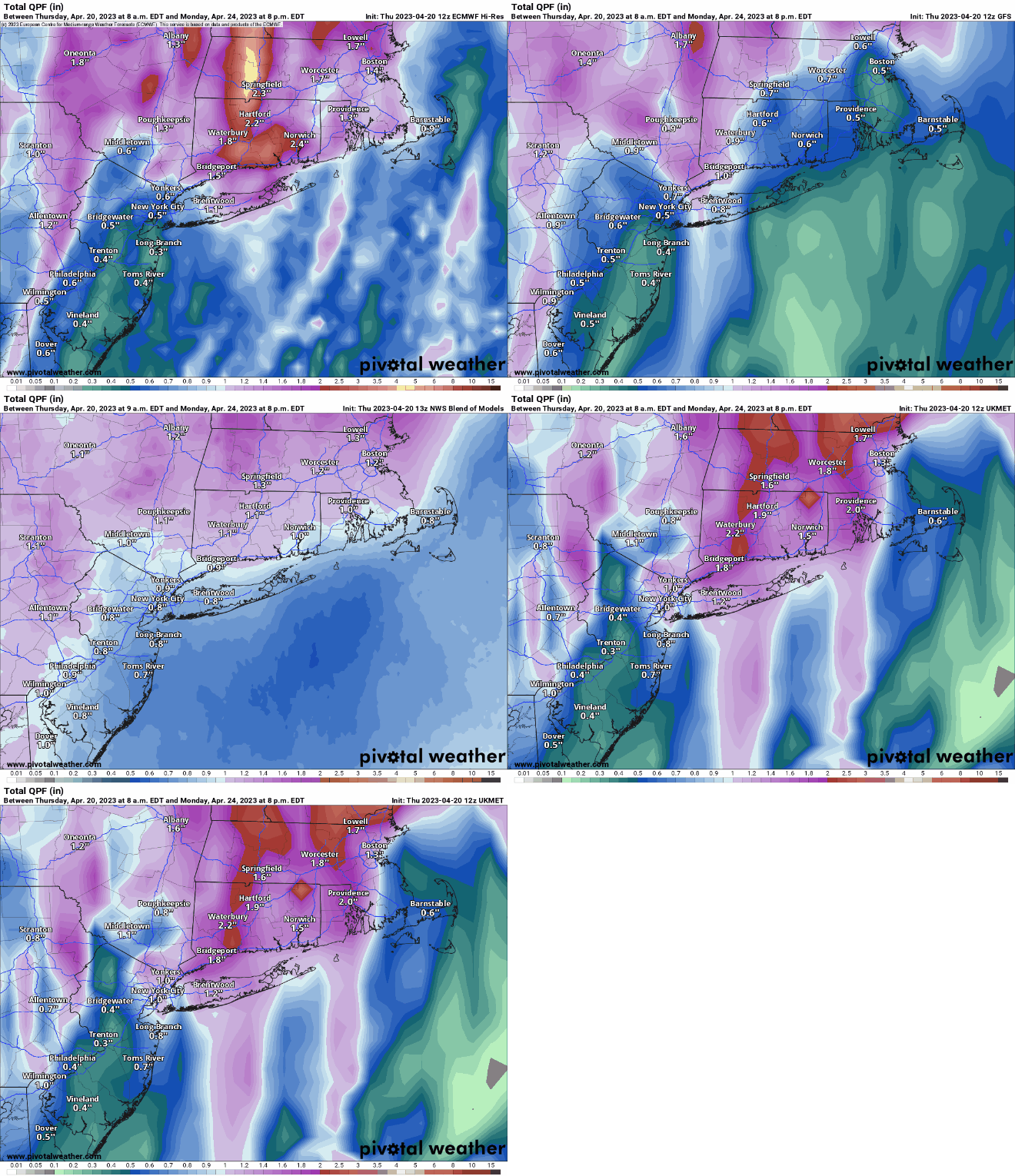
The models have been overestimating rainfall around here for quite some time, but we still should get some much needed rainfall this weekend. Images provided by Pivotal Weather.

Thursday night: Clar to partly cloudy. Low 36-43.

Friday: Sunshine and a few clouds. High 55-62 near the coast, 63-70 inland.

Friday night: Becoming mostly cloudy. Low 39-46.

Saturday: Mostly cloudy and breezy, a little drizzle is possible. High 55-62, a little cooler near the coast.

Saturday night: Cloudy, breezy, showers developing. Low 43-50.

Sunday: Cloudy and windy with periods of rain in the morning, then some occasional showers during the afternoon. High 51-58.

Sunday night: Mostly cloudy with showers tapering off. Low 41-48.

Monday: Plenty of clouds with some sunny breaks, breezy, some additional showers are possible. High 55-62.

Weekly Outlook: April 17-23, 2023

No record heat is expected this week, but it won’t be that chilly for the most part either.

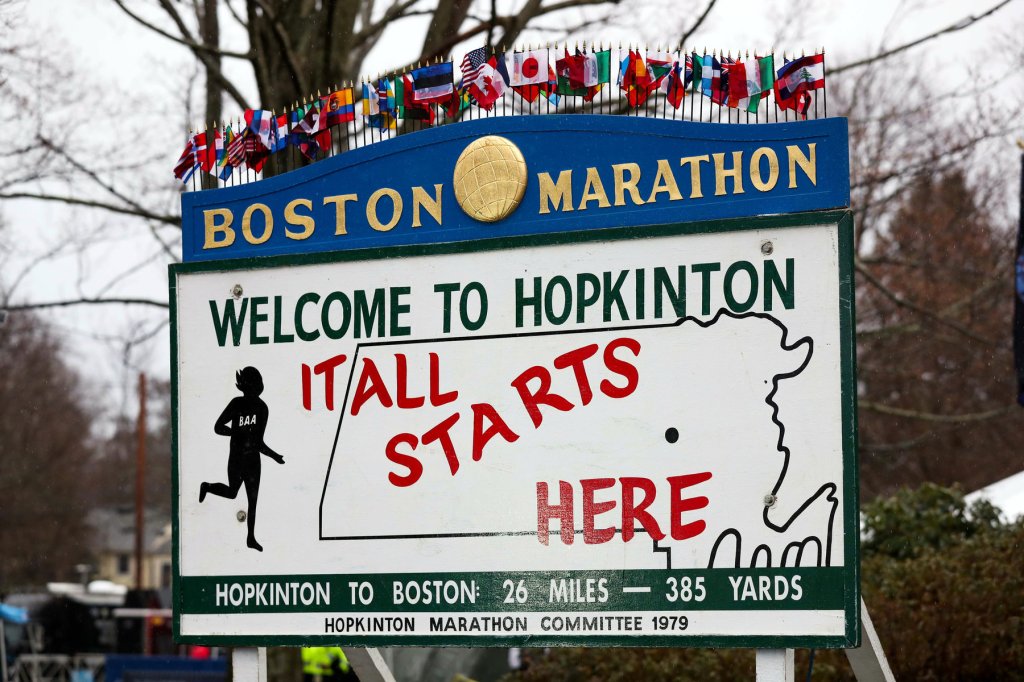
As far as we’re concerned, Patriots Day is the best day of the year. Image provided by the New York Times.

We start the week off with a cold front crossing the region on this Patriots Day. It will produce some showers, mainly during the afternoon, so they shouldn’t have too much of an impact, if any, on the morning reenactments in Lexington/Concord, the Marathon from Hopkinton to Boston, or the traditional 11am Red Sox game. The front pushes offshore later today, then skies clear out tonight. However, we’ll have an upper-level trough of low pressure cross the Northeast on Tuesday, so we may see some sunshine in the morning, clouds will regenerate, and we could even have a few pop-up showers during the afternoon.

The showers both today and tomorrow should be scattered and light in nature. Loop provided by WeatherBell.

High pressure builds in for Wednesday with sunshine and seasonably mild temperatures. A warm front moves across the region early Thursday, possibly producing a few showers, then Thursday looks to feature dry and warmer conditions, but not nearly to the extent we had last week. Friday looks warm as well, but with more clouds as another slow-moving cold front begins to approach. At this time, at looks like some showers are likely at times from late Friday into Sunday before the cold front finally moves through. None of the days should be a washout, and there will be long dry periods, but the showers are possible at almost any time ahead of the front. Temperatures should remain on the mild side ahead of the front, especially on Friday and Saturday, though the clouds and rainfall will keep them in check somewhat.

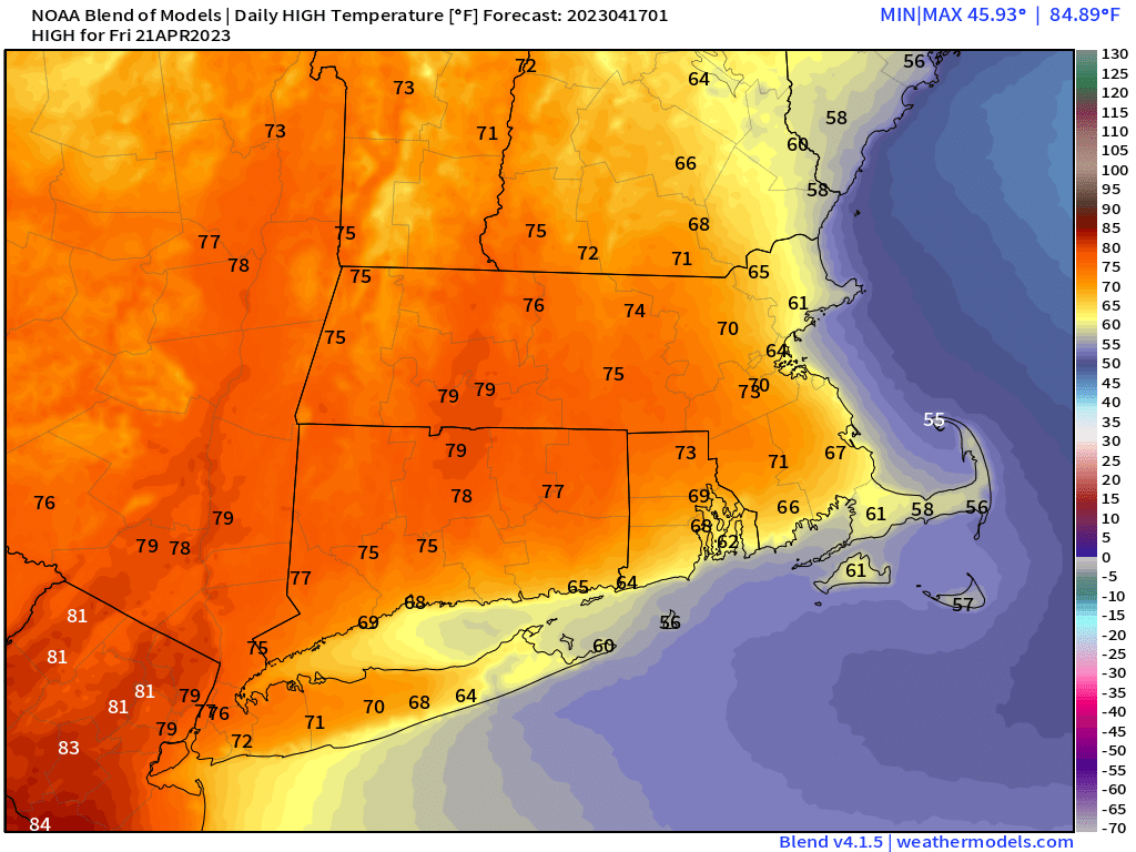
Friday has the potential to be a very warm day. Images provided by Weathermodels.com

Monday: Morning fog, otherwise mostly cloudy with showers likely, mainly during the afternoon. High 56-63.

Monday night: Becoming clear to partly cloudy. Low 42-49.

Tuesday: Intervals of clouds and sun, breezy, chance for a few pop-up showers during the afternoon. High 54-61.

Tuesday night: Clear to partly cloudy. Low 36-43.

Wednesday: Mostly sunny, breezy. High 53-60.

Thursday: A mix of sun and clouds, chance for a few showers early. High 60-67.

Friday: Partly sunny, showers may develop towards evening. High 64-71, cooler along the coast.

Saturday: Mostly cloudy and breezy with occasional showers. High 61-68, cooler along the coast.

Sunday: Plenty of clouds, more showers, breezy again. High 58-65.

Weekend Outlook: April 14-17, 2023

Our early summer preview will last for another day for parts of the region, but April will be coming back rather quickly.

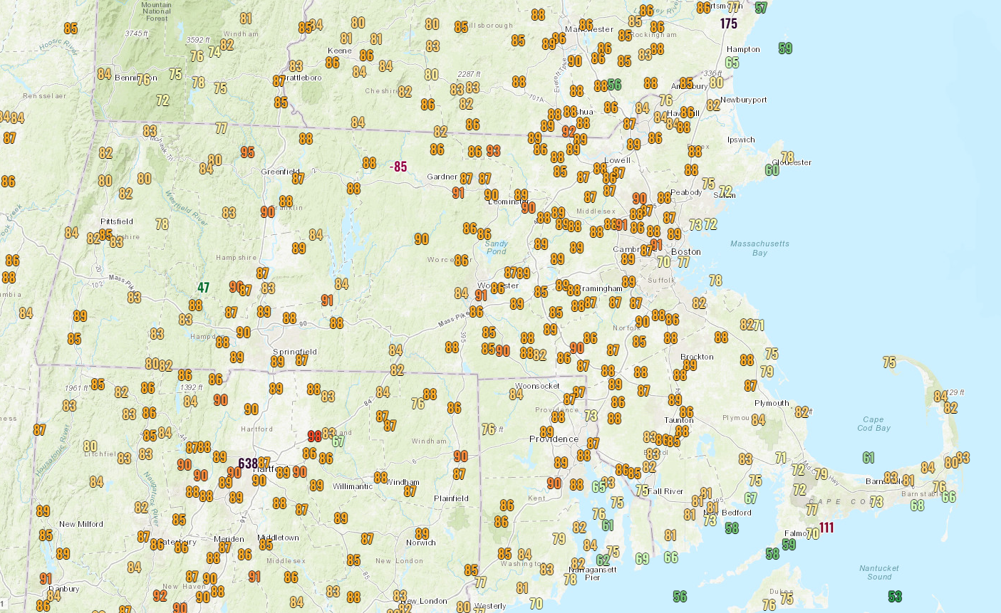
It’s a very warm afternoon across the region. Image provided by NOAA.

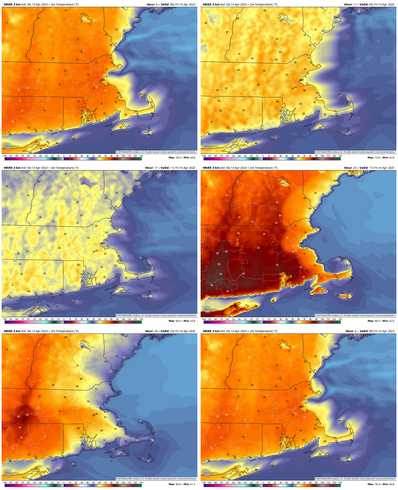
High pressure remains in place offshore, keeping most of the region very warm for the rest of today and tonight, and into the day on Friday. However, a backdoor cold front will start to move inland during the day on Friday, which means that coastal areas will quickly turn cooler, with inland areas likely staying warm again Friday, cooling off late in the day. While some inland locations could make a run at 90 during the afternoon, coastal locations may drop into the 50s at the same time. That front likely stalls out at some point on Saturday, keeping most of us on the cooler side, with temperatures in the 50s to lower 60s, which is close to normal for mid-April. South and west of the front, it’ll be another warm day, but this is mostly likely for areas from the Connecticut Valley south and west. A weak disturbance moves through for Saturday night and Sunday with a few showers, mainly south of the Mass Pike. However, with plenty of clouds and some showers around, temperatures will stay in the 50s for most of us.

Temperatures quickly plunge Friday afternoon as the backdoor cold front moves in. Loop provided by WeatherBell.

This brings us to Monday – Patriots Day, when weather will be very important, since we have both the Boston Marathon and the Red Sox traditional 11am game, as well as other assorted activities such as the reenactments of Paul Revere’s ride and the first shots of the Revolution in Lexington and Concord. We also have the Bruins 1st playoff game at night, but the weather won’t impact that. A cold front will bring moving into the region, bringing some rain, but the timing is still in question. Some models have showers in the morning, some hold off the rain until afternoon. Obviously, that makes a huge difference, so we’ll be keeping an eye on that as we go through the weekend.

When will the rain arrive on Monday? The models don’t agree. Images provided by Pivotal Weather.

Thursday night: Clear through the evening, some clouds may start to drift in after midnight. Low 56-63.

Friday: Partly to mostly sunny. High 72-79 along the coast, 80-87 inland, but temperatures will drop sharply in the afternoon, especially closer to the coast.

Friday night: Increasing clouds. Low 44-51.

Saturday: More clouds than sun, a few showers possible late in the day, mainly south of the Mass Pike. High 57-64 near the coast, 65-72 inland.

Saturday night: Mostly cloudy with some showers likely, again mostly south of the Mass Pike. Low 45-52.

Sunday: Mostly cloudy and breezy with showers likely, mainly across eastern Massachusetts and Rhode Island and mainly during the morning. High 52-59.

Sunday night: Mostly cloudy. Low 44-51.

Patriots Day: Mostly cloudy and breezy with showers likely, especially during the afternoon. High 59-66, cooler along the coast.

Weekly Outlook: April 10-17, 2023

Much of the upcoming week will be not only dry, but some much warmer weather is on the way.

High pressure remains in control today, with sunshine and milder temperatures, though a seabreeze will keep coastal areas a little cooler. We’ll have another cool night tonight, but the real warmup begins tomorrow. Morning sunshine will start to fade behind increasing afternoon clouds as a weak frontal system heads our way. Gusty west winds will result in a warmer day, even at the coast. Most locations should get close to or over 70 degrees tomorrow. With the gusty winds and dry weather, brush fire danger will be quite high, and will remain that way for much of the week. Wednesday will feature some clouds in the morning, but sunshine returns during the afternoon, temperatures will be a few degrees cooler than Tuesday, but still well above normal for mid-April. Thursday and Friday look like absolutely fantastic days for mid-April. Thursday should feature lots of sunshine, and temperatures well into the 70s, except right along the coast thanks to a seabreeze. While Friday will have some more clouds we’ll likely see temperatures get well into the 80s in many areas, again the coast will be cooler thanks to a seabreeze.

Record highs are in jeopardy in many locations on Friday. Image provided by WeatherBell.

A backdoor cold front moves through Friday night, but it may not make it too far inland. Saturday could end up very mild again in some areas, with cooler weather along the coast and into parts of northeastern Massachusetts and southern New Hampshire. Sunday could end up another warm day, again except near the coast, but a cold front will be approaching from the west. This will likely bring in some showers late Sunday and Sunday night, possibly lingering into Monday. Since Monday features the Boston Marathon and the 11am Red Sox game, the timing of the rain will be important. We should have a better idea on that when we get to our Weekend Outlook on Thursday.

The GFS and ECMWF have different ideas for the timing of the rain on Patriots Day. Images provided by Pivotal Weather.

Monday: Plenty of sunshine. High 58-65, coolest along the coast.

Monday night: Clear to partly cloudy. Low 38-45.

Tuesday: Morning sun, then clouds increase and thicken, breezy. High 66-73.

Tuesday night: Mostly cloudy and breezy. Low 49-56.

Wednesday: Morning clouds give way to some afternoon sunshine, breezy again. High 64-71, coolest along the coast.

Thursday: Lots of sunshine. High 74-81 inland, 66-73 along the coast.

Friday: Sunshine and some afternoon clouds. High 80-86, 72-79 along the coast.

Saturday: More clouds than sun. High 71-78 inland, 63-70 along the coast.

Sunday: Intervals of clouds and sun with a few showers possible. High 65-72 inland, 57-64 along the coast.

Patriots Day: Mostly cloudy and breezy with more showers possible. High 64-71.

Weekend Outlook: April 7-10, 2023

An extended stretch of dry weather is expected through the weekend and into next week.

Average high temperatures for early April are in the lower to middle 50s. Image provided by Weathermodels.com

A cold front will move across the region this evening, producing some showers and possibly thunderstorms. Once the front moves offshore, high pressure will build in for Friday, though we’ll still have a decent amount of cloudcover as a upper-level trough of low pressure swings across the Northeast. Skies will clear out Friday night, resulting in a rather chilly night as winds diminish. Saturday will feature plenty of sunshine, though temperatures will be on the cool side. Sunday looks fairly similar, though temperatures will be a few degrees warmer as the high moves off to the east and southwest winds bring milder air in. Monday looks to be even milder under partly to mostly sunny skies. In fact, much of next week looks dry and warm for the most part, with temperatures likely getting into the 70s by midweek, and there’s a chance we could be talking about highs near or above 80 by the end of the week.

Much of next week is looking very warm across the Northeast. Image provided by WeatherBell.

Thursday night: Mostly cloudy, showers and thunderstorms ending. Low 39-46.

Friday: Intervals of clouds and sunshine, breezy. High 52-59.

Friday night: Partly cloudy. Low 26-33.

Saturday: Sunshine and a few clouds. High 44-51.

Saturday night: Clear skies. Low 27-34.

Sunday: Plenty of sunshine. High 47-54.

Sunday night: Clear skies. Low 30-37.

Monday: Mostly sunny. High 57-64, cooler along the South Coast.

Weekly Outlook: April 3-9, 2023

As is typical of April, this week will be cool, warm, wet, and dry. Let’s get into the details.

High pressure slides offshore today, allowing milder weather to move back in on gusty south to southwest winds. A frontal system will drop southward later in the day, bringing some clouds in, along with a few showers at night, mainly north of the Mass Pike. That front will continue to slowly drift southward during the day on Tuesday, with some additional showers possible. South of the front, temperatures will be in the mild side, possibly well into the 60s, on Tuesday, but to the north of it, it will be much cooler, with temperatures only in the 50s, perhaps upper 40s. With the front expected to stall out south of the region, Wednesday looks chilly and somewhat damp thanks to east winds off the still-cool Atlantic.

The models don’t agree on how quickly the front drops southward on Tuesday, which has a significant impact on temperatures from north to south across the region. Images provided by Pivotal Weather.

That front will lift northward again as a warm front Wednesday night, setting up a rather warm day on Thursday. Despite plenty of clouds, temperatures will get well into the 60s, likely topping 70 in some spots. If we can get any sunshine, temperatures could get well into the 70s across the region. The warm air won’t hang around long though, as a cold front moves through late in the day with some showers and possibly thunderstorms. High pressure builds in for Friday and the weekend with dry weather. Temperatures will be cooler on Friday and Saturday, but should moderate on Sunday.

If we can get some sunshine, Thursday could be a very warm afternoon. Image provided by WeatherBell.

Monday: Morning sunshine, clouds start to filter in during the afternoon, breezy. High 49-56.

Monday night: Mostly cloudy, winds diminish during the evening, a few showers likely after midnight, mainly north of the Mass Pike. Low 39-46.

Tuesday: Plenty of clouds, with some additional showers possible, again favoring areas north of the Mass Pike. High 50-57 north of the Mass Pike, 58-65 south of the Pike, except cooler along the coast.

Tuesday night: Cloudy with areas of fog and drizzle. Low 38-45.

Wednesday: Cloudy with a few showers and some drizzle likely. High 44-51.

Thursday: More clouds than sun, breezy, and warm with some late-day showers, possibly a thunderstorm. High 65-72, cooler along the South Coast.

Friday: A mix of sun and clouds, windy, and cooler. High 51-58.

Saturday: Plenty of sunshine, breezy. High 48-55.

Sunday: Mostly sunny, breezy again. High 55-62.

Weekend Outlook: March 31-April 3, 2023

Half of the upcoming weekend looks decent weather-wise, but that means that half the weekend won’t be so nice.

A warm front will approach the region today, with clouds streaming in, and rain developing by late afternoon. The rain may start as some sleet or wet snow across the hills of central Massachusetts and southwestern New Hampshire, but even there, a change to rain is expected with little accumulation. Temperatures rise behind the front at night, and the rain comes to an end, but as second round of rainfall is likely on Saturday in the warm air. Don’t be shocked if some thunderstorms develop as well as a cold front approaches. The front moves through in the evening then high pressure builds in for Sunday with sunshine and chilly conditions once again. As the high moves offshore, temperatures will moderate on Monday.

Around 1 inch of rain is expected late Friday and Saturday across the region. Image provided by WeatherBell.

Thursday night: Clear skies, clouds start to filter in late at night. Low 22-29.

Friday: Becoming cloudy and breezy with showers developing in the afternoon, possibly some sleet or wet snow in the hills. High 44-51.

Friday night: Cloudy and breezy with rain tapering off in the evening, showers redevelop late at night. Low 37-44 during the evening, temperatures will start to rise overnight.

Saturday: Partly to mostly cloudy and windy with rain likely, possibly a thunderstorm. High 57-64, cooler along the South Coast.

Saturday night: Mostly cloudy and breezy with showers ending in the evening, some clearing late at night. Low 31-38.

Sunday: Plenty of sunshine, windy, and cooler. High 41-48.

Sunday night: Clear to partly cloudy. Low 24-31.

Monday: Partly sunny, windy. High 50-57.

Weekly Outlook: March 27 – April 2, 2023

The week won’t be completely quiet, but dry weather is expected for Red Sox Opening Day on Thursday.

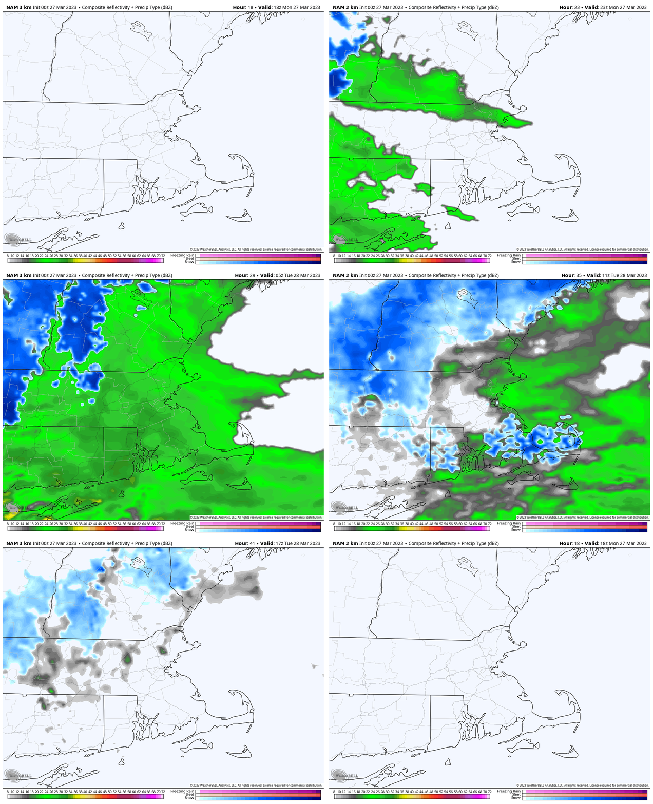
The week starts off with high pressure moving offshore, allowing for a dry day today, but clouds will be on the increase ahead of a weak storm system. That system will pass south of the region tonight, with some rain showers likely, possibly mixed with a little snow, especially across the hills and into southern New Hampshire and the Merrimack Valley. Skies will be slow to clear out on Tuesday behind the system with an upper-level disturbance moving through, possibly producing another shower or two. High pressure builds in for Tuesday night and Wednesday with clearing skies and seasonable temperatures. A cold front moves through Wednesday night or early Thursday with a few rain or snow showers likely.

Tonight’s system should be mostly rain, but some wet snow is possible. Loop provided by WeatherBell.

For Red Sox Opening Day on Thursday, skies should become partly to mostly sunny, but it will be on the breezy and cool side. For first pitch a little after 2pm, it will only be around 42 degrees, but when you factor in the northwest winds at 10-20 mph gusting to 30 mph, it will feel like it’s only in the lower to middle 30s.

It may not feel like baseball weather on Thursday, but it’s another sign that Spring has arrived.

Friday will turn warmer as winds shift into the southwest, but clouds will be on the increase again ahead of the next storm system. The details are still a little fuzzy on this one, but for now, it looks like we’ll have periods of rain at some point between Friday night and Sunday, though it could start and/or end as snow across southern New Hampshire and the Worcester Hills. As for temperatures, the models all show a warm front moving in, but how far north it gets is up for debate. South of the front, temperatures could climb into the 60s, north of it, they may stay in the 40s (or 30s). We should have more clarity when it’s time for our Weekend outlook on Thursday.

The models vary by 20-30 degrees on temperatures for Saturday afternoon. Images provided by Pivotal Weather.

Monday: Morning sunshine, increasing and thickening clouds in the afternoon, showers develop late in the day. High 50-57.

Monday night: Cloudy with some light rain and showers likely, possibly mixed with wet snow before ending. Low 31-38.

Tuesday: Clouds and some afternoon sunny breaks, a shower or two is possible. High 41-48.

Tuesday night: Partly cloudy. Low 26-33.

Wednesday: Sunshine and a few clouds, chance for a rain or snow shower at night. High 46-53.

Thursday: Mostly sunny and breezy. High 40-47.

Friday: Mostly cloudy and breezy, showers developing at night. High 45-52.

Saturday: Mostly cloudy and windy with rain likely. High 59-66, potentially much cooler north of the Mass Pike.

Sunday: Early showers, then becoming partly sunny and breezy. High 43-50.

Weekend Outlook: March 24-27, 2023

We’ve got some unsettled weather coming our way for the next few days.

Some showers are likely through the evening before a cold front crosses the region overnight. We’ll see some clearing on Friday as high pressure tries to build in, but with the front stalled out just to the south, some clouds will linger, especially near the South Coast. Gusty winds behind the front will usher some cooler air in. Friday night will be on the chilly side with lighter winds and clear skies allowing for radiational cooling. Clouds quickly return on Saturday ahead of another storm system. While this one will be mainly rain, it may start as some snow, especially north and west of I-495. Some slushy accumulations are possible, but a change to rain will wash them away by late in the day. Rain comes to an end Sunday morning, then high pressure builds in for the rest of Sunday and Monday with dry and seasonable conditions.

Most of the models show precipitation beginning as a wintry mix outside of I-495 Saturday afternoon. Images provided by Pivotal Weather.

Thursday night: Partly to mostly cloudy with showers ending before midnight, breezy. Low 35-42.

Friday: Partly sunny, breezy in the morning. High 47-54.

Friday night: Partly cloudy. Low 27-34.

Saturday: Mostly cloudy and breezy with showers developing, starting as some wet snow outside of I-495 before changing to rain. High 39-46.

Saturday night: Mostly cloudy and breezy, with rain likely. Low 32-39 during the evening, temperatures may rise a bit overnight.

Sunday: Showers end early, then becoming mostly sunny, windy. High 51-58.

Sunday night: Clear skies, breezy. Low 30-37.

Monday: Sunshine and a few clouds, still breezy. High 46-53.