Colder weather has arrived, and more is on the way, but so is some rain.
The week starts off with low pressure pulling away from the region, with any lingering snow showers ending this morning, then skies start to clear out as high pressure builds in. Clear skies, lighter winds, and some fresh snowcover will result in radiational cooling tonight, with many places dropping into the teens. High pressure remains in control on Tuesday with sunshine and cool temperatures. An upper-level disturbance moves through on Wednesday, and it may be accompanied by some snow showers, especially along the coast. Even colder air settles in behind it for Wednesday night.

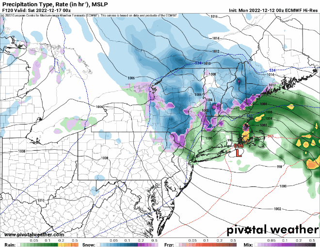
Clouds start to stream back in on Thursday as low pressure begins to head toward the region from the Southwest. For most of the region, this looks like a rainstorm for Thursday night and Friday, but a period of snow or wintry mix to start across parts of central Massachusetts and southwestern New Hampshire. However, this is still 4-5 days away, and a lot can change between now and then. Even small changes to the track that the low takes can have a big impact on the forecast. A track farther south and/or east could result in in wintry weather for a larger portion of the region and potentially for a longer period of time. We’ll be keeping a close eye on this as the week goes on. Behind the storm, cooler and drier weather returns next weekend.
Monday: Any lingering snow showers end early, then becoming partly to mostly sunny and breezy. High 33-40.
Monday night: Some clouds across the Outer Cape, otherwise clear and chilly. Low 16-23.
Tuesday: Plenty of sunshine. High 33-40.
Tuesday night: Mostly clear skies, breezy. Low 16-23.
Wednesday: Partly sunny and breezy, chance for a few snow showers near the coast. High 32-39.
Thursday: Becoming mostly cloudy, rain develops after midnight, possibly starting as snow or a wintry mix well inland. High 39-46.
Friday: Cloudy and breezy with periods of rain, possibly mixed with snow well inland. High 43-50.
Saturday: Rain may mix with or change over to snow before ending in the morning, becoming partly sunny in the afternoon, breezy. High 39-46.
Sunday: A mix of sun and clouds, breezy. High 35-42.
