It’s a long holiday weekend for most of you, but unfortunately, it’s not going to be all sunshine and warm temperatures.
What’s left of the warm and humid weather disappears overnight as a frontal boundary settles south of the region. This will bring in showers and thunderstorms, some of which may produce heavy rain. The front stalls out to our south on Friday, with waves of low pressure riding along it, bringing in more showers, along with much cooler conditions. Some of the models are forecasting very heavy rainfall across the region, which could lead to some areas of flooding. We’re not quite sure we believe some of these numbers, but your lawn should definitely get a big drink of water over the next few days.
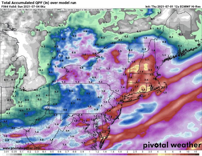
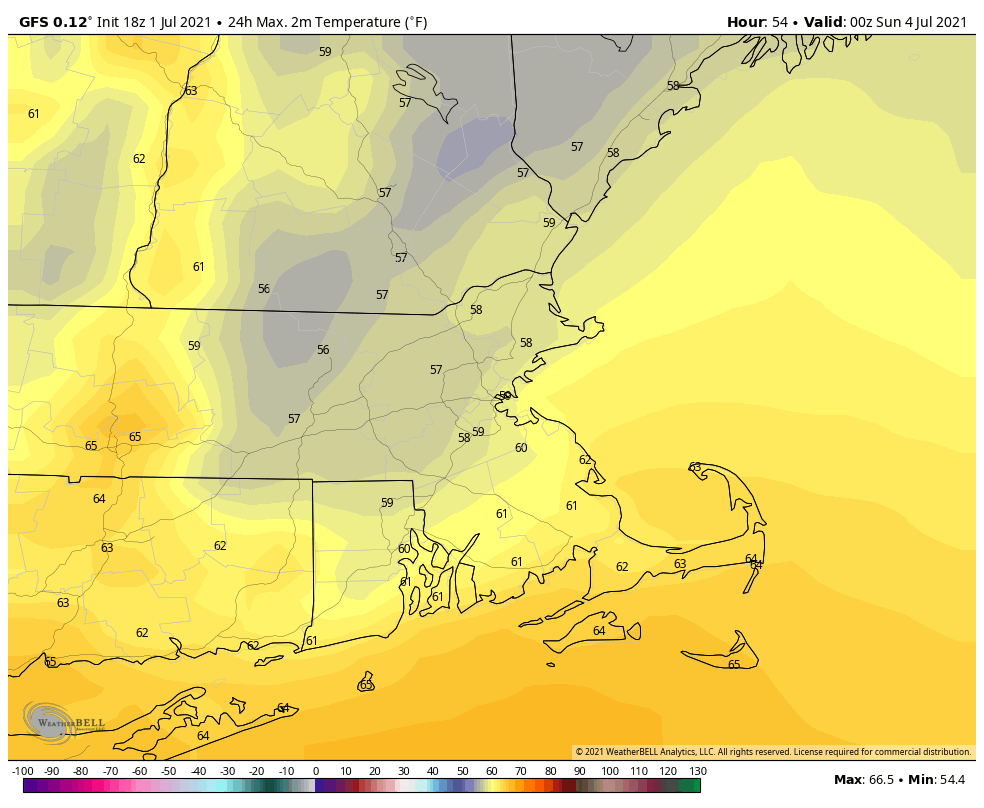
Over the weekend, the front washes out, but an upper-level low pressure system will slowly move across the region. This will keep clouds and cool temperatures in place, especially on Saturday, with some occasional showers, but neither day looks to be a washout. While Sunday isn’t ideal barbecue weather for the Fourth of July, it may not be THAT bad. Just keep an eye on the radar if you do have outdoor plans. By Monday, the upper low moves out, and we get back into sunshine and temperatures closer to normal for early July.
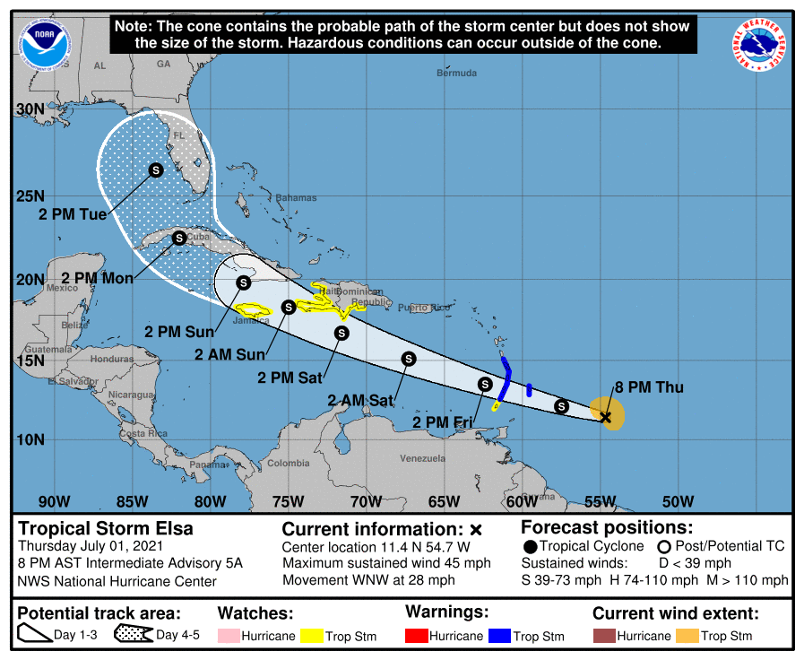
In the tropics, Tropical Storm Elsa was centered about 345 miles east-southeast of Barbados this evening, moving toward the west-northwest at 28 mph. Maximum sustained winds are near 45 mph. Tropical Storm Watches and Warnings are in effect for various islands in the eastern and northern Caribbean. The current forecast calls for some strengthening, as conditions remain favorable for the next day or so, but unless it slows down, it won’t strengthen too much. We’ll take a much more in-depth look at Elsa in a special blog post either Friday afternoon or evening.
Thursday night: Cloudy with periods of rain and showers and some embedded thunderstorms. Low 59-66, a little milder near the South Coast.
Friday: Mostly cloudy with more showers, especially in the morning. High 64-71. Offshore: Winds becoming northeast to north 10-15 knots, gusts to 20 knots, seas 3-6 feet, visibility under 1 mile in showers and fog.
Friday night: Plenty of clouds with more showers likely. Low 53-60.
Saturday: Mostly cloudy and cool with occasional showers. High 59-66. Offshore: Northeast 10-20 knots gusts to 25 knots, seas 3-6 feet, visibility 1-3 miles in showers and fog.
Saturday night: Mostly cloudy, chance for a few showers. Low 51-58.
Fourth of July: Clouds and some sunny breaks with more showers possible. High 65-72. Offshore: Northwest 10-15 knots, seas 3-6 feet, visibility 1-3 miles in showers and fog.
Sunday night: Showers end in the evening, some clearing late at night. Low 52-59.
Monday: Partly to mostly sunny. High 74-81. Offshore: Southwest 10-20 knots, seas 3-5 feet, visibility 10 miles or better.
