We’re getting down to the end of the year already. Christmas is a little more than a week away now, so this might be a good time to start your shopping. The good news is, that the weather should cooperate for most of the week.
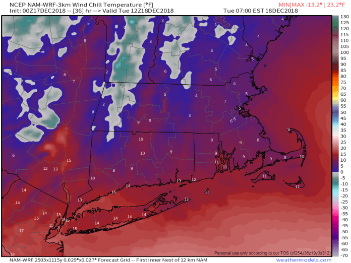
We are starting the week with low pressure pulling away from the region. We’ve got some lingering snow or rain this morning, but it should end before midday. Skies will start to clear out tonight as high pressure settles into the region behind the storm system. This will bring us a windy and cold day for Tuesday. Winds die down Tuesday night as the high moves across the region, then a moderating trend is expected for Wednesday and Thursday with the high moving offshore.
That brings us to Friday, which is the first day of Astronomical Winter. The Winter Solstice occurs at 5:22pm. If you believe the models though, they are in fairly good agreement that a storm system will bring in some milder air and rain, possibly a lot of it on Friday, which will certainly not feel like winter. However, the models have been utter crap (Note: technical term) beyond 2-3 days lately, so we’re not convinced yet that it will be mild or very wet. We should transition back to a breezy and colder pattern next weekend as Friday’s storm moves into Atlantic Canada.

Monday: Rain or snow showers ending early, some sunny breaks may develop in the afternoon, breezy. High 37-44.
Monday night: Gradual clearing, breezy. Low 18-25.
Tuesday: Wall-to-wall sunshine, windy, and cold. High 24-31.
Tuesday night: Clear to partly cloudy. Low 15-22.
Wednesday: A mix of sunshine and clouds. High 33-40.
Thursday: More clouds than sunshine. High 40-47.
Friday: Cloudy and breezy with a chance of rain. High 47-54.
Saturday: Plenty of clouds, breezy, more showers possible, especially early. High 44-51.
Sunday: Sun, sun, and more sun, but a bit breezy again. High 35-42.
