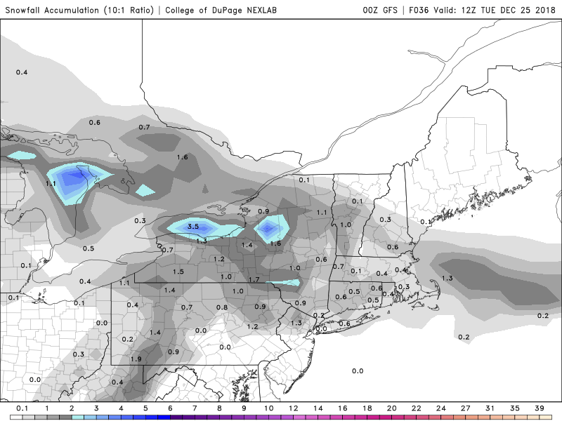
To qualify as a White Christmas meteorologically, we need to have 1″ or more of snow on the ground at 7am Christmas morning. We’re likely not going to have that this year, but that doesn’t mean the ground will be bare in some areas.
The week starts off with a weak system passing south of the region this morning and an upper-level disturbance crossing the region later today and tonight. Between these two, we’ll have some light snow and snow showers across the area today and tonight. Most of us will just see a dusting of snow, but it wouldn;t be a surprise if a few places picked up 1/2″ to 1″. Nothing major, but just enough to make the ground white in time for Christmas. As for Christmas itself, high pressure will build back in with sunshine and cooler conditions. The high will remain in place through Thursday with the dry and seasonably cool conditions expected.
By Friday, another system will be heading towards the Great Lakes. We’ll have milder air out ahead of it, with rain likely. We could see a little freezing rain at the start, especiallyinto central New Hampshire, as the colder air may be a little slow to depart. Friday looks wet and mild at this point. The storm passes to our north Friday night, dragging a cold front through early on Saturday, with drier and cooler weather returning during the day on Saturday after a mild start. Another Alberta Clipper will come through on Sunday with some light snow expected.
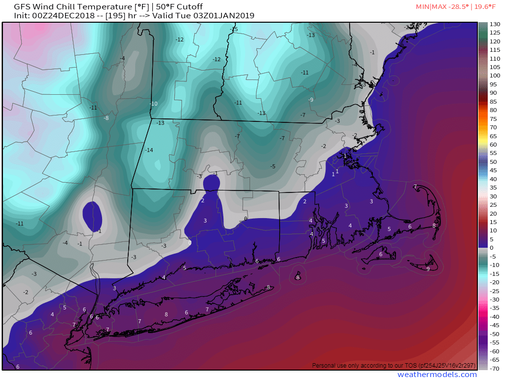
If you’re looking ahead to New Year’s Eve – right now it’s looking windy and cold with some snow showers as the Alberta Clipper pulls away from the region. If you’re planning to be outside for First Night activities, the models right now are showing temperatures in the teens with wind chills near or below zero. Obviously, we’ll have a closer look at the forecast in next week’s outlook.
Monday: Mostly cloudy with scattered snow showers, possibly mixed with some rain across the South Coast and Cape Cod. High 33-40.
Monday night: Any lingering snow showers ending in the evening, then skies clear out overnight. Low 20-27.
Tuesday: Sunshine and a few afternoon clouds. High 31-38.
Tuesday night: Clear skies. Low 18-25.
Wednesday: Mostly sunny. High 33-40.
Thursday: Plenty of sunshine, but some clouds will start to move in late in the day. High 31-38.
Friday: Cloudy, breezy, and milder, with rain likely, possibly starting as a little freezing rain across central New Hampshire before daybreak. High 46-53, possibly staying cooler across central and southern New Hampshire.
Saturday: Plenty of sunshine, breezy, and turning cooler again. High 46-53 early, then temperatures drop in the afternoon.
Sunday: Becoming cloudy with some light snow possible late in the day. High 28-35.
