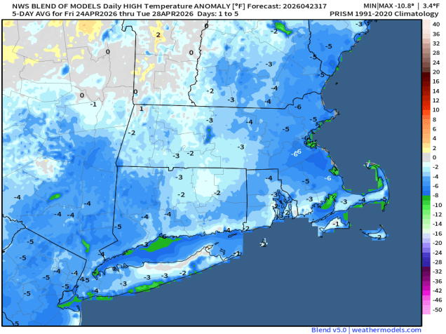
We’re not going to sugarcoat this – the 2nd half of the week is going to suck.
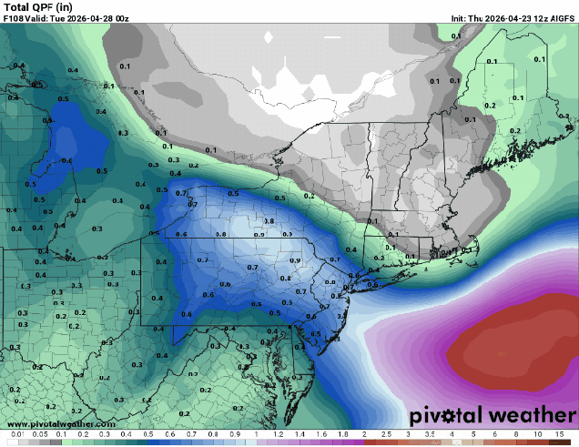
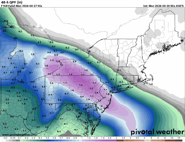
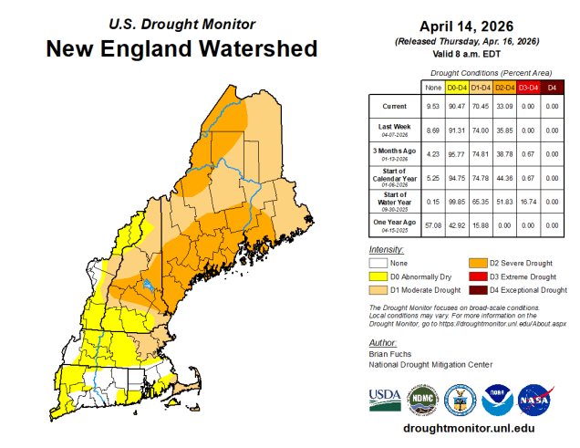
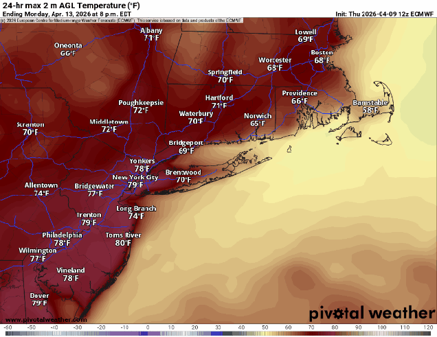
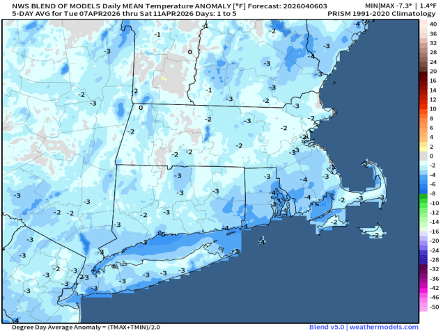
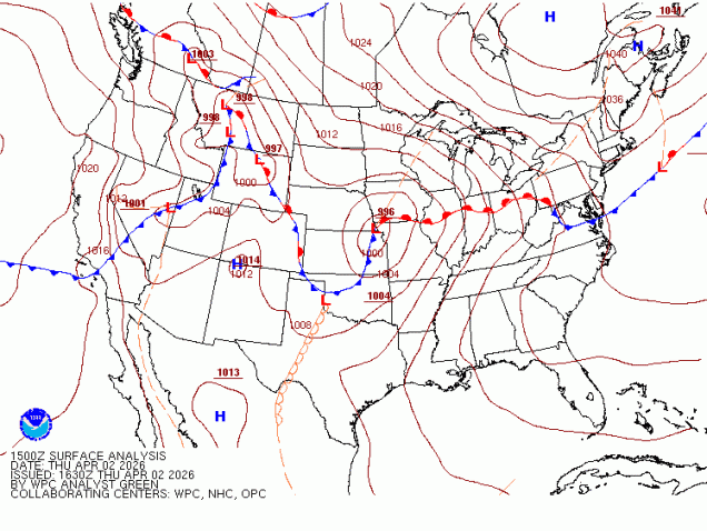
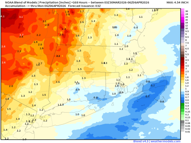
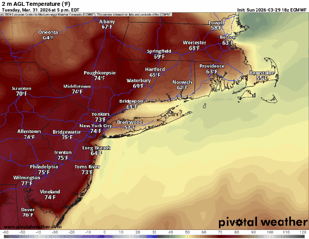
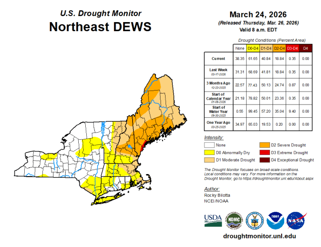
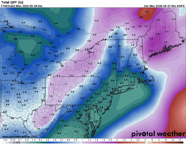
The week starts off with a nice Monday with high pressure in control, providing us with sunshine and temperatures that are close to or a little above where we should be in late April. Tuesday will be fairly nice as well, but we’ll see clouds start to move in during the afternoon. With high pressure moving into Atlantic Canada and an offshore low pressure system starting to move back towards the area we’ll see winds shift into the east, allowing cooler air to move back in from the ocean. The onshore flow will likely result in some drizzle, fog, and a few showers accompanying the cool temperatures on Wednesday, especially across eastern Massachusetts. Low pressure will move off the Mid-Atlantic coast later Wednesday, bringing some steadier and heavier rain in for Wednesday night and Thursday. Before that system can pull away, and upper-level low pressure system will develop across the Northeast, capturing the surface low, and allowing it to meander around for the end of the week and the weekend. While it won’t be raining the entire time, we can expect lots of clouds cool temperatures and occasional showers and drizzle from Friday into Sunday (and possibly into early next week as well). We also need to watch for the potential for another system to develop and pass offshore, though how close it gets to the coast is up in the air at this point. It’s not all bad news though, as we do need the rain to help put a dent in the ongoing drought.
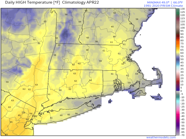
Monday: Plenty of sunshine. High 61-68, a little cooler near the coast.
Monday night: Mostly clear. Low 35-42.
Tuesday: Mostly sunny in the morning, clouds start to filter in during the afternoon. High 55-62, except 47-54 near the coast.
Tuesday night: Partly to mostly cloudy. Low 36-43.
Wednesday: Mostly cloudy, a few showers or some drizzle across eastern Massachusetts. High 54-61, except 46-53 near the coast.
Wednesday night: Cloudy with light rain developing. Low 41-48.
Thursday: Periods of rain. High 49-56.
Thursday night: Rain tapers off to showers. Low 39-46.
Friday: More clouds than sunshine with a few showers around. High 50-57.
Saturday: Partly to mostly cloudy with a chance for a few showers. High 49-56.
Sunday: More clouds than sun, another shower or two possible. High 51-58.