We hope you enjoyed the warm weekend, because in case you forgot, it’s January. Don’t worry, Mother Nature will remind you as the week goes on.
Record highs were smashed across the Northeast again on Sunday, but a cold front moved through during the afternoon, ending the warmth. Temperatures will still be near to above normal for the next few days, but the 60s and 70s are gone. High pressure builds into Quebec today, but there will be plenty of clouds around thanks to northeast winds off of the ocean. In fact, we could see a few flurries or snow showers, especially along the coast from Plymouth County up to the New Hampshire Seacoast. Temperatures will be mainly in the 30s, so yes, you’ll need to find your winter clothes again. As the high slides off to the east, temperatures will start to moderate again on Tuesday, but a weak system will also be moving in. This system will produce a little light rain Tuesday night, maybe mixed with some snow from the Merrimack Valley into Southern New Hampshire.

Behind that system we’ll have some clearing on Wednesday with mild temperatures, but clouds quickly come back late in the day ahead of yet another system. This system also doesn’t look like a big deal, but it could produce a little more in the way of precipitation late Wednesday night into Thursday, with a better chance for some light snow mainly north of the Mass Pike.
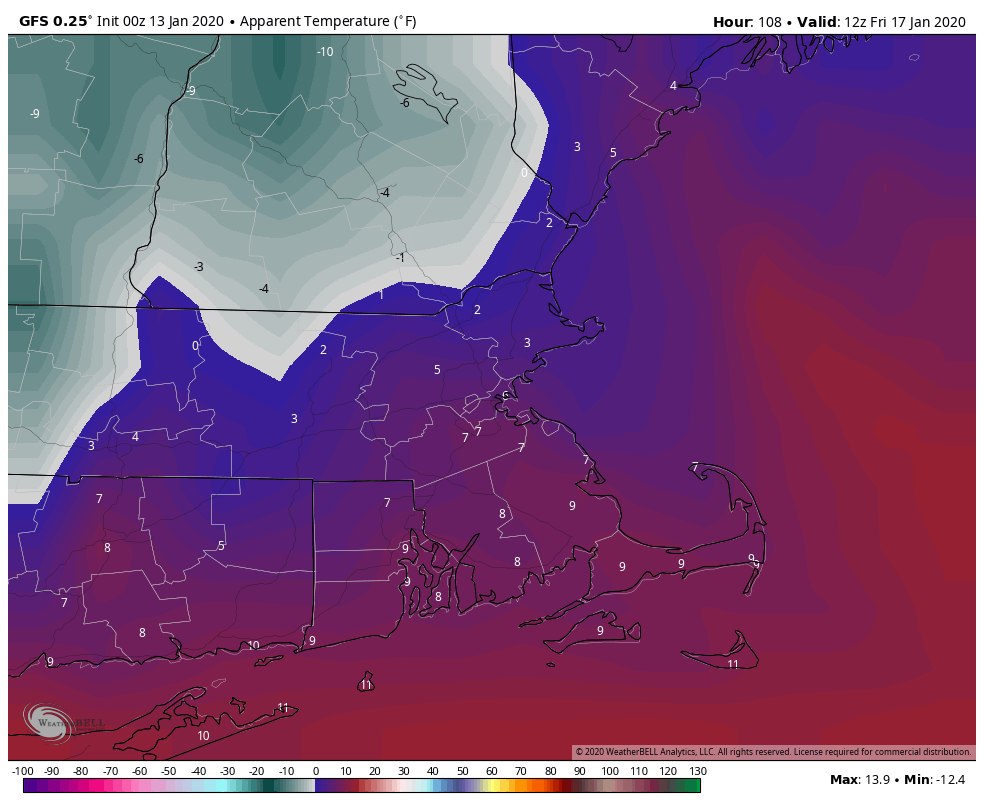
Once that system pulls away, gusty winds will usher much colder air into the region for Thursday night and Friday. You’ll be wishing for the 60s and 70s again, as temperatures will likely stay in the 20s on Friday, with wind chills in the single digits and teens.
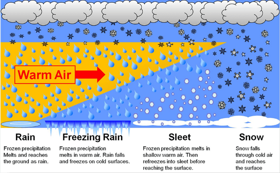
By Friday night, low pressure will be starting to move out of the Ohio Valley towards the East Coast, and it will likely impact us from Saturday into Sunday. Right now, most of the models have the system track very close to or right across southern New England, but the timing is still in question (along with many other aspects of this potential storm). It’s still 5-6 days away, so things can and will change, but obviously we’ll need to keep an eye on this. Right now, the models are showing the potential for snow, changing to rain at least south of the Mass Pike, possibly farther north. We’re not going to get into many more details than that at this point, but suffice to say, if you have plans on Saturday, keep an eye on the forecast, as the potential exists for a snowstorm, possibly a significant one. Behind the storm, windy and even colder weather settles in on Sunday, and remains in place for much of next week.

Monday: Partly to mostly cloudy with a chance for some snow showers or flurries along the coast. High 34-41.
Monday night: Partly to mostly cloudy. Low 26-33.
Tuesday: More clouds than sunshine. High 37-44.
Tuesday night: Mostly cloudy with some showers likely in the evening, possibly mixed with snow from the Merrimack Valley into Southern New Hampshire, some partial clearing possible late at night. Evening low 31-38, then temperatures hold steady or rise a bit overnight.
Wednesday: Mostly sunny, but clouds start to return late in the day. High 42-49.
Thursday: Partly to mostly cloudy and windy with a chance for showers during the morning, possibly some snow showers from southern New Hampshire into northern Massachusetts. High 38-45.
Friday: Sunshine and a few clouds, breezy, and colder. High 21-28.
Saturday: Cloudy and windy with a chance of snow, possibly changing to rain, especially south of the Mass Pike. High 28-35 north of the Mass Pike, 36-43 south of the Mass Pike.
Sunday: Snow or snow showers ending early, then clouds give way to some afternoon sunny breaks, windy. High 27-34.