For the third year in a row, the “M” storm in the Atlantic is prepared to wreak havoc on a populated area, but Michael isn’t the only headline maker in the weather at the moment.
Hurricane Michael isn’t the only storm in the news, but it is the biggest threat at the moment. As of early Tuesday afternoon, Michael was centered about 335 miles south of Panama City, Florida, moving toward the north at 12 mph. Maximum sustained winds are near 110 mph, making Michael a Category 2 Hurricane. Additional strengthening is expected over the next 12-18 hours as the storm moves over the warm waters of the eastern Gulf of Mexico. Hurricane and Storm Surge Warnings are in effect for the Florida Panhandle and the Big Bend area of Florida, with Tropical Storm Warnings and Watches surrounding the Hurricane Warnings. Tropical Storm Watches are also in effect for the Atlantic coast from northeastern Florida into South Carolina.

Michael is expected to make landfall in the Florida Panhandle Wednesday afternoon, likely as a Category 3 storm. Strong winds, torrential rainfall, storm surge, and some tornadoes are all possible with this storm. Unlike Florence, which hung around the Carolinas for days and dumped incredible amounts of rainfall on the region, Michael is expected to keep moving at a steady pace, emerging off the Mid-Atlantic coast by Friday morning. Rainfall totals of 5-10 inches are still expected in parts of the region, which will produce flooding in some areas, especially in Carolinas, where many areas are still recovering from Florence. Right along the coast, a storm surge of 6-12 feet is possible, especially in the Big Bend area of Florida. Fortunately, this area is not heavily populated, but for the residents that do live in this area, storm surge flooding is a significant threat.
Once it moves back into the Atlantic early Friday, it should pass well south of our area. The northern edge of the rainfall from the system could reach the South Coast, but the bulk of the heavy rain should remain well to the south.
This is the 3rd year in a row that the “M” storm is expected to result in significant damage to a populated area. In 2014, Category 5 Hurricane Matthew left a path of death and destruction across parts of Haiti, Cuba, the Bahamas, and eventually parts of the southeastern United States. Last year, Category 5 Hurricane Maria devastated the northeastern Caribbean, including Puerto Rico and the US Virgin Islands. While Michael is not expected to become a Category 5 storm, it is still expected to result in significant damage to parts of Florida and the Southeast.

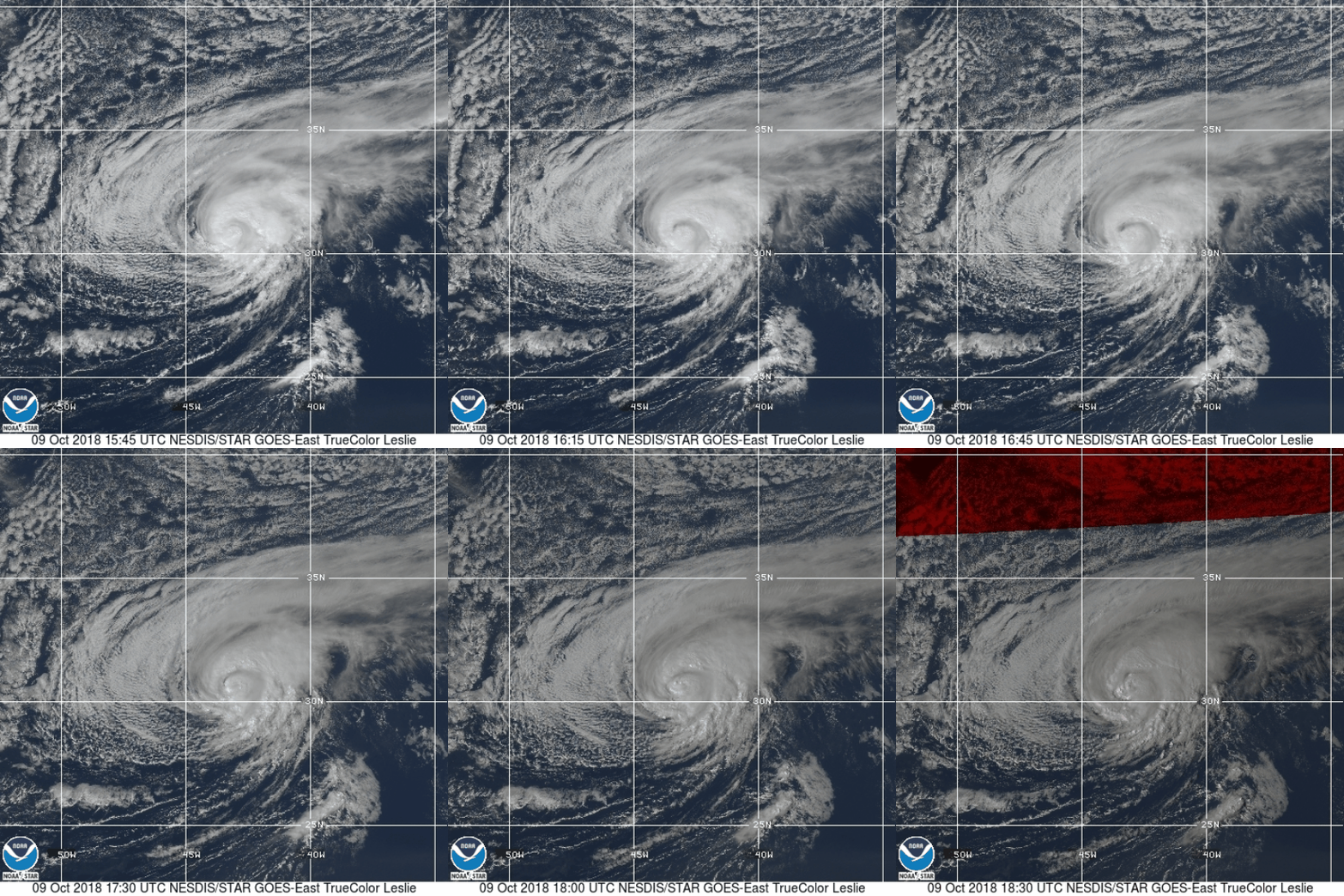
Meanwhile, in the eastern Atlantic, Tropical Storm Leslie refuses to go away. As of midday Tuesday, Leslie was centered a little more than 1000 miles west-southwest of the Azores, moving toward the south-southeast at 13 mph. Maximum sustained winds are near 65 mph. The forecast for Leslie calls for a turn more toward the east over the next few days while it strengthens back into a hurricane. Leslie is expected to remain over open waters for the next few days, and could become an extratropical storm this weekend while continuing on a general easterly track.

To the south, Tropical Storm Nadine as formed nearly 500 miles southwest of the Cabo Verde Islands. Nadine has maximum sustained winds near 40 mph, and is moving toward the west-northwest at 9 mph. Nadine is expected to remain fairly weak over open waters for the next several days while turning more toward the northwest. As it moves over colder water late this week and this weekend, it should weaken and eventually dissipate.

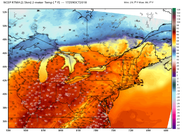
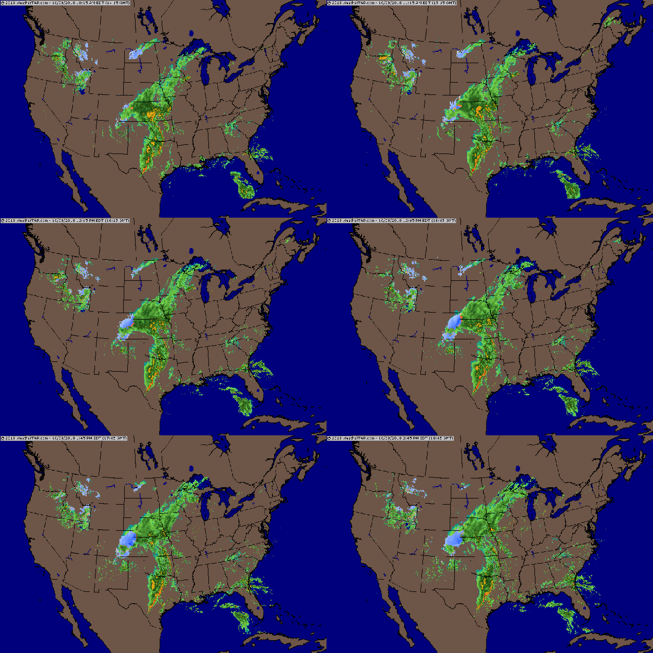
Back in the United States, unseasonably warm conditions remain in place across much of the eastern half of the nation. Temperatures are in the 70s and 80s across much of the region, which is 15 to 25 degrees above normal. A strong frontal system is located in the Plains states this afternoon, separating the warm air in the East, from much cooler weather behind it in the Plains and the Rockies. Right along this front, which hasn’t moved much for the past 24 hours, severe weather and heavy rainfall are common this afternoon.

Several tornadoes have been reported already today, including a few in the Oklahoma City area, and more are expected later today and tonight. Heavy rainfall is also expected from Texas into the Central Plains and parts of the Upper Midwest. Rainfall totals of 1-3 inches and locally heavier may produce flash flooding in some areas. Flash flood watches are in effect for much of the region.

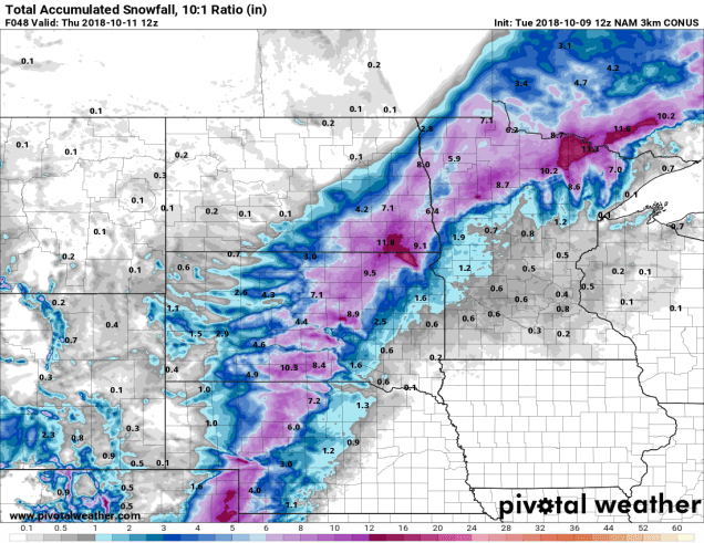
On the other side of the front, where much cooler weather is in place, rain is expected to change over to snow as low pressure rides along the front and into the Midwest. Winter weather advisories have already been posted for parts of the region. Snow is already falling in parts of Colorado this afternoon, and several inches may fall over the next 36-48 hours from western portions of Kansas and Nebraska into the Dakotas and northern Minnesota.

As the system moves eastward, it will spread some heavy rain and thunderstorms into our area on Thursday. We’re not expecting any severe weather, but some heavy downpours are possible, especially from western Massachusetts into southern New Hampshire. Some localized flooding may result. Once this front pushes offshore, much cooler weather will settle in for the Friday and the weekend.