We’ve reached Patriots Day weekend, which is usually one of the truest signs that winter is over and Spring has finally started in New England. This year that will not be the case. In fact, this year, Patriots Day weekend is going to be absolutely miserable.
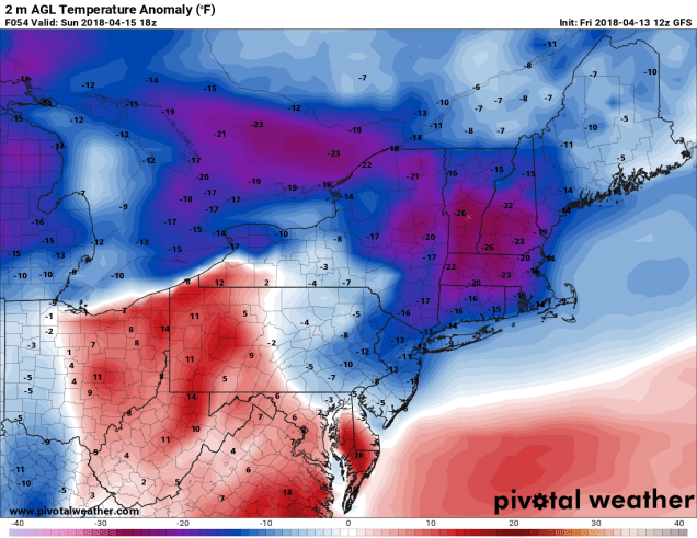
Don’t let today’s warmth fool you. Even though temperatures are in the 60s and even lower 70s away from the South Coast, big changes are coming, and not for the better. A backdoor cold front will drop down across the region late tonight and early Saturday, bringing much colder air back into the region. Temperatures are going to go slowly down through the 40s all day on Saturday and gusty northeast to east winds are going to make it feel even colder. By Saturday evening, temperatures will drop into the 30s, and they’ll likely stay there through most of Sunday. They may start to drift back up Sunday night and Monday, but it will still be on the chilly side. That’s the least of our problems.
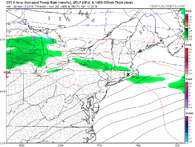
A large storm system is going to bring severe weather to the Mississippi Valley and Gulf Coast today and tomorrow, while producing blizzard conditions in the Plains and Upper Midwest, with a significant ice storm expected in parts of the Great Lakes. That storm is going to slowly make progress eastward over the next few days, with the moisture from it likely arriving late Saturday. As we mentioned earlier, temperatures are going to be dropping into the 30s late on Saturday. If you combine that with incoming moisture, you get a giant mess.
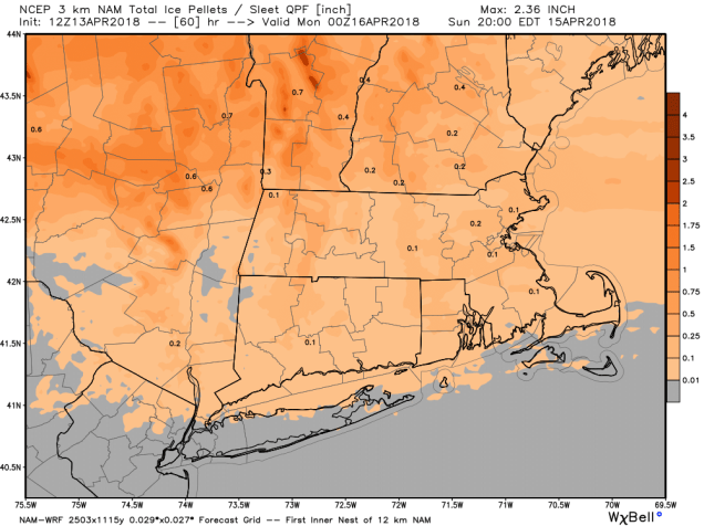
Rain will develop late Saturday afternoon or evening across the region, but as temperatures continue to drop, some sleet will likely mix in, with freezing rain also a possibility, especially north and west of Boston where temperatures could even fall into the upper 20s Saturday night. Sleet and freezing rain will continue across much of the region for a good chunk of the day on Sunday, as temperatures will only rebound into the middle 30s at best for most of the area. The reason we’re expecting sleet (and freezing rain) and not snow, is that the colder air will all be at the lower levels of the atmosphere. It will actually be warmer aloft. We wouldn’t be surprised if the summit of Mount Washington is one of the warmest places in New England Sunday afternoon.
Somewhat milder air will start to filter in Sunday night as low pressure moves into the eastern Great Lakes. This will change everything back over to a cold rain. For once, a cold rain is actually good news, because it means we don’t have to worry about the sleet any more. However, this is bad news as we head into Marathon Monday. As that low heads off to the north and west of the region, it will bring a cold front towards the Northeast. As warmer air surges northward ahead of the front, it will help bring some heavy rain into the area. That warmer air will mainly be aloft, but some of it could reach the surface during the afternoon. In the morning though, when the race starts, and the Red Sox are scheduled to play, we’ll likely have periods of heavy rain, with temperatures only in the upper 30s to middle 40s. Not exactly baseball or running weather. Temperatures could get into the 50s or even low 60s in the afternoon, especially south of Boston, but we’ll still have the heavy rain to deal with. The cold front moves through late in the day, and drier air starts to filter in on Tuesday. Even then, a few showers are still possible as an upper-level low pressure system moves across the Northeast.
So, is this it for winter? We’d like to say yes, but at this point, we can’t make that statement definitively. Longer-range models show below normal temperatures continuing into much of May. While it’s awfully tough to get wintry weather around here at this time of year, it’s not impossible. We have had heavy snow events in late April (1987), and early May (1977). As some of you may remember, in 2013, up to 3 feet of snow fell in parts of Northern New England and Upstate New York during Memorial Day weekend. So, we’d wait until at least mid-May before taking the flip-flops and shorts out of where ever you stored them for the winter.
