Some rather cold air is on the way for the next couple of days, but it’s stay should be rather short.

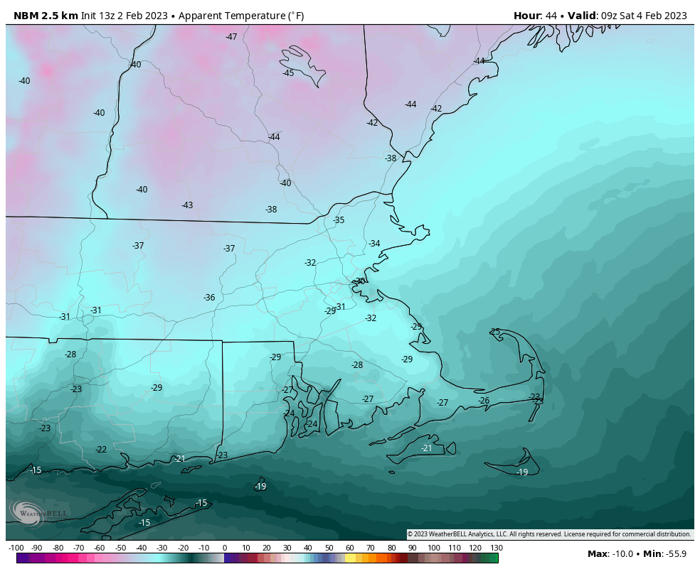
A strong cold front will cross the region late tonight, possibly accompanied by a few flurries or snow showers. Behind it, gusty northwest winds will usher some arctic air into the New England. This is likely some of the coldest air we’ve had around in several years, so make sure you are prepared for it if you have to go outside. Temperatures will likely have dropped into the teens and lower 20s by the time most of you get out of bed Friday morning, and they will continue to drop during the day despite sunshine. Temperatures will be in the single numbers by evening, and below zero for near the entire region at night. Wind chills will drop below zero during Friday afternoon, and with northwest winds of 20-30 mph gusting to 40 mph at times, we’ll see wind chills in the -20 to -40 range Friday night and early Saturday. Temperatures bottom out in the -5 to -15 range Saturday morning, but it will remain breezy, so we’ll still be dealing with bitterly cold wind chills in the morning. Winds will diminish during the day on Saturday, but temperatures will only slowly rise. The good news is that high pressure will slide offshore, allowing winds to shift into the south and southwest, so temperatures will start to moderate, likely rising all through the night Saturday night, but we’ll also have some clouds starting to move in as a frontal system begins to approach from the west. By Sunday, temperatures will be above normal again, likely reaching 40 for most of us. A few showers are possible Sunday night as the frontal system moves through and another passes well to the south, then we’ll see some sunshine and mild temperatures again on Monday.
Thursday night: Partly cloudy, slight chance for a snow shower, breezy. Low 13-20.
Friday: Mostly sunny, windy and turning sharply colder, chance for a few snow showers across the Outer Cape. High 13-20 early, temperatures drop during the day.
Friday night: Clear to partly cloudy, windy, and bitterly cold. Low -6 to -13.
Saturday: Mostly sunny, clouds start to filter in later in the day, breezy in the morning. High 11-18.
Saturday night: Partly to mostly cloudy, becoming breezy again late at night. Low 8-15 during the evening, temperatures rise overnight.
Sunday: Plenty of clouds, windy, and milder. High 39-46.
Sunday night: Mostly cloudy and breezy with a chance for a few showers across Southeastern Massachusetts and Cape Cod. Low 27-34.
Monday: Morning clouds and possibly a few showers in southeastern Massachusetts give way to some afternoon sun, breezy. High 41-48.
