Our recent stretch of dry weather is coming to an end and temperatures are going to turn cooler. There’s also the potential that a few spots in the area could see some of that s-word on Monday. You know which word I’m talking about. It’s definitely November.
High pressure slides offshore tonight as a strong low pressure system moves into the Great Lakes. A frontal system well ahead of that low will approach the region on Friday. Showers will develop Friday morning, with a period of steady, and perhaps heavy, rain likely during the afternoon and evening hours. Don’t be surprised if you hear a rumble of thunder as well. Gusty southerly winds ahead of the front will result in a mild day with many places topping 60 degrees. The front moves through in the evening, bringing an end to the rain, with skies clearing out overnight.
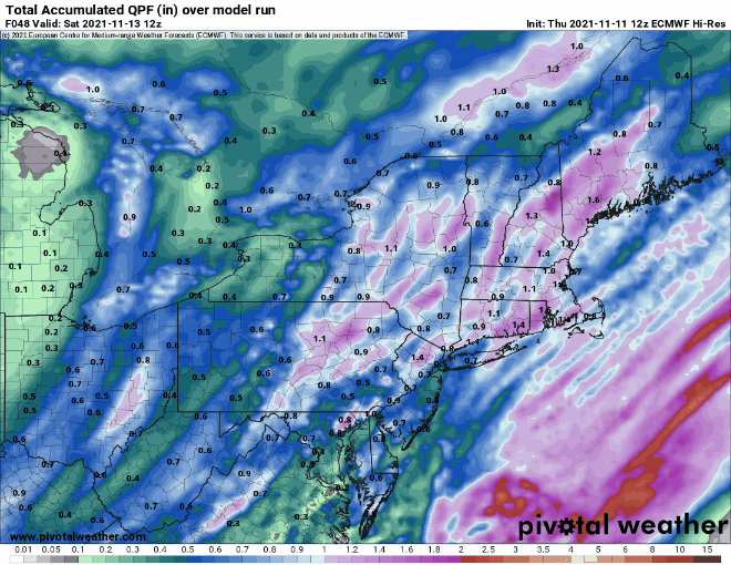
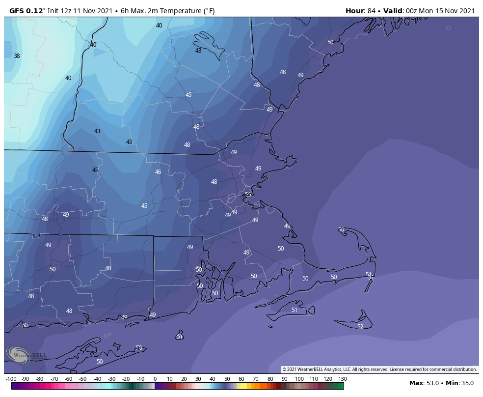
Saturday starts off with some sunshine, but clouds quickly return. That low pressure system will move into southern Canada, but a disturbance rotating around it will bring in a few more showers Saturday night. Skies will clear out again behind that on Sunday, but much cooler air will start to settle in. We’re not done with that low pressure system though. Another disturbance will rotate around it Sunday night and Monday, and it will trigger another weak system that will bring in some more showers for Sunday night and Monday. With the cooler air in place, we could even see a few wet snowflakes mix in, especially across the hills from central Massachusetts into southern New Hampshire.
Thursday night: Mostly cloudy, some drizzle or a few showers may develop towards daybreak. Low 40-47 this evening, then temperatures may rise a little overnight.
Friday: Cloudy and breezy with showers likely through early afternoon, becoming a steady and potential heavy rain for the mid-to-late afternoon hours. High 57-64.
Friday night: Showers end during the evening, followed by clearing after midnight. Low 37-44.
Saturday: Mostly sunny through midday, clouds start to move back in during the afternoon with showers possible by late in the day. High 54-61.
Saturday night: Mostly cloudy and breezy with some showers likely during the evening, then clearing after midnight. Low 32-39.
Sunday: Sunny in the morning, clouds return during the afternoon. High 45-52.
Sunday night: Cloudy with showers developing after midnight, possibly mixed with some wet snow across the interior hills. Low 33-40.
Monday: Mostly cloudy with scattered showers, possibly mixed with some wet snow across the interior hills. High 44-51.
