It looks like it’s finally time to put away the winter gear and break out the summer gear, if you haven’t already. We’ve got some warm weather on the way for much of the upcoming week.
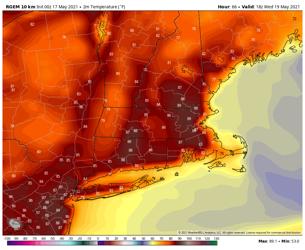
High pressure will be in control for the next several days. However, we’ll also have some weak upper-level disturbances moving across the region. What that means is that much like the past few days, we’ll start out with sunshine in the morning, then clouds develop, followed by some showers and thunderstorms, and once the sun sets, everything winds down and skies clear out. That’s what will happen today and to a lesser extent on Tuesday as well. High pressure becomes a little more dominant on Wednesday with sunshine and warmer weather. Temperatures may top 80 on Wednesday away from the coast.
Thursday is when we may see some changes start to take place. It still looks like a sunny and warm day well inland, but closer to the coast, a backdoor cold front may move in, ushering cooler air in to eastern parts of the region during the afternoon. That cooler air may hang around for Friday and Saturday as a disturbance moves across the region with more clouds and possibly some showers. Some of the models try to bring the warm air right back in on Friday and/or Saturday, but as we’ve learned the hard way over and over again, extended stretches of warm weather are hard to come by during Spring here in eastern New England. The ocean is still quite cool, and has a big impact on temperatures at this time of year. With this in mind, we’re going to lean cooler than some of the models (and nearly all of the talking heads on TV). Sunday should be warmer again as winds shift into the west ahead of a cold front, which may produce showers and thunderstorms.

Monday: Sunny to start, then clouds develop and some showers and thunderstorms pop-up. High 70-77, a little cooler along the coast.
Monday night: Becoming clear to partly cloudy. Low 48-55.
Tuesday: A mix of sun and clouds, chance for a shower or thunderstorm. High 73-80, coolest along the coast.
Tuesday night: Partly cloudy. Low 51-58.
Wednesday: Sunshine and some afternoon clouds. High 77-84, cooler along the coast.
Thursday: Early sun, then some clouds move in, a shower is possible late in the day. High 77-84, but temperatures may drop into the upper 50s or 60s during the afternoon, especially along the coast.
Friday: Intervals of sun and clouds. High 69-76, coolest along the coast.
Saturday: More clouds than sun with a chance for a few showers. High 68-75.
Sunday: Partly to mostly cloudy, showers and thunderstorms are possible late in the day. High 74-81.
