All good things must come to an end, and that includes our recent stretch of dry and warm weather.
We’ve got one more warm to hot day on Friday before a backdoor cold front brings an end to the warm weather party. The front will be accompanied by showers and possibly a few thunderstorms, then once it sags southward, gusty northeast winds will usher much cooler air into the region for Saturday. In fact, the cooler air will hang around through the weekend and into Monday. The other forecast issue is an offshore low pressure system, and how close it gets to New England, which will have an impact on the forecast for later Sunday and Monday. Right now, we’re thinking that it stays far enough offshore to have little impact on most of the region, though it may be close enough for some showers across eastern Massachusetts. We’re not expecting a washout unless something changes significantly.
Thursday night: Clear to partly cloudy, fog possible near the South Coast. Low 57-64, a little cooler near the South Coast.
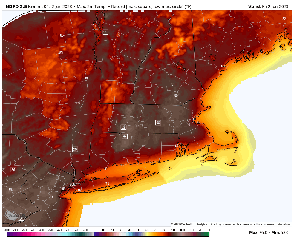
Friday: Morning sun, then increasing clouds with showers and possibly some thunderstorms during the late afternoon and evening. High 78-85 near the coast, 86-93 across the interior.
Friday night: Cloudy and breezy with showers likely. Low 47-54.
Saturday: Mostly cloudy and quite breezy and lingering showers end in the morning, some sunny breaks may develop late in the day. High 56-63, coolest near the coast.
Saturday night: Partly to mostly cloudy. Low 42-49.
Sunday: Intervals of clouds and sun, chance for some showers across eastern Massachusetts, breezy. High 55-62, a little cooler near the coast.
Sunday night: Partly to mostly cloudy, breezy, showers possible across eastern Massachusetts. Low 44-51.
Monday: More clouds than sun, again some showers are possible, mainly in eastern Massachusetts. High 61-68, coolest near the coast.
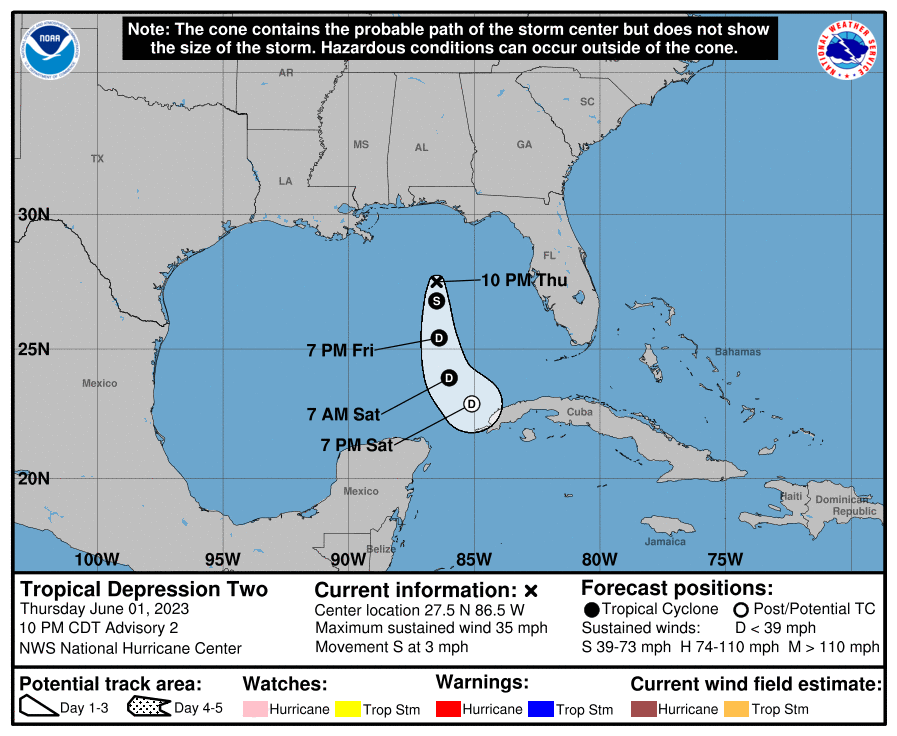
Finally, Hurricane Season began on Thursday, and at the end of our preview, we mentioned that the Atlantic was quiet. Well, that turned out to be incorrect. A cluster of thunderstorms in the Gulf of Mexico got organized enough on Thursday to be classified as Tropical Depression Two. The system is weak, though it has a chance to become a weak tropical storm on Friday, but it is expected to weaken and dissipate during the weekend, without impacting land. The thunderstorms from the system may end up producing heavy rain across parts of Cuba, Florida, and the Bahamas, but the system itself won’t do much.