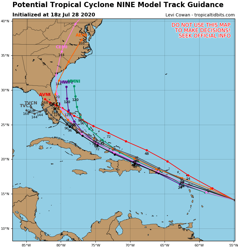
We’ve been mentioning for several days now that a wave in the Atlantic needed to be watched for development. It isn’t a tropical cyclone yet, but it appears to be a matter of when, not if, it will become one.

While the system has a broad circulation and plenty of thunderstorm activity, it has not become a tropical cyclone as of yet. Until that circulation tightens up into a well-defined low-level center, it is just a tropical disturbance. The National Hurricane Center has dubbed it “Potential Tropical Cyclone Nine” as of midday Tuesday. This designation allows the issuance of Tropical Storm Watches and Warnings for many of the islands in the northeastern Caribbean, including Puerto Rico and the Virgin Islands. The center of the system is estimated to be about 500 miles east of the Lesser Antilles. It is moving toward the west at 23 mph, and has maximum sustained winds of 40 mph. The expectation is that the circulation will tighten up and the system will become a tropical storm in the next 24 hours. If it does, it will be given the name Isaias (pronounced ees-ah-EE-ahs). This has already led to many in the media and on the internet saying that it is the earliest “I” storm on record. This is true, but it ignores the fact that at least 2 of the storms we’ve had so far this season should not have been named.

Air Force reconnaissance aircraft are out investigating the system this afternoon, trying to determine its strength and whether it has developed a low-level center yet. Once that center does develop, we’ll have a better idea of where the system may go. Right now, the forecast is for the system to cross the Lesser Antilles early Wednesday, then move across the Virgin Islands and Puerto Rico Wednesday night and early Thursday. However, if recon finds that the center has developed in a spot that is not near where the Hurricane Center currently thinks it is, that will obviously have implications on the track of the system. Changes to the track will also have implications for how strong to system gets. As we’ve been saying for a few days now, until the system actually develops, all model forecasts for the system are suspect.

Obviously, minor details could have major implications om the system’s future, but right now, it looks like it will track near or just north of the Greater Antilles. How close to passes to the islands will determine it’s strength. The closer it is, the more likely it is that the mountains of Hispaniola disrupt the circulation and keep it weak. The farther away, the more likely it stays mostly over water and strengthens while possibly impact the Bahamas along the the Turks and Caicos Islands. We’re not even going to speculate beyond that, because even forecasting this far out is more speculation than we’d like. We’re highly aware that many models, especially the ensembles show a threat to the East Coast, literally anywhere from Florida to Nova Scotia. We’re not ruling that out yet, but again, it is pure speculation at this point. We’ll say it again – once the system actually develops, we’ll start to have a better idea of where it’s going and how strong it may be. For now, it’s just something to keep an eye on.