We’ve got some typical summertime weather coming up for most of the week, with heat, humidity, and thunderstorms all expected.
The week starts off with high pressure building in from the north, which will bring in sunshine, lower humidity, and slightly cooler temperatures, especially along the coast. By Tuesday, however, that high will move off to the south, allowing more humid air into the region, along the the chance for a few showers and thunderstorms.
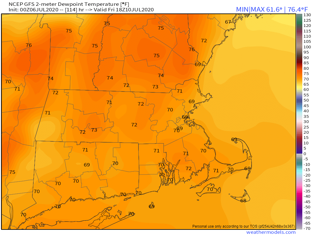
You’ll start to hear the “Triple-H” talk for Wednesday through Friday, but it may not quite qualify. It’ll be quite warm to hot, with temperatures will into the 80s and lower 90s in many locations. It’ll also be quite humid, as dewpoints will get well into the 60s, and possibly even lower 70s. Will it be hazy? Probably not. Even without the haze, it’ll still be quite comfortable for a lot of people.
The end of the week and into the weekend is a bit of a question mark right now. Low pressure currently over the Southeast will move off the Carolina coastline by midweek, and then head northeastward up the coastline. The National Hurricane Center has already given it a 40% chance of development before the end of the week. Given their recent track record, we’re assuming that assuming it moves off the coast, as long as it’s spinning and has a thunderstorm nearby, it’ll be called Tropical Depression Six, or maybe they’ll go right to Tropical Storm Fay. Either way, it may very well have some impact here by Friday or Saturday. The most likely impact is for some heavy rainfall. We’ll already have a very soupy airmass in place, and adding tropical air to that will help wring out even more moisture. While this will help put a dent in the developing drought for some areas, it may also lead to flooding in others. We could also see some impacts from wind, depending on the development of the system, and rough surf along the coast. Unsettled weather may hang around through the weekend, as the system may be slow to depart.

Monday: Partly to mostly sunny. High 77-84, cooler along the coast.
Monday night: Partly cloudy. Low 57-64.
Tuesday: A mix of sun and clouds, just a slight chance for an afternoon shower or thunderstorm. High 76-83.
Tuesday night: Partly cloudy. Low 61-68.
Wednesday: Partly sunny with showers and thunderstorms likely in the afternoon. High 81-88.
Thursday: Sunshine and a few afternoon clouds, a shower or thunderstorm may pop up. High 86-93.
Friday: Early sun, then clouds move in, some showers and thunderstorms develop, possibly become a steady rain late in the day and at night. High 84-91.
Saturday: Rain ends early, then becoming partly sunny, a few showers and thunderstorms are possible in the afternoon and evening. High 80-87.
Sunday: Intervals of clouds and sun, more showers and thunderstorms are possible. High 82-89.
