The National Hurricane Center is tracking another system in the Atlantic, but the only threat it presents is to the Hurricane Center’s credibility.
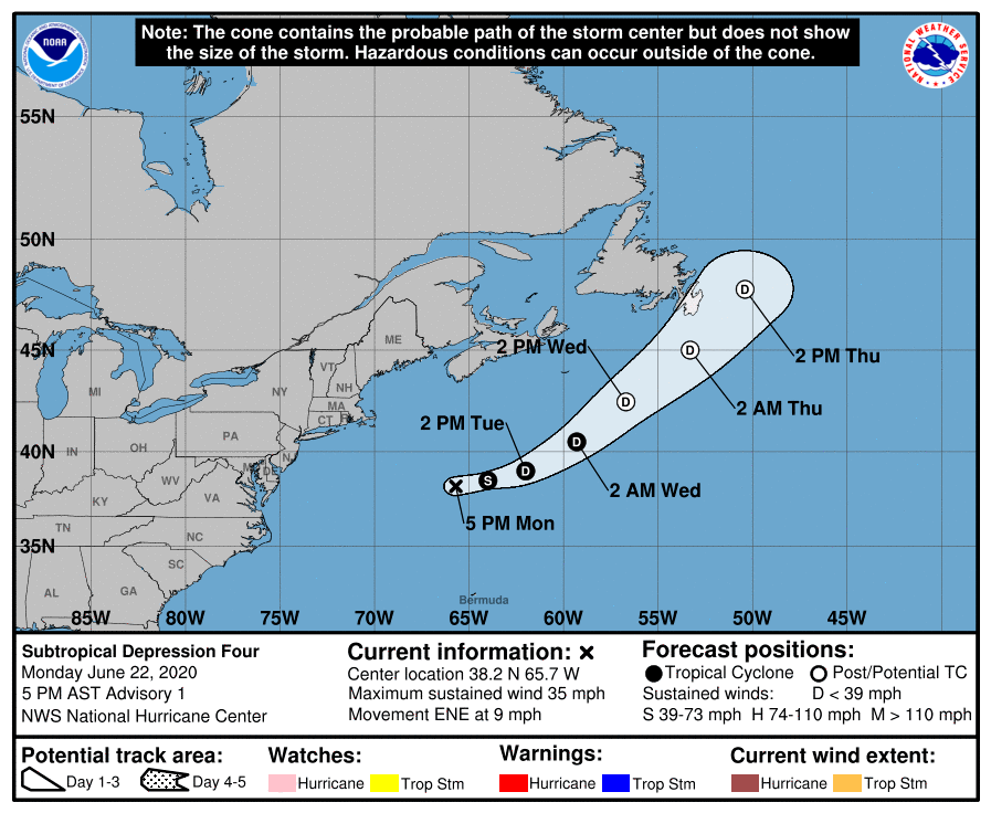
Late Monday afternoon, the National Hurricane Center started issuing advisories on “Subtropical Depression Four”, which was centered a little more than 300 miles southeast of Nantucket. Their forecast calls for it to strengthen into a Tropical Storm tonight, at which time it would be given the name “Dolly.” The system should head eastward then northeastward, staying over open waters before it weakens and then, according to the forecast, becomes “extratropical”. Here’s the problem. It’s extratropical now, and has been the entire time.

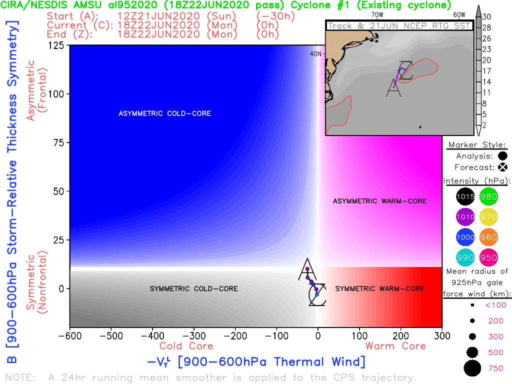
To be considered a tropical or even subtropical system, it needs to be “warm core.” What that means, is that temperatures are warmest at the center of the storm, and cooler as you head away from the center. In some stronger hurricanes, like Dorian from last year, temperatures can be as much as 20 degrees warmer in the eye compared to just outside the eye.
Tropical systems also need warm water to feed them and help them strengthen. The threshold is generally accepted as 27C (80F) as the minimum needed for a tropical system to maintain itself and/or strengthen. This system is over the northern edge of the Gulf Stream, which is fairly mild, but water temperatures in the region are 25-26C, and quickly drop to 22-24C just to the east of the system’s current location. That’s not warm enough to sustain a “tropical” system.

Lastly, and this partially refers back to the first point we made about the system being cold-core, the storm itself is centered under an upper-level low pressure system. Tropical systems usually need an upper-level high pressure system over them, to help vent the rising air near the center. The stronger the high aloft, the more a tropical system will strengthen. A storm sitting under an upper-level low is the same as most of the storms that we see impacting us all through the year – extratropical. As you can see in the analysis below, there is a trough of low pressure extending southward from the system. It’s not quite a cold front, but close enough. Extratropical systems have fronts and/or troughs extending from them, tropical systems don’t.

Assuming this gets named Dolly, it will be our fourth named “tropical” system this year. However, only one, Cristobal, was ever truly tropical. Cristobal was a tropical storm when it moved into southern Mexico. When it moved back over the Gulf and headed towards Louisiana, it was already extratropical, even though the Hurricane Center didn’t declare it extratropical until it got into Iowa.
It’s been a running joke among meteorologists for years that if a system is over water and has a thunderstorm nearby, it’ll get a name from the “National Thunderstorm Center.” This storm is just further proof of that. With many forecasts for an active hurricane season, every system is going to get named to pad the stats and help verify that forecast. We’ve had colleagues joke that by the time this season is over, we’ll have gone through the entire name list and the Greek Alphabet. We not only agree with that sentiment, we even made a prediction elsewhere that “Tropical Storm Lambda” will produce 70 mph winds on Nantucket in late December while bringing 6-12 inches of snow to southern New England. As long as there’s a thunderstorm in the warm sector, it’ll get a name.
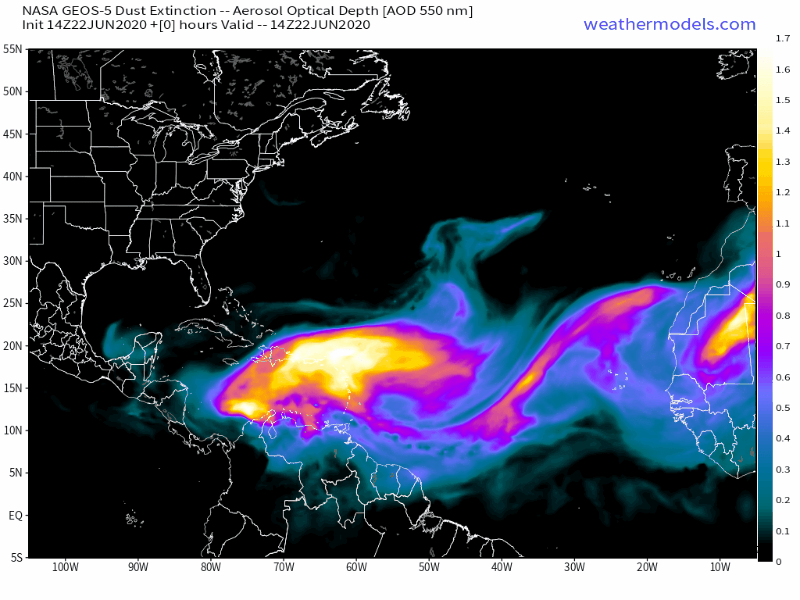
As far as actual tropical systems, none are forthcoming in the Atlantic for at least a week or two, thanks to several plumes of Saharan dust moving off the coast of Africa and across the Atlantic over the next several days. The dust is accompanied by very dry air, which suppresses thunderstorm activity.
