Now that the warmer weather has finally arrived, we’re going to start issuing a Weekend Outlook on Thursdays, in addition to our Weekly Outlook that gets issued early Monday morning. This coming weekend will be better than a lot of the ones we’ve had recently, but it’s not all sunshine and mild temperatures.
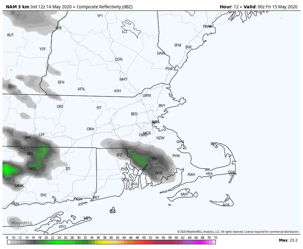
The high pressure system giving us a rather nice day today will slide offshore and clouds will start to increase as we head through the afternoon. Low pressure moving into the Midwest will send a warm front our way tonight and Friday. A period of showers with some embedded heavier and steadier rain is likely tonight, mainly after midnight, as the warm front moves across the region, with most of the rain moving offshore around or a little after daybreak. This sets up a challenging forecast for Friday.
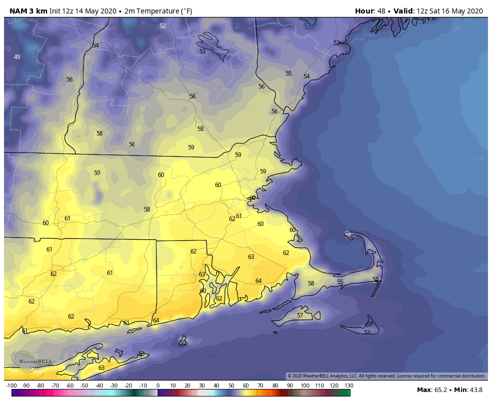
That warm front will bring much milder air into the region on Friday, with many locations likely jumping into the 70s. This brings us to forecast dilemma #1 – how far north does the warm front get before it stalls out? Right now, we’re thinking that most of the region will break into the warm air, with the exception of southern Maine, the New Hampshire Seacoast, and possibly extreme northeastern Massachusetts (i.e. Salisbury Beach/Newburyport area). In those areas, temperatures may stay in the 50s or lower 60s. This front will eventually start sagging back southward as a backdoor cold front later in the day, allowing cooler air to move back into eastern areas late in the day.

Now we get to forecast dilemma #2 – how much sunshine develops in the warm sector? This will be key for a couple of reasons. Obviously, the more sunshine we get, the warmer it will get, possibly allowing some locations well inland to get to 80. However, the other reason it’s important is that we’ll have a cold front moving in from the west, triggering showers and thunderstorms. The more sunshine and heating we get, the more unstable the atmosphere can become, and the stronger the storms we could see. We think that the best chance for any severe weather will be from the Connecticut Valley into eastern New York, but a few stronger storms could make it farther east. Some of these storms could produce heavy downpours and strong winds, with hail also a possibility. There’s also a chance for a tornado or two, mainly across western New England.

The cold front moving in from the west will bring cool air back into much of the region Friday night. High pressure then builds in on Saturday with sunshine and seasonably mild temperatures through at least midday. However, the afternoon will be a different story. It appears as though another backdoor cold front is going to drop down the coast. This will bring in clouds and much cooler conditions once again. We’ll jump into the 60s or lower 70s by lunch time, but by late afternoon, we’ll be back in the 50s, with some upper 40s the closer to the coast you get.
High pressure slides offshore on Sunday, with winds shifting back into the south, so we’ll start to warm up again, but like Saturday, temperatures will start to drop again in the afternoon as winds shift onshore. We’ll also have clouds start to stream in ahead of another storm system moving in from the west. This brings us to Monday, when things really go downhill again. Low pressure will be heading towards the Mid-Atlantic states, while a tropical or subtropical disturbance starts to take shape near or north of the Bahamas. The initial storm will bring us some rain on Monday, with gusty easterly winds keeping temperatures in the 50s, maybe even upper 40s. Yeah, we’re back to that nonsense. Monday is going to be a miserable day. Beyond that, we’ll have to see how the Mid-Atlantic system and the offshore system evolve, but there’s a decent chance that Tuesday won’t be much better, and possibly Wednesday as well, especially along the coast. We’ll get into more detail on that in our Weekly Outlook early Monday morning.
This Afternoon: Sunshine starts to dim behind increasing high clouds. High 64-71, coolest along the South Coast.
Tonight: Thickening clouds with a period of rain likely after midnight. Low 45-52.
Friday: Any showers end early, then becoming partly sunny. Clouds move back in late in the day. High 70-77, cooler across the South Coast, Cape Cod, and also the New Hampshire Seacoast.
Friday night: Showers and thunderstorms likely during the evening, then skies start to clear out late at night. Low 45-52 across southern New Hampshire and northeastern Massachusetts, 52-59 across southeastern Massachusetts and Rhode Island.
Saturday: Sunshine in the morning, clouds return to coastal areas in the afternoon. High 64-71, cooler along the coast. Temperatures quickly drop in the afternoon.
Saturday night: Partly to mostly cloudy. Low 42-49.
Sunday: Some sunshine in the morning, clouds return in the afternoon. High 61-68, cooler along the coast.
Sunday night: Cloudy with rain developing. Low 43-50.
Monday: Breezy and cool with periods of rain. High 51-58.
