We’ve reached Patriots Day, which is the “unofficial” end of winter in many years. We’ve got the Marathon, the Red Sox 11:05am game, and usually, but not always, some decent weather.

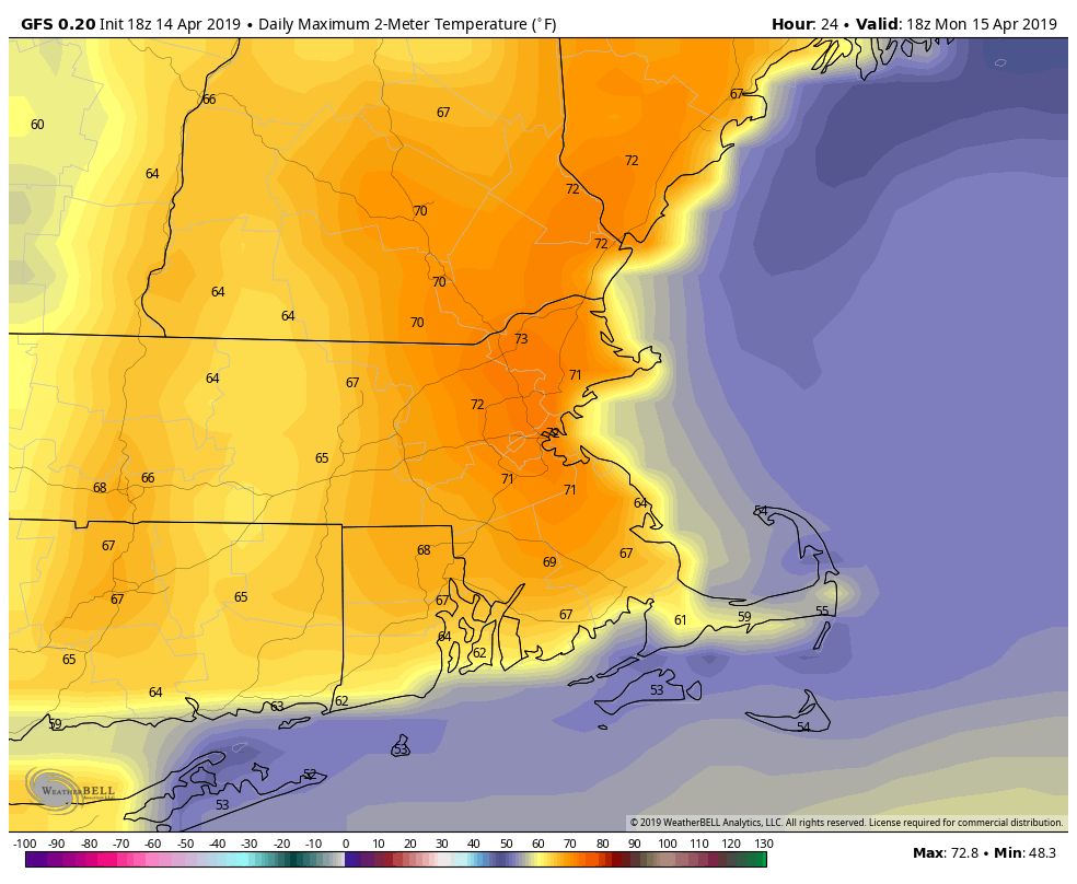
The week starts off on a damp but mild note as warm front lifts northward during the morning. Showers and maybe even some thunderstorms are likely. This system has been producing severe weather across much of the eastern half of the nation for the past few days, but we’re not expecting any severe weather here. Some downpours, gusty winds, and a little lightning are expected, but nothing severe. The rain should end around 9-10am, which is perfect timing for both the Marathon and the Red Sox game. Some sunny breaks could develop in the afternoon, which may allow temperatures to get up to 70 once again. The mild weather comes to an end late this afternoon as a cold front moves through, likely with a few more showers.
Windy and cooler weather moves in behind the front for Monday night into Tuesday as high pressure builds in. Wednesday looks dry as well, and slightly milder, but still cooler than what we enjoyed this past weekend. Thursday will see some clouds move in ahead of a warm front, along with some showers, but we’ll stay on the cool side until the front actually moves through, which will likely be sometime on Friday.
This brings us to the end of the week and the weekend. Another strong storm will be moving through the Plains states and into the Midwest. More severe weather is likely, but with this storm only making slow progress eastward, we’ll also be dealing with it for a couple of days. We’ll have some showers around on Friday as the milder air moves in, but a period of heavy rain is possible later Friday into Saturday. Don’t go cancelling any outdoor plans yet, but we’ve got the potential for quite a bit of rain. The rain may linger into Sunday before a cold front finally moves across the region.

Monday: Rain, maybe a thunderstorm this morning, then some sunny breaks in the afternoon before another round of showers moves through late afternoon. High 64-71.
Monday night: Clearing, windy, and cooler. Low 34-41.
Tuesday: Sunshine and a few clouds, breezy. High 53-60.
Tuesday night: Clear skies. Low 33-40.
Wednesday: Mostly sunny, though some high clouds may start to stream in late in the day. High 54-61.
Thursday: Partly to mostly cloudy. High 48-55.
Friday: Mostly cloudy and breezy with a few showers possible, becoming a steadier rain at night. High 61-68.
Saturday: Cloudy and breezy with rain likely, possibly heavy. High 61-68.
Sunday: More clouds than sunshine, a few lingering showers possible. High 64-71.
