Some cooler weather is on the way over the next few days.
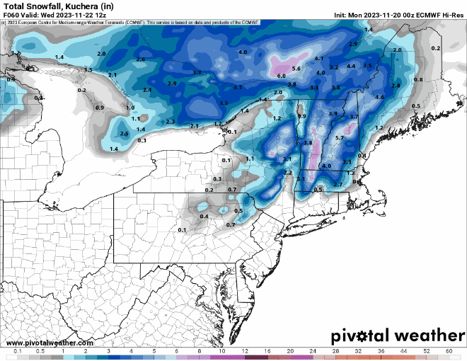
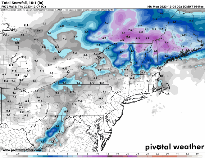
We’ll start to dry out today, but plenty of clouds will remain in place, and there could be a stray shower as an upper-level disturbance crosses the Northeast. Tuesday will be a dry day but a little cooler as high pressure tries to build in. Things could get a little interesting Tuesday night and Wednesday. Low pressure will pass well offshore, but an extension of it, called an inverted trough, may set up. Normally, trough of low pressure are oriented in a general north-south direction from low pressure to the north. In this case, it’ll be the opposite, south-north from low pressure well to the south, hence the “inverted” part. What this will serve to do is enhance some onshore winds, which will in turn generate some precipitation. With colder air settling in, that precipitation will likely fall as snow. Now, this isn’t a big snowstorm we’re talking about, but across eastern Massachusetts, Rhode Island, and southern New Hampshire, we could see an inch or two in spots, especially across southeastern Massachusetts.
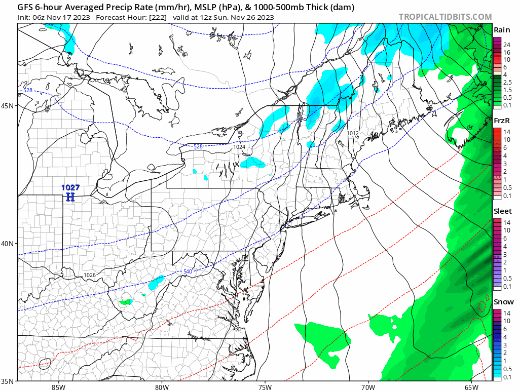
High pressure builds back in for Thursday, which will likely be a rather chilly day. High pressure slides off to the east, allowing temperatures to moderate for Friday and Saturday. The next system approaches on Sunday, but there are timing issues to be worked out with this storm. Some rain is possible during the day, but for now, it looks like most of the rain will hold off until Sunday night and Monday. This is subject to change however as the models start to hone in on the eventual solution. It does look like Sunday could be quite a mild day ahead of the storm, but again, let’s not etch that in stone just yet, since it is 6 days away.

Monday: Intervals of clouds and sun, slight chance for a shower. High 45-52.
Monday night: Partly to mostly cloudy. Low 29-36.
Tuesday: More clouds than sun, cooler. High 36-43.
Tuesday night: Mostly cloudy with some light snow or snow showers around. Low 24-31.
Wednesday: Mostly cloudy, light snow or snow showers ending. High 32-39.
Thursday: A mix of sun and clouds. High 31-38.
Friday: Partly sunny. High 39-46.
Saturday: Intervals of clouds and sun. High 47-54.
Sunday: Mostly cloudy, breezy, and mild with scattered showers. High 51-58.