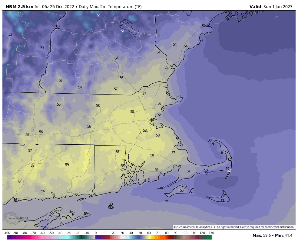
The final week of 2022 will feature a warmup across the region.
We start the week off with high pressure in control, keeping us chilly today. We’ll have sunshine in the morning, but clouds start to stream in during the afternoon as a weak disturbance moves toward the region. This may produce a few flurries tonight, but for the most part, we’ll remain dry. High pressure then builds in for Tuesday with clearing skies and temperatures remaining near or a little below normal for late December. The warmup begins on Wednesday, and continues into the weekend, with temperatures getting above normal, perhaps well above normal for New Years Eve and New Years Day, with highs well into the 50s or even near 60. A weak backdoor cold front may try to bring in some cooler weather on Friday, especially from the North Shore to the New Hampshire Seacoast, but this is looking less and less likely as time goes on. The dry weather will continue into Saturday morning, but unfortunately, low pressure will approach later or New Years Eve into New Years Day with some rain, especially on Sunday.
Monday: Morning sunshine begins to fade behind increasing and thickening afternoon clouds. High 26-33.
Monday night: Cloudy with a few flurries possible, some clearing develops late at night. Low 16-23.
Tuesday: Becoming mostly sunny. High 28-35.
Tuesday night: Clear to partly cloudy. Low 15-22.
Wednesday: Partly sunny, milder. High 34-41.
Thursday: A mix of sun and clouds. High 41-48.
Friday: Partly sunny and mild. High 47-54.
New Year’s Eve: Mostly cloudy, showers possible during the afternoon, becoming more likely at night. High 49-56.
New Year’s Day: Periods of rain. High 52-59.
