We’ve got quite the week coming up with everything from some snow and bitterly cold temperatures to heavy rain and possibly more record highs by the end of the week.
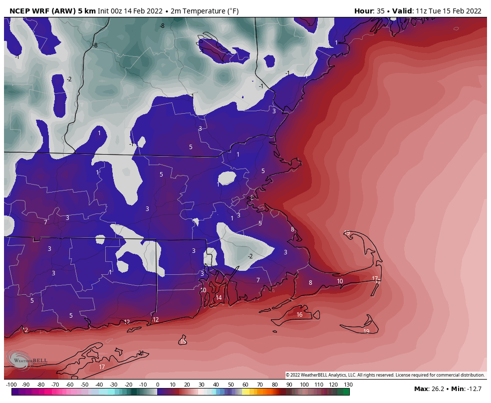
Snow showers will come to an end this morning, then skies will start to clear out this afternoon as high pressure starts to build in. Despite the developing sunshine, temperatures will only be in the 20s, which is 10-15 degrees below normal for mid-February. As skies become clear tonight and winds diminish, combined with the fresh snowcover, we’ll have some radiational cooling. Temperatures will likely drop into the single numbers, with some sub-zero readings possible. Tuesday remains chilly, but not quite as cold as today as the high pressure area continues to build in. By Wednesday, that high shifts offshore, and a significant temperature moderation develops. The milder air will be accompanied by clouds though as a storm system begins to move toward the region.
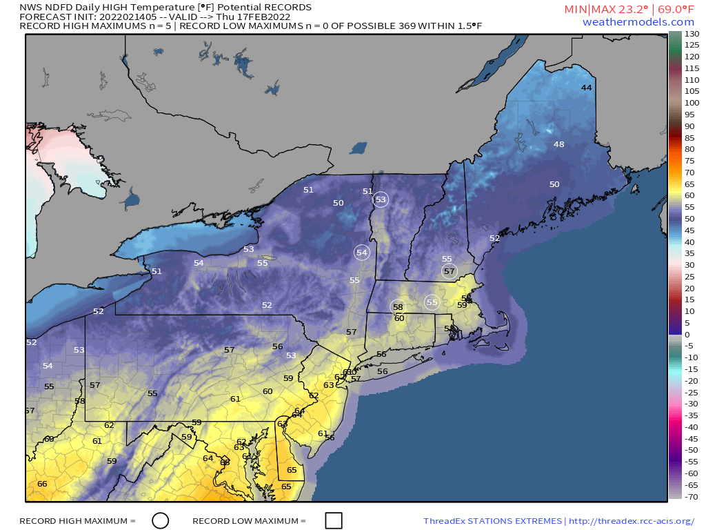
By Thursday, that system draws nearer, with gusty southwest winds sending temperatures well into the 50s and possibly 60s, with more record highs possible. While temperatures will be mild during the day, it looks like the warmest temperatures will be at night. We could be near or above 60 degrees at midnight Thursday night across the region. We’ll also have some heavy rain as the system gets closer, which combined with the mild weather, will help melt much of the snow that remains on the ground. A widespread soaking rainfall is likely, with rainfall totals of more than an inch possible. We wouldn’t even be surprised if there’s a rumble of thunder. This storm will likely produce some severe weather across the South, and while that’s not likely here, a few thunderstorms are possible. Friday likely starts off warm and wet with temperatures still in the 50s at daybreak, but as a strong cold front comes through during the morning, the rain will end, and temperatures will drop during the day. High pressure builds back in for the weekend with dry and seasonably cool conditions for Saturday, but we may start to turn milder again on Sunday.
Monday: Snow showers ending in the morning, skies start to clear out by late in the day, breezy. High 18-25.
Monday night: Becoming mostly clear. Low -2 to +5.
Tuesday: Sunshine and some afternoon clouds. High 23-30.
Tuesday night: Clear to partly cloudy. Low 6-13.
Wednesday: Sunny in the morning, clouds start to stream in during the afternoon, becoming breezy and milder. High 38-45.
Thursday: Plenty of clouds with some sunny breaks, especially in the morning, showers developing in the afternoon, becoming windy. Wind-swept rain likely at night, possibly some thunder as well. High 56-63. The warmest temperatures are likely at night.
Friday: Windy with rain ending in the morning, clearing during the afternoon. High 47-54 at daybreak, temperatures drop during the day.
Saturday: Mostly sunny. High 34-41.
Sunday: Sunshine and a few clouds. High 35-42.
